
I’m signing in from real-time Day 24 to report on Days 11-18, and while it will take a few days to get to Paradise, this report also includes both a literal and a figurative Near-Hell, for those with the patience to read to the end.
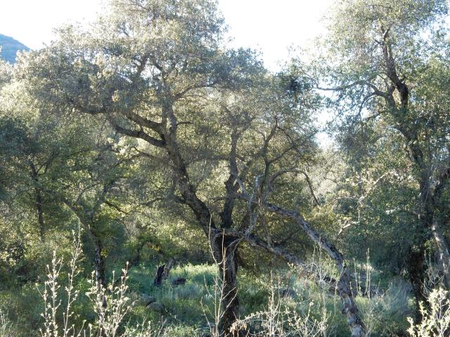
Day 11 (Apr. 4) Just as I finish packing up my beautiful creekside camp and shouldering my backpack, here comes B. bounding up the trail. I hike with him a bit to catch up on his news: he’s changed to “tennis shoes” (trail runners), lightened his pack up some, read the food notes on my blog, is planning to try out some of my recipes, and he has a conference call in 49 minutes. I’m planning on enjoying this oak-filled heaven and stopping to get water the last time the trail crosses Agua Caliente Creek, so I drop behind after a while (and “see” him next in the trail register at the Paradise Valley Cafe, a few days later). B. turned out to be the only hiker I saw on trail all day, though I saw two later that day at Mike Herrera’s place, definitely NOT on trail.
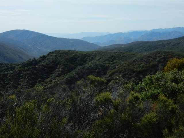
As the trail climbs, the views open up, with lots of big sagebrush (Artemesia tridentata): 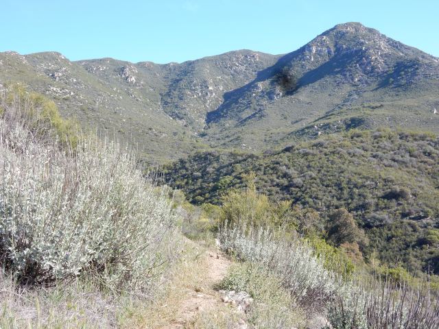
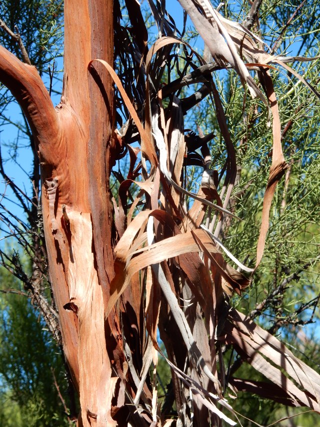
For the first time on the PCT, I’m seeing red shank (Adenostoma sparsifolium, below), which I thought was a manzanita relative, but in fact it is the only other species, along with chamise (A. fasciculatum) in the genus Adenostoma, and the total range of red shank is only about 300 miles. Respect!
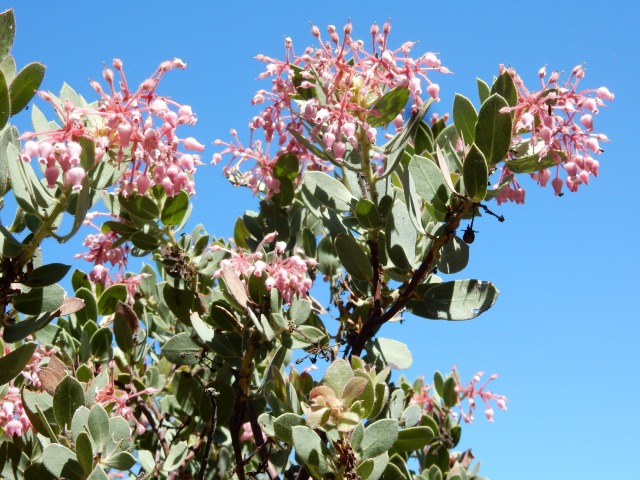
Okay – I promised Dwight to trim down the botanizing in my blog, out of consideration of my long-suffering readers, so below, I am not showing you the beautiful blooms of manzanita (Arctostaphylos sp.); rather, I’m showing you how incredibly blue the sky was:
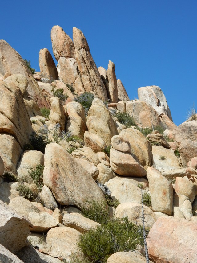
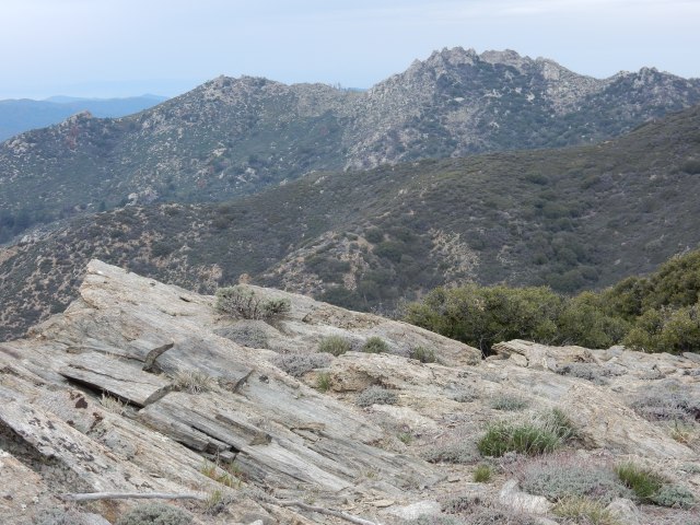
Lots of big boulders dominated today’s stretch of trail:
I started to think, “Gee, if I were cold-blooded, today would be a great day to warm up in the sun,” and soon enough, at PCT mile 126.4, I encountered this beauty:
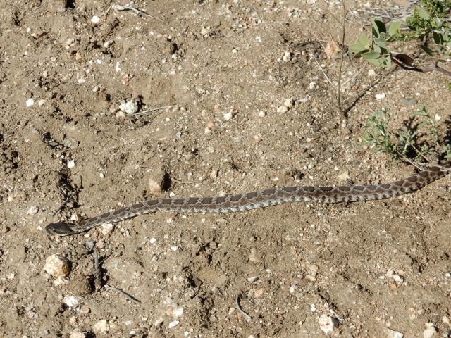
Snake #3, and this one a Southern Pacific Rattlesnake (“SPR”).
 We had the following conversation: Me: Hey there! Say, would you mind moving off the trail? SPR: Naw, I’m very content here. Why don’t you just walk around me? Me: Well, there isn’t enough space for me to walk far around you, because of all these spiny shrubs. SPR: You don’t need a lot of space – I’m just going to lie here. Peace out!
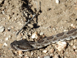
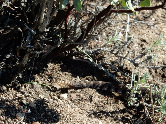
So I took SPR at its word and walked carefully around, and took the opportunity on the far side to grab this photo showing its four rattles and a button:
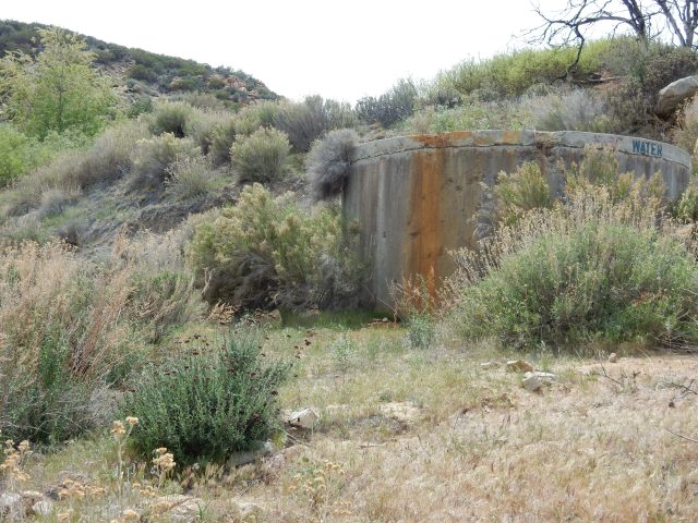
 A half-mile later, I was at Mike Herrera’s water tank, an important source of water in what is often a very hot, exposed section of trail. Today was sunny but not really hot, with some nice breezes – another advantage of having started early, so no need to carry huge quantities of water today. I took 3 liters, left a donation, and had an amusing chat with two young men who were lying rolled up in their sleeping bags like burritos on cots in the bunkhouse available for hikers. I had the impression they hadn’t moved in about two days.They told me my hiker friend Tim had been by earlier that afternoon, so I must be about half a day behind him. Herrera’s caretaker Josh offered me the RV reserved for “women and couples,” but I wanted to get in a few more miles, so I hiked on to a campsite below Combs Peak, pitching my tent after a 14.49-mile day, and sleeping at 5433 ft. elevation, with great views out toward the desert.
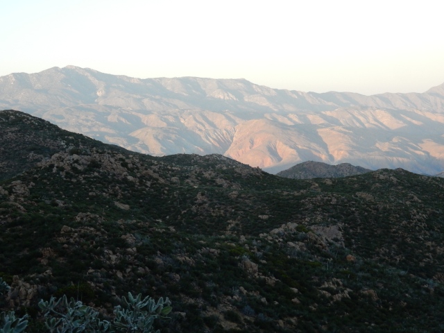
Day 12 (Apr. 5)
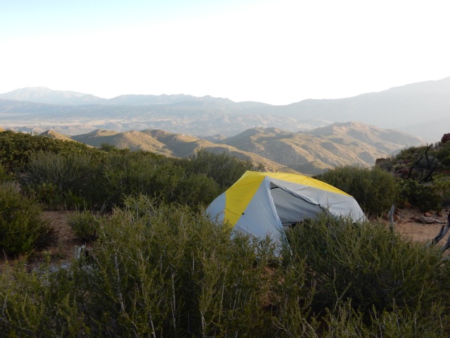
Here’s the morning view from my campsite (and no, I’m not camping on vegetation – I’m just snuggled up next to the chamise). This LL Bean tent is tiny, lightweight and super fast to pitch. I’m really loving it; I’ll write a detailed review of it on my gear page after I’ve spent more time with it.
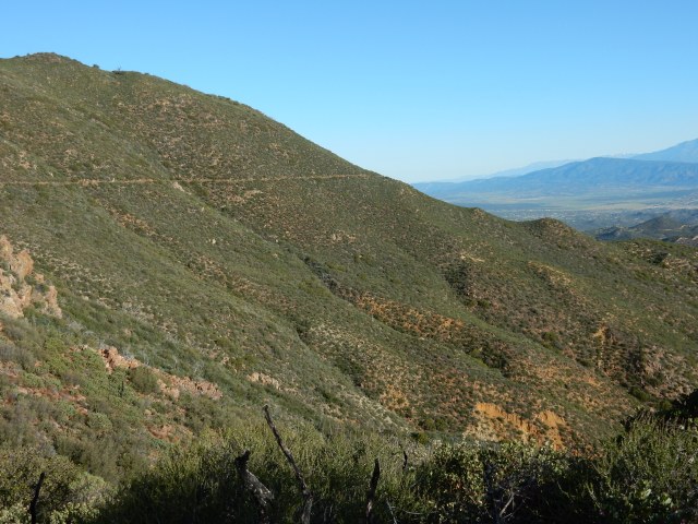
Here’s an unusually horizontal stretch of today’s trail. The PCT loves to put you high up on whatever ridge or canyon wall might be around, and doesn’t like a straight line if it’s possible to have long switchbacks instead, taking you around every possible curve.
As I was finishing lunch under the shade of some shrubs by the trail, two fast young hikers from Calgary, Canada came by: Jake and Chris, both 19 years old. Humans! Fellow Hikers! I asked if they were going to Paradise Valley Café today, but they said they would stop short of there for the night. Paradise deferred for the sake of being able to eat breakfast as well as lunch there!
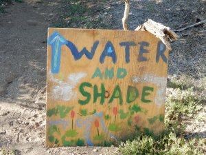
A 1/4 mile detour from the PCT takes you to Tule Spring, another important water source in this semi-arid land:
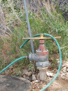
You actually get the water from this contraption (at left) rather than directly from the tank, turning the big yellow bar to get water flowing through the hose.
Of course, you have to filter the water, but it’s an amazing water source out here. At such an oasis, I expected to see other hikers getting water, but not a soul was there. I laughed later to learn that Jake and Chris had opted to avoid the 1/4 mile detour and instead take water up the trail from a crumbly cement thing called “the guzzler” that holds some sketchy, scummy water underground.
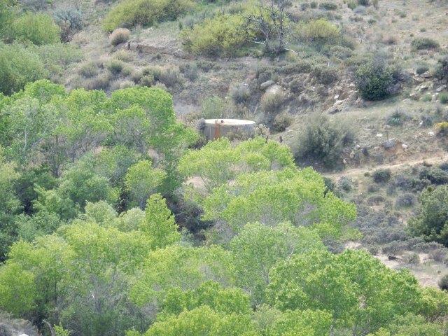
At Tule Spring, the nearby creek is lined with cottonwoods, a bright green strip running through an otherwise dry landscape. Below, you can see the scale of these trees compared to the water tank. The trail at right brings you here from the PCT.
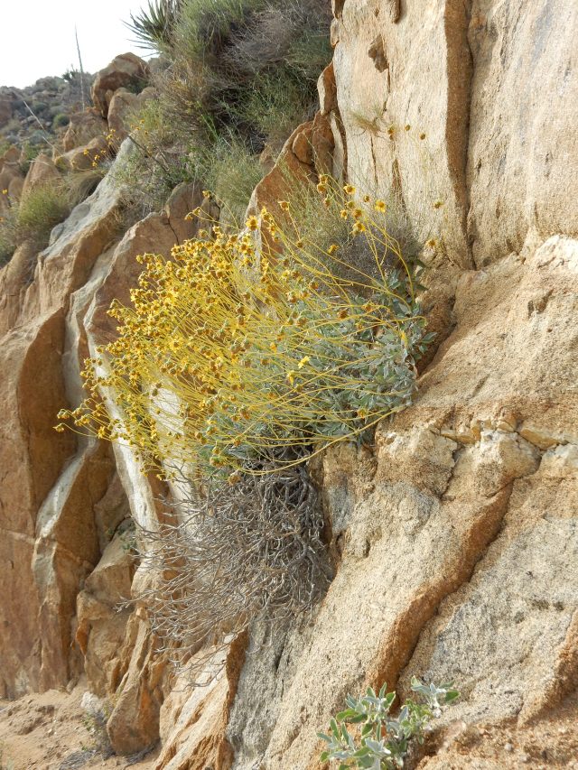
Once again, a huge variety of plants are in beautiful bloom today – If you beg, I’ll show you the dozens of photos I took, but I’ll put just one here, a brittlebush (Encelia farinosa) that found a fine home in a rock crevice.
During the day, I passed a number of “compounds” isolated out in the hills – who would live in these remote places? Survivalists? Marijuana growers? All I knew was that I didn’t want to sleep to the sound of massive generators. Hiking upward, I heard singing – was it fellow hikers? Laborers enjoying a beer after a hard day’s work at one of the mysterious compounds? By the end of the day, I found myself at some campsites scattered between huge boulders, with six other hikers: Matt (now “Sunrise Chatterbox”), the two Swiss guys Dwight and I met at Warner Springs (who admitted to being the singers I had heard), a hiker now trail-named Olaf, and the young Canadians, Jake and Chris. Lake Morena and Barrel Springs are the only other place I’ve camped around other hikers so far, so I was delighted to be around human voices – though by the time I arrived around 7:30, it was almost lights-out for everyone, well in advance of “hiker midnight” (9 pm).
Today’s mileage: 14.83, ending at PCT Mile 144.02.
Day 13 (Apr. 6) – Paradise!
All of my fellow campmates hiked out early so they could arrive at the storied Paradise Valley Café in time to order from the breakfast menu, then wait for the kitchen to turn so they could order lunch. My own version of Paradise involved the incredible, highly varied terrain along the way:
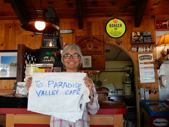
Once the PCT hits Hwy 74, there is a one-mile road walk (or hitch) to the Café. Road walking is hard on the feet and spirit, and I was concerned no one would pick me up, thinking I was going all the way to Idyllwild and not just to the nearby café, so I made this hitching sign on part of my Tyvek groundcloth. It worked, but only for the last 1/3 mile.
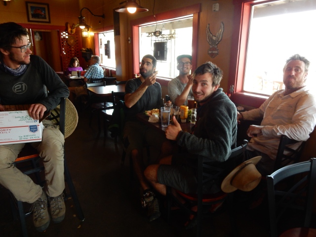
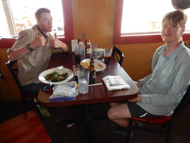
Once there, all my hiker friends had finished breakfast, and were about to order lunch. Tim (at left) is opening a box of freeze-dried veggies and tomato powder I had left him at his request, to improve his nightly spaghetti. The two Swiss hikers are closest to Tim; that’s Matt in the white shirt, and Olaf with the big smile at the back.
And here are Jake and Chris from Calgary, looking somewhat askance at my salad topped with a veggie burger, and somewhat wistfully at my beer – the drinking age is apparently 18 in Canada, but 21 here, so they are beer-less during their time on the PCT, at least at restaurants.
I spent some time on the café patio organizing and packing my food resupply from the box Dwight and I had dropped off here earlier, on my Warner Springs nearo (a zero is a day with no hiking; a nearo is a day with very few hiked miles). On the patio, I met Lucky, a young man hiking in very short, brightly colored shorts; chatted with Vince, a section hiker; and met Gillian, who is thru-riding with her horse. She’s apparently done it once before, and while many equestrians complete sections of the trail, relatively few have managed to do the entire trail in one season.
All my hiking pals elected to hitch to Idyllwild for a zero – they would stay in Idyllwild two nights, and then instead of coming all the way back to PCT Mile 151.7, one mile east of the cafe, they would hike up the Devil’s Slide Trail to rejoin the PCT at Mile 179.4
[Skip this part if you aren’t interested in the logistics of the Mountain Fire closure.] The rationale for the route my hiking pals are taking, one that most 2016 hikers appear to be taking, is that the PCT is closed between Mile 162.6 and 178 because of the 2013 Mountain Fire, so it seems practical to hitch from Paradise Valley Cafe to Idyllwild, then rejoin the PCT at Mile 179.4, where the Devil’s Slide Trail meets Saddle Junction in the San Jacinto Mountains. Halfmile has mapped out an alternate route that allows hikers to get the miles from 151.7 to the closure at Mile 162.6 – that’s more than 10 PCT miles that are open to hike. But for hikers going to Idyllwild for a zero, it would be a long hitch back to get back to Mile 151.7, and then once you hit the closure, there are a lot of non-PCT miles that take you back down to Hwy 74, and then along mountain bike trails and dirt roads to reach the Southridge Trail, which Halfmile’s alternate uses to take hikers up into the San Jacinto Mountains rather than Devil’s Slide Trail. Southridge Trail is less convenient to get to from Idyllwild, but avoids missing the 1.4 PCT miles that the Devil’s Slide Trail misses.
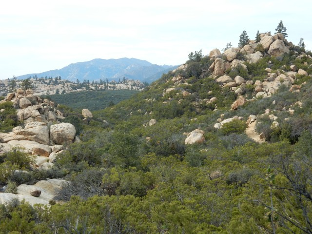
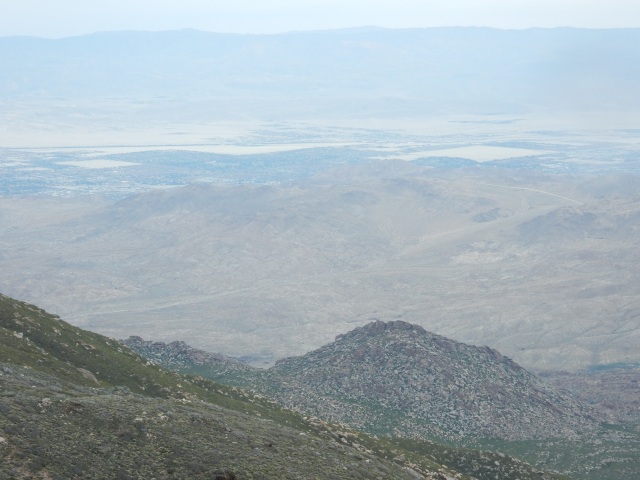
Hikers decide individually what is important to them and what defines their own thru-hike – and for me, it is hiking every mile of the PCT that is legally open to hike. So as my hiking pals headed toward Idyllwild, I wrapped up my resupply chores, then walked back one mile from the cafe to PCT Mile 151.7 and headed up the trail to get those open 10.9 miles. I knew I would almost certainly see no other hikers while on Halfmile’s Mountain Fire Alternate Route, but the trail itself provided great company, with stellar views out toward the desert (near Palm Desert, I think), and beautiful, ever-changing terrain.
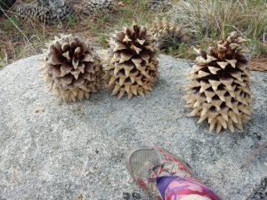 My late afternoon start provided me with cool hiking weather. The pine cones were huge, and my campsite for the night was encircled by manzanita, pines, and ceanothus.
I pitched my tent taut expecting rain, but there were just a few sprinkles, and after some hours at the wonderful and hiker-friendly Paradise Valley Cafe, I now felt like I was in the trail version of Paradise, with beauty all around me.
My mileage for the day: 13.35.
Day 14 (Apr. 7) – From Paradise to (the first) Near-Hell and Back
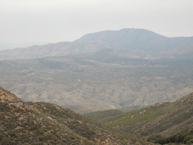
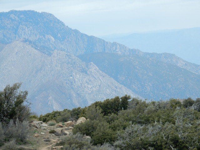
I know I keep saying that “the terrain today was incredibly diverse and beautiful,” but the miles to the fire closure were exactly that. Here are just a few glimpses:
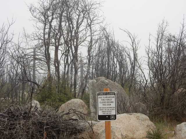
And then – I reached the signs marking the official fire closure.
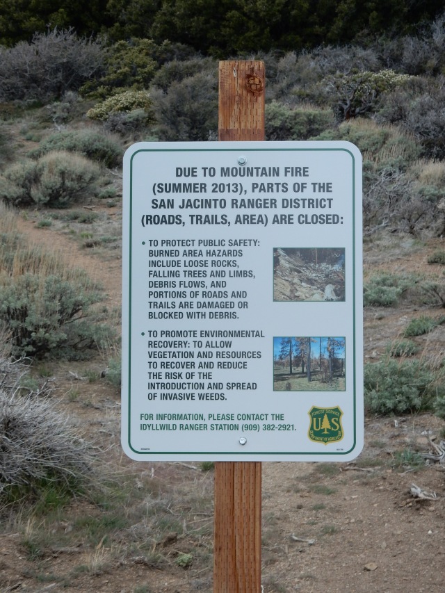
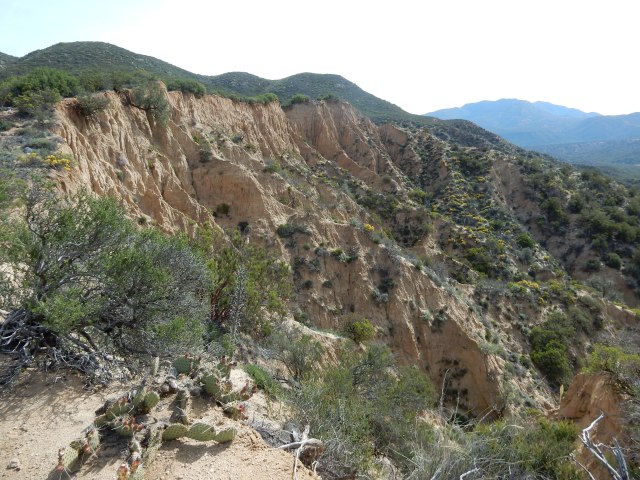
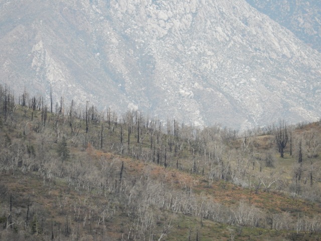
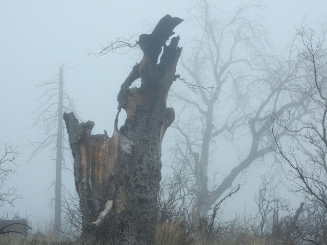
Looking past the closure sign, I could zoom in with my camera and see a small part of the aftermath of the fire – the Near-Hell of today’s hike:
With a pang of regret that I couldn’t continue, but very happy to have experienced the beauty of the miles up to the point of closure, I finally turned and went downhill – lots of non-PCT miles along trails and roads back toward Highway 74.
Once I hit Morris Ranch Road, a paved road with almost no traffic, I thought again about what my PCT thru-hike means to me, and decided while it definitely includes hiking every open PCT mile, it does not necessarily include roadwalks that are not part of an official PCT alternate route. So when I heard what may have been the only car that came down the road that day, I quickly stuck out my thumb and hitched the 6.6 miles to Lake Hemet Market, where I could grab a few supplies and then walk to the Hurkey Creek Campground. There, I took a coin-operated shower, washed some clothes, and hunkered down in the rain in my tent, with the second half of the Halfmile Fire Mountain Alternate Route my plan for tomorrow.
Day 15 (Apr. 8) – Near-Hell and Back
This day featured some additional Near-Hell of the physical sort (fire aftermath), as well as a figurative version, later in the day.
Following the second part of Halfmile’s Alternate, I set out on a mountain bike trail, intending to connect to the Southridge Trail to ascend into the San Jacintos. There were searing images along the way, photographed from dirt roads that are open, but have fire closures on either side of the road:
The alternate map was a little harder to read than the usual Halfmile maps because of a smaller scale, and some ambiguous (to me) wording caused me to miss the correct place to pick up the Southridge Trail going up into the San Jacintos. Instead, I walked several miles out of the way to Saunders Meadow, which turns out to be a community on the outskirts of Idyllwild, and then I road-walked a crazy-steep road, sometimes paved, sometimes not, to the Southridge trailhead. In fact, it was useful to be familiar with this community, later on.
At the Paradise Valley Cafe on Wednesday, I had talked with a table full of CalFire guys, and their take on the weather (rain Thursday, snow today at higher elevations, snow tomorrow down to 6500 ft.) led me to conclude that today was my best day to get up to the PCT and through the high-elevation miles up in the San Jacintos. That was especially true now that the forecast included snow/rain through Monday, rather than through Saturday back when I talked with the CalFire guys.
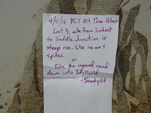
“Last 1/2 mile from lookout to Saddle Junction is steep ice. Use ice ax & spikes. Or take the unpaved road down into Idyllwild.”
So when I saw this note on the Southridge Trail signboard, I thought: “Well, the note is 4 days old; the weather has been fairly warm since then; it is raining now, not snowing. So I can’t really tell what the conditions are now, and I should go up and check it out – I can always come back down, but today is my best shot to get through.”
Where, you might ask, were my spikes? Why, on my gear shelf, with my Whippet nearby, back at home.
Hiking up the trail, I saw almost no snow. Promising, I thought! Even above 8,000 ft. elevation, it was raining, and snow was visible along the trail just in isolated patches.
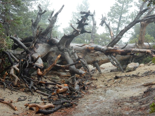
I didn’t take many photos along the way, since it was raining all day. (Rain, I thought – that’s good! – not for my camera, but for melting snow!) Plus, there was very little visibility because of the weather. Since I’ve hiked to San Jacinto’s summit before (at 10,834 ft. elevation, So. Cal’s second-highest peak), I didn’t care that much about the missed views today. I did capture this giant blowdown across the trail:
Halfmile’s Alternate Route is 20.4 miles in total. I had now completed 20.0 miles of it: 13.8 by hiking, and 6.6 by road hitch (not counting my “bonus” miles to Saunders Meadow). Then I reached the Tahquitz Lookout Tower (8,846 ft. elevation), at Mile 20.0 of the Alternate Route. Just 0.4 mile left – then, BOOM. Reality is non-negotiable, and just past the Lookout Tower, the reality was that the trail was covered with deep snow, with a fairly steep downslope. Hmmm.
I could see a set of footprints going across, so I decided I would carefully test out the first few of those steps and see if I might be able cross by stepping into those prints. Hmmm. So this worked for several steps, though I was sinking in pretty deep – then the next step was on a part of the trail that no longer had snow, but was deeply saturated, and the edge was crumbly. So the rocks and stones here couldn’t be trusted to hold weight. One of my trekking poles got stuck in deep snow, and in the process of trying to free it, it slid down the steep slope. All right then — I am NOT following my pole.I used my gloved hands to dig good handholds, and kicked each step carefully, testing each one before putting weight on it. Very slowly, crouching to lower my center of gravity and maintaining 3 points of contact at all times, I crept back to the safe place.
So there it is, the figurative near-hell.
I had excellent cell reception by the lookout tower, and I made some quick calculations: the weather was going to get worse for 3 days before it got better, so there was no sense in camping up here in a sheltered place until tomorrow. Idyllwild is an expensive, touristy town bursting at the seams with hikers waiting out the weather; home is pretty close. So I called Dwight from 8,846 ft. and he readily agreed to drive to Idyllwild to pull me off trail for a few days. My phone’s battery was almost gone, so I told him it would probably take me about the same amount of time to get down the mountain as it would take him to drive to Idyllwild, and I’d find a way to call him so we could find each other.
Knowing I had not only the mountain to descend, but also that crazy steep road from the trailhead back to Saunders Meadow, I practically ran down the trail whenever the path was smooth. At some point, I also figured out I really didn’t need most of the water I was carrying, so I poured out about 4 pounds of water to lighten my pack, and put on my down jacket under my rain jacket since it was getting colder.
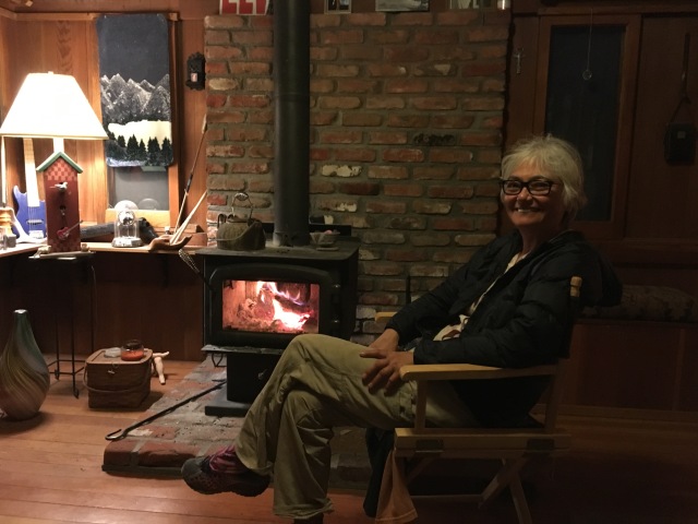
Once I got into the Saunders Meadow area I had become familiar with earlier because of my “bonus” miles, I walked past some of the fancy “No Trespassing” signs that are pervasive in Saunders Meadow; walked past many dark homes, presumably empty vacation homes, and walked past an occupied home with a dog that barked ferociously. I realized I wasn’t sure how to get to the center of Idyllwild, and then I walked by a house that looked super-friendly and laid-back, with a warm fire visible through the window. With my phone now dead, I knocked on the door to see if the residents would call Dwight and give him directions to where I was. This turned out to be the home of Megan and Tucker, two amazing people who put a chair in front of the fire for me until Dwight arrived. We enjoyed some great conversation, and Megan took this photo and emailed it to me the next day. If they weren’t trail angels before, they are certified for life now! Thanks, Megan and Tucker, for this amazing hospitality – it was sublime.
Days 16, 17 and 18 (Apr. 9, 10 & 11): ZERO, ZERO, ZERO!
So I went off-trail for three (!) zeroes, to give me time to figure out what made the most sense based on the weather forecast, plus another fire closure (the Lake Fire closure) located a few miles north of San Jacinto.
Three zeroes! I was home, but I pretended I wasn’t so that I would get all the chores done that need to happen during zeroes: resupply, laundry, planning, etc. One task was to call the Rangers’ office to let them know that in case anyone reported a concern based on seeing my trekking pole down the steep slope, there was in fact no hiker there as well. I offered to accept a fine for what had to be the week’s largest “Leave No Trace” violation, but the ranger laughed and said he would give me a pass.
I assembled all the intel I could about the conditions in the Jacintos and the experience of other hikers, including those who had gone up Devil’s Slide Trail. Flashback Dave posted a very informative video shot in his tent on-trail, reporting “Saddle Jct to Mile 190 lots of snow, hardpack with ice on top,” sometimes difficult to navigate because footprints from people who are lost/not on the trail. He reported steep areas on the backside, plus lots of blowdowns – maybe 40 trees down with a few that are a challenge to get around.
I sent a summary of all this intel to Scout and Frodo (San Diego trail-angels-in-chief and PCT thru-hikers) by email, and then had a long discussion with Scout about my options. Bottom line: the conditions may not be significantly better for awhile, and since I am local, I can easily come back and get these miles later in the season, either at the end or at some other point – and by then, the Lake Fire closure might be lifted or reduced in size, or there might be an official alternate route. So I might well end up with more legal PCT miles to hike, later on.
For the Lake Fire closure, many 2016 hikers are taking a van from Ziggy and Bear’s (just north of I-10, at approx. Mile 210.9) to Big Bear – missing the open miles from Z&B north to Mission Creek at Mile 236.5, and also missing the open miles from Onyx Summit (at Mile 252) to Big Bear (where most people appear to be getting on trail at Cougar Crest Trail, at approx. Mile 277.9). By skipping to Onyx Summit now, I’ll catch the approx. 26 miles between Onyx Summit and Big Bear that many hikers are missing by going by road to Big Bear. I’ll also be able to hike from Mile 178 to Mission Creek at Mile 236.5, instead of missing the 25.6 miles between Ziggy and Bear’s and the Lake Fire closure at Mission Creek, since I can hike out-and-back to Mission Creek from Whitewater Preserve, where Dwight can get to by car to pick me up; and I might be able to get some newly opened miles once authorities can evaluate the Lake Fire closure and perhaps lift some or all of that closure, or develop an official alternative.
So that’s the plan I developed after talking it all over with Scout and Dwight – temporarily skip to Onyx Summit now in order to get the fullest number of legal PCT miles during my hike. I realize other hikers come from long distances and don’t have the options I do, but this seems like the right choice for me.
(And now, in real time, I’ve spent four and a half wonderful days hiking from Onyx Summit (Mile 252), to Mile 341.8, the crazy place at Cajon Pass where the PCT is just 0.4 mile from a McDonald’s and a Best Western motel, with massive I-15 traffic and huge long trains that go through continuously, day and night. But in real time, I am also out of computer time – so reporting on the next part of my hike will have to wait until perhaps next week.)

What a story, Betty! I am glad you are ok and back out there. I would have called it quits a long time ago
LikeLike
Hi Betty, my wife and I are retired in Portland and planning our PCT hike for next spring. Your blog is terrific and your experience an inspiration. Sounds like a frustrating week but you clearly have the right attitude. Thank you. Bill and Barbara.
LikeLiked by 1 person
So Betty, Tuesday, October 18 or Monday October 24th to tell us about this fab adventure in person?
Julie
LikeLike
Looking forward to your talk on either date!
LikeLike
Have you really memorized the Latin botanical names, or do you have a flower guide along for help? Very impressive in either case. You’re carrying a lot of knowledge either in your brain or on your back. Hope you replace the trekking pole…two are better than one.
LikeLike
Sigrid— I remember almost all the Latin names of plants I know, but spent 2 days on trail trying to remember a common name – chamise! All I could remember was Adenostoma fasciculatum. Ridiculous! (Sorry if spelling is off in this reply – I’m at 8100 ft in my tent replying by phone).
LikeLike
We called the ranger station from the alternate and they told us not to go up South Ridge due to treacherous conditions. That was probably about the time you were up there. So we roadwalked into Idyllwild and took the Black Mountain alternate. I can’t believe how many people are skipping big parts of the trail.
LikeLike
So happy things have worked out for you! What an adventure and a story to tell for ages;~) And yes, I definitely would like to see the flowering photos.
Be safe and enjoy!
LikeLike
Please don’t tone down the botanizing talk. I love it! Great blog. 🙂
LikeLike
Love reading about all your challenges and the pictures are great! Glad you found some angels in Saunders meadow/Idyllwild. Continue to share….love reading this! Be safe!!
LikeLike
Betty, being a botanist myself, I really do appreciate your featuring the wonderful plants you have sighted along the trail. Many are unfamiliar to me as I live in Washington State. Please keep it up.
LikeLike
Nice details, but I almost think blogging and computers defeat the purpose………
LikeLike
You sure are having some adventures out there Betty! Great job documenting it all for us 🙂 keep on keepin’ on!
LikeLike
Betty — Fabulous review of your trip in the San Jacintos. I hadn’t realized that parts of the trail had been closed due to the previous fire(s). You know that I love that area, having hiked from the other side four times to San Jacinto peak, including getting caught in two feet of snow in late May last year. I remember watching the struggling hikers coming up from the west to Wellman Divide and being forced to retreat. I also recall the McDonalds that you had pointed out during our road trip to Whitney. Great memories. Wishing you the best. Keep safe. — Charlie Gaylord
LikeLike