
Greetings, friends and random blog followers, from real-time Day 37 of my PCT hike, catching up on as much as the confluence of Internet and laptop access and spare time on my resupply day here in Tehachapi (PCT Mile 558.5!) allows.
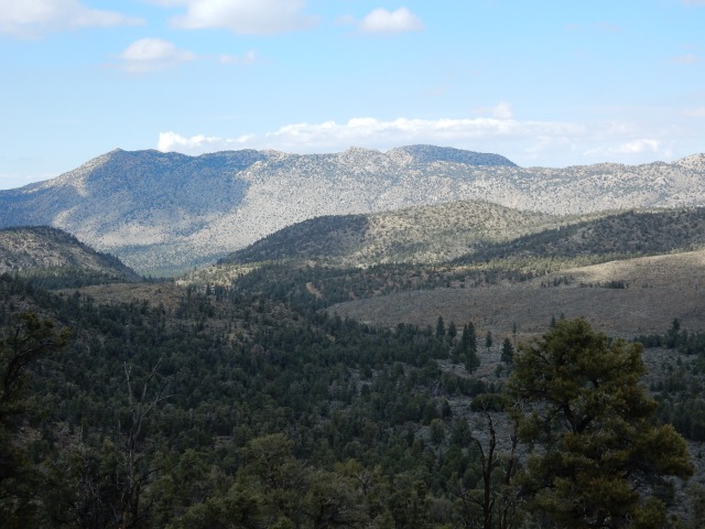
Day 19 (Apr.12): With the Lake Fire Closure still in effect, my Super Trail Angel Dwight drives me to Onyx Summit, Mile 252.1 (elevation 8565) where the official fire closure ends. Here, the trail offers forests filled with spectacular large trees:
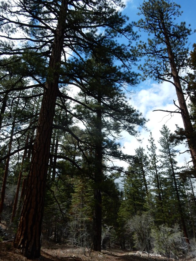
and big vistas:
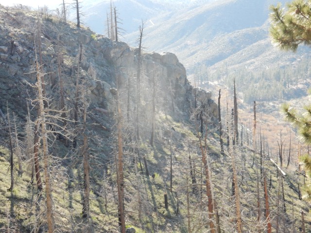
but the land is heavily scarred by fire:
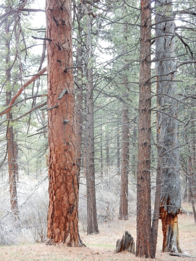
 I know that the Lake Fire (2015) was human-caused, but can’t find an update on the final determination as to the cause, or the details. After walking 20.0 miles of the 20.4-mile Unofficial Mountain Fire Closure last week, I’m beginning to think someone needs to publish a special PCT Fire Guide, with details of all of the fire damage we hikers will be seeing throughout the Southern California portion of the trail.
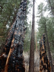
The fire damage is extreme in some areas, with very tall, thick trees having broken like twigs at perhaps the 30-foot point, with huge chunks of trunk and limbs scattered over a wide area, sometimes right across the trail.
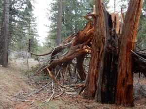 I try to imagine what wind or other force would snap such a huge trunk 30-feet up, and I’m glad to be hiking through here on a day with no wind.
Knowing that many hikers are getting back on trail at Big Bear, rather than Onyx Summit, I assume I’ll be hiking alone today, and indeed, I see no one on the trail all day. I do see this semi-amusing, semi-appalling (Leave No Trace, anyone?) example of Trail Magic along the way:
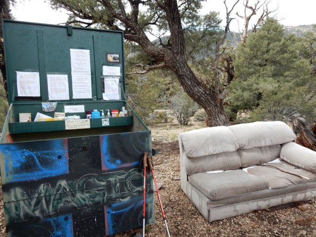 The metal bin holds a random assortment of Easter candy, hand sanitizer, foot powder, and other items hikers might want, plus information about Big Bear. (Note the snow on the sofa.) The bin also has a trail register that allows me to see how few hikers have signed in for this Onyx Summit-to-Big-Bear stretch of open trail. These trail registers are also a key way to check to see where people you’ve met on the trail are – one day ahead? two? – and estimate if/when you might see them again.
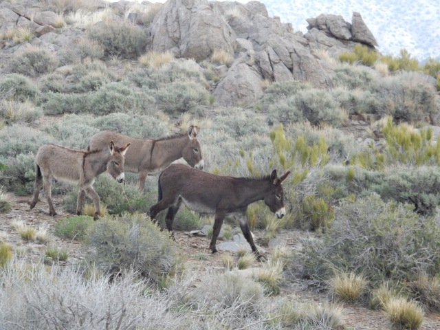
Though I didn’t see any other hikers today, I did see a jack rabbit so large it reminded me of the novelty “jackalope” postcards that we saw as kids at gas stations along Route 66, and then I saw 7 of these creatures – feral donkeys? – hiking the PCT just ahead of me:
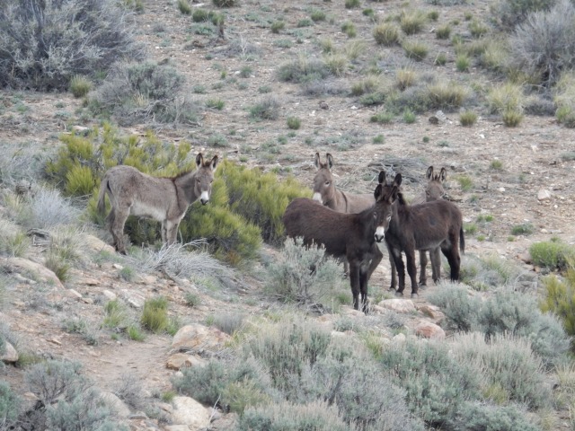 They would walk on the trail for a bit, then stop and look back at me. I would stop when they stopped and talk to them. This went on for awhile, until they reluctantly went off-trail. Bye, and thanks for the company!
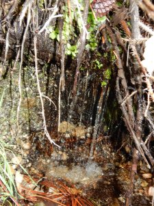 The Southern California section of the PCT is quite dry, so we hikers closely study a crowd-sourced Water Report to see what water sources are available. At left is what qualifies as a magnificent water source in these dry parts: some snow melt drips down right by the trail, forming a pool of water at least 6 inches wide. Yay! I do my part and phone in an update to the Water Report once I get to a place where I have phone reception.
Though I have great views both toward the mountains backing Big Bear, and out toward the desert, there’s a big ridge separating me from views of Big Bear Lake, and I know that tomorrow will include lots of winding in, out, and around all the folds of that ridge before I get those lake views. Meanwhile, with the drive to Onyx Summit having taken most of the morning, I end my day at Mile 265.75, for a total of 13.61 miles.
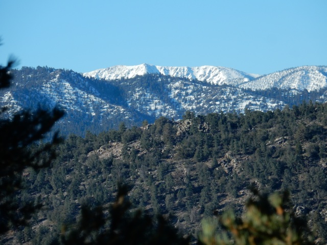
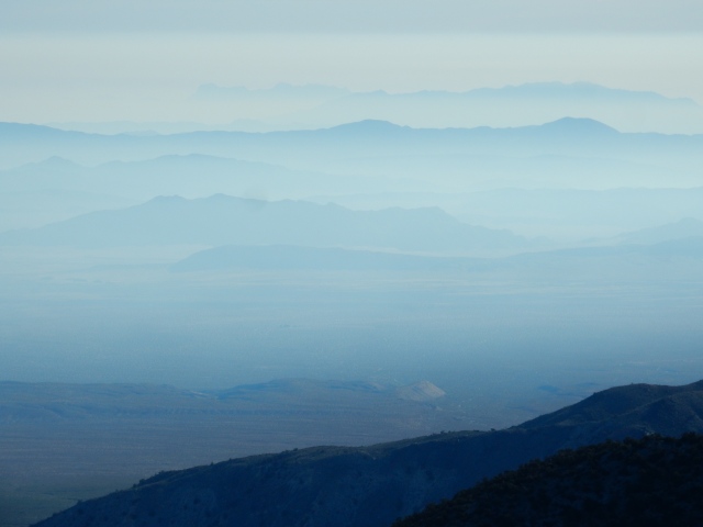
Day 20 (Apr.13): The morning brings some stellar long-distance views both south and north:
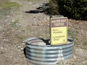 The morning also brings me to this amusing water source (at left), at Doble Trail Camp, with a small horse corral, a stock trough filled with water that a hiker could filter if nothing better is around, and a faucet behind the “non-potable” sign that delivers a slow trickle of water. Again, this is considered an excellent water source for So. Cal. PCT hikers! We trust the 0.10 absolute micron hollow fiber membranes of the Sawyer filter to protect us from water-borne harm.
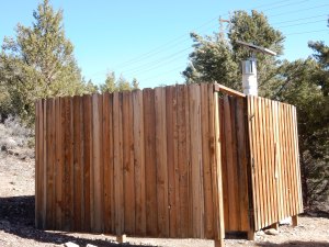 The Doble Camp also featured a solar composting toilet that was in excellent condition (with toilet paper!) and also provided a nice enclosure I used to hang up my tent for a few minutes to dry off the morning dew.
I knew I had to hike around a long ridge to get to the stretch of trail that offers views down to Big Bear Lake, but I found myself on long switchbacks that would take me far back in the direction I come from, just a little higher up the ridge than when I had originally walked that stretch. I tried not to be annoyed (the trail has to be graded to accommodate equestrians as well as hikers) – but I was a little annoyed that I had to cross this long, steep rubble field twice, at two slightly different elevations:
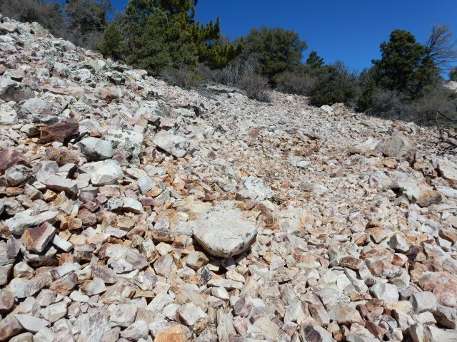
Yes, this is the trail. . .
I kept thinking it would not be good to be on this rubble field during an earthquake – death by stoning!
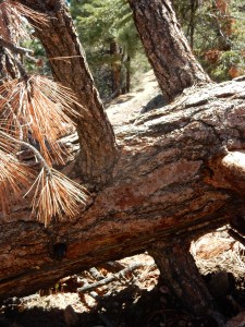 There were lots of blowdowns on today’s trail – some are small enough to step over, some are on a gentle grade that allows you to walk around them, but some you just have to clamber over, like the one at left. A challenge for short-legged folk like myself!
At the Cougar Crest Trail junction above Big Bear Lake, I met four hikers – two Swiss couples, ranging from 62-66 in age – who are thru-hiking under the group trail name of the “Gray Coyotes.” I asked them about their experience through the San Jacintos, and they said, “There was a lot of snow, but we are Swiss so we are used to it.”
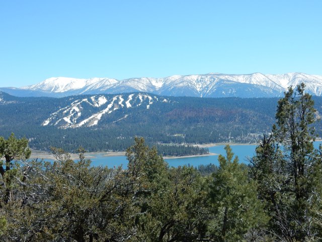
Big Bear Lake came into view, with beautiful snowy mountains as the backdrop:
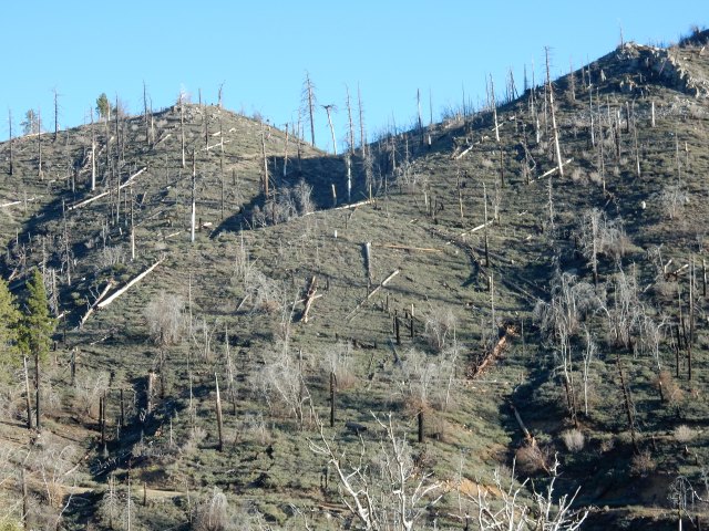
Once past the lake area, I entered one of the most depressing fire burn areas I’ve seen so far. For miles, almost everything was burned, with very little new growth.
The scene below looked like a giants’ game of pick-up sticks:
As the day ended, I reached Little Bear Springs Camp, a horse camp similar to Doble, right by Holcomb Creek with lots of accessible water, and even better, with a terrific family camping there: a 13-year-old girl whose trail name is Spinner who turned out to be a very skilled fire-builder (in the camp’s fire ring), and her parents. Mom (Dora) has lupus, and I was filled with admiration for the persistence and resilience she is showing to hike this trail. Dad Jason cooked them a terrific looking dinner, while I prepared my freezer-bag-style dinner of millet and brown rice ramen noodles, freeze-dried veggies and tofu, and miso powder. What great company this family was for a little dinner conversation and a warm fire on a very cold night! They told me they had had a miserable time going through the San Jacintos, with their dry bags eventually failing, leaving them with wet sleeping bags. That puts you in “hike or die” territory. I found out later they had gone through that area with Flashback Dave, who posted a video on the Facebook PCT Class of 2016 page that helped me decide that the best course was to come back for the section through the San Jacintos later, after the snow melts.
Mileage for today: 19.95 miles, ending at PCT Mile 285.60.
Day 21 (Apr.14): When I opened my tent door in the early morning, I thought some dirt fell on me, until I realized it was flakes of frost. Okay then – I’ll be packing up a wet tent again today, and hiking in my amazing wind/rain jacket for warmth. I can’t believe I ever worried that this jacket was too heavy for the Southern California section of the PCT – I’ve worn it more days than I can count. Thank you, L.L. Bean!
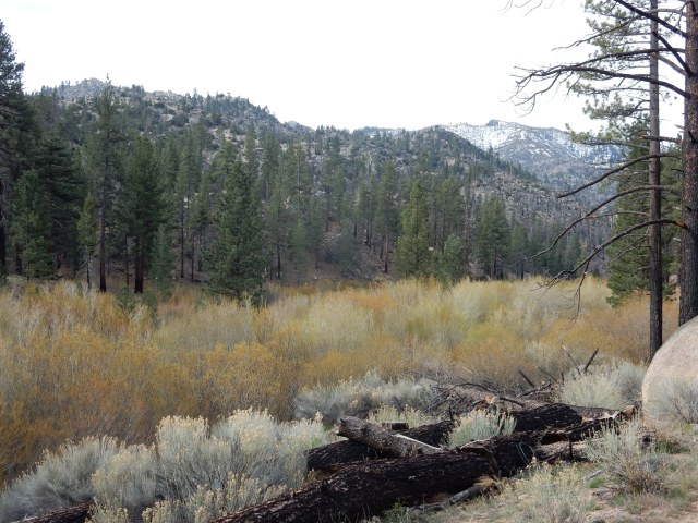
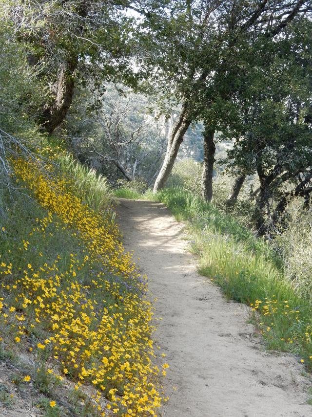
This morning’s trail followed Holcomb Creek, which meant that between the pines and the trail was a beautiful strip of stream-loving plants – willows, for example – and lots of access to crisp flowing water.
Around 8:30, I passed a hiker from Lithuania whose trail name I later learned is Zapka (sp?) – he would become someone I would see periodically in the coming two weeks, though he is a faster hiker than I am. Our first conversation was hilarious: Me: “That was a sad fire area we hiked through yesterday, wasn’t it?” Z: “Fire area? No, I did not see such a thing.” Me: (pointing to all the burned trees in our immediate vicinity): Like this! Z: “Oh well, these things happen.” Later on, I learned that Z. thought maybe I was an official from the Forest Service, interrogating him as to whether he had walked through a fire closure area.
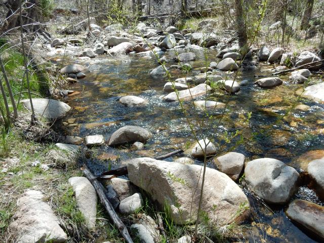
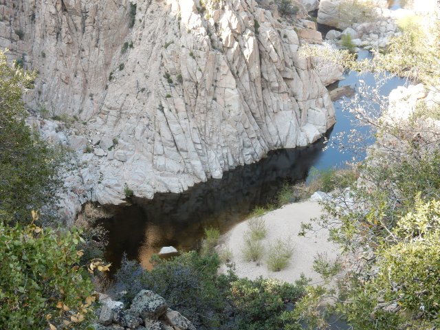
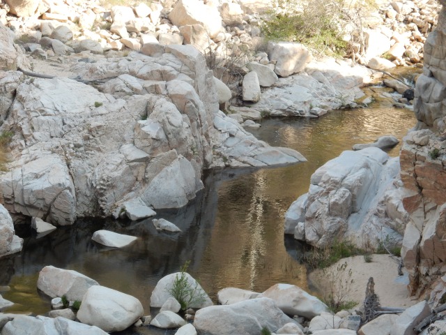
Holcomb Creek is my companion for at least 10 miles of trail, sometimes far below me, as in the photo below, where the trail is high up on the ridge, often narrow where a misstep could send you on a long white-sand slide down-canyon:
The trail crosses the stream – a little balance test, just a modest practice for what’s ahead in the Sierra:
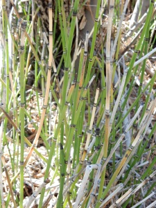 And by the stream is some Equisetum (Horsetail, pictured at left), modest-looking here, but a “living fossil” in that it is “the only living genus of the entire class Equisetopsida, which for over one hundred million years was much more diverse and dominated the understory of late Paleozoic forests. It propogates by spores rather than seeds, and its stems contain silicates that make them useful for scouring metal, leading to its other common name, scouring-rush.
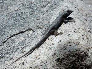 Lots of lizards and similar creatures are all along the trail in So. Cal., but few will pose for a photo; here’s one I captured.
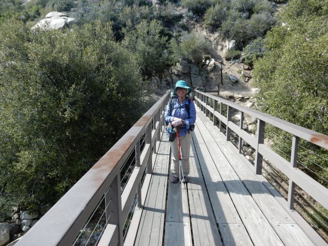
At Deep Creek Bridge (Mile 298.7), a road is nearby, so some day visitors were around who obliged me by taking my photo (and no, I’m not carrying more than one shirt – I just temporarily swapped shirts at my last resupply for a warmer one for this section).
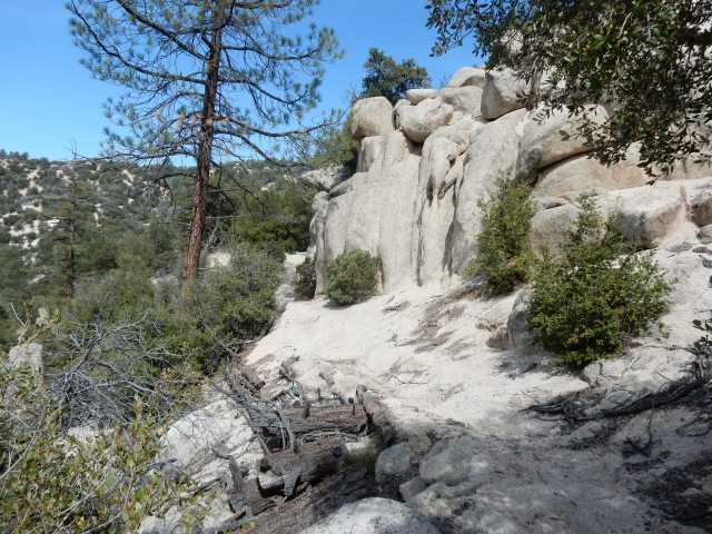
This bridge marks a very long (11+ mile) beautiful section of trail with Deep Creek far below, the trail often on high perches next to steep slopes. You could spend a lifetime taking photos of the beautiful creek views, plus the fabulous flowers blooming everywhere under beautiful canyon oaks. Here are just a few photos from this section:
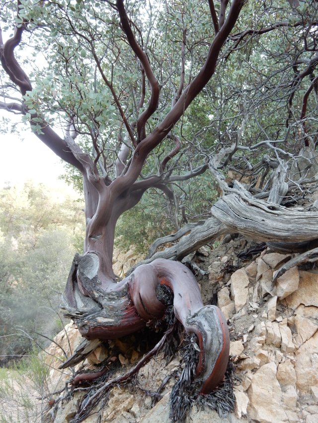
What beautiful mahogany colors in the manzanita, above, that has managed to survive so many years rooted in what is almost bare rock!
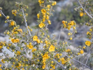
I’m pretty sure this is the first place I saw one of my favorite native shrubs, Fremontodendron californicum, on trail. (Its common names include California flannelbush or California fremontia.) I may never have seen it before other than in botanical gardens, so I was thrilled to see it in full bloom here.
By the end of the day, I was still hiking above Deep Creek – and Deep Creek is a day-use only area, with no camping – but I decided I really wasn’t at Deep Creek itself, since I was so high above it, and I found myself a tiny flat spot off-trail, just big enough for my tiny tent. More beautiful than any 4-star hotel!
Today’s miles: 285.6 to 304.70, for a total of 19.1 miles.
I’ll try to post more today, because my blog is lagging so far behind real time – but for now, my priority is putting together my resupply for the next stretch of trail.

Awesome views and I love the donkeys!
LikeLiked by 1 person
Glad to see your posting. I was afraid you had quit or been injured. Your pictures and commentary are great!
LikeLiked by 1 person
BWG, I live near tehachapi, if you have time would love to meet you, run errands or treat you to lunch/dinner? We are enjoying your blog so much!
LikeLike
Hi, Barb: If you are free for dinner tonight, that would be fun! You can reach me at 858-205-3834. I am doing errands and various resupply tasks until about 6pm, then will be free.
LikeLike
Absolutely fabulous, Betty! The pictures are wonderful and I thank you so much for making it so real. You even had me scared the days you were traveling without anyone around but a herd of wild donkeys. I don’t think they know how to call 911 should something happen, never mind figure out a DeLorme! Stay safe, have fun, and keep journaling – we love it! Lots of hugs, Lynn
LikeLiked by 1 person
Again, Betty, I am enjoying living vicariously through your adventures. Beautiful beautiful photos. I would have been thrilled to come upon those donkeys!
LikeLiked by 1 person
Loving your blog Betty. I am following you from Australia, my daughter is hiking behind you, and isusually about where you blog about. I’m loving seeing the trail! Thank you
LikeLiked by 1 person
Loving your blog Betty. I am following from Australia” my daughter is behind you on the trail, usually about the spot that you post about. Thank you for bringing it all alive for me!
LikeLiked by 1 person
Hi Betty. I, too, have been waiting for your latest post. I chuckled at your story about the hiker from Lithuania. Your day amongst the wild donkeys reminded me of some of the descriptions in ‘Wild.” Keep writing and taking those amazing photos. We are waiting to read more…
LikeLiked by 1 person
Thanks again Betty! The pictures are beautiful….love the donkeys and the manzanita tree is gorgeous! You are looking great! Keep on hiking and sharing your stories with us! Love traveling with you! Robin
LikeLiked by 1 person
Hi Betty. I am providing “a catered thru hike” for my husband and daughter, who begin hiking on May 25th. I have enjoyed reading your posts and hearing about your caterers. I will be camping and dayhiking, with our dog, during days I don’t meet up with them. I am not from the CA area……so any advice or information from your blog is great.
Susan
LikeLike
Great thing you’re doing for your husband and daughter! Given their start date, essentially everywhere I have been cold or windblown, they might be scorching hot, and some of the seasonal water sources will be gone. So if you keep up with the water report updates and help them manage water, that could be a huge help to them. Best of luck to you!
-sent from my tent, nestled in a circle of trees
LikeLike
I’m loving every minute of your report. There aren’t a lot of people who can describe so richly and accurately the plants, animals and topography like you do.
You don’t mention San Gorgonio…did you go through there on your way to Big Bear?
LikeLike
Hey, Karen! The PCT goes through part of the San Gorgonio Wilderness, but doesn’t go that close to the peak itself – the Fish Creek Trailhead to San Gorgonio is 1/2 mile west of PCT Mile 240, and the summit is about 9-10 miles by that trail. The Lake Fire Closure is from approx. PCT Mile 236.5 to Onyx Summit at Mile 252, so the Fish Creek Trail is currently closed. Even when this section of the PCT is open, I don’t think most thru-hikers make a side-trip to the summit since it involves a side trip with about 3400 ft. of elevation gain and about 9-1/2 miles each way from the Fish Creek Trailhead. We (Dwight, Molly and I) certainly saw San Gorgonio as we drove to Onyx Summit where I got back on trail at the end of Lake Fire closure, and we went by the turnoff to the Vivian Creek trailhead. Great memories!
LikeLike
This is quite interesting Betty! I knew nothing about this ‘fossil plant’: <<>>
LikeLike
Excellent hike summary ~ Also, that is a great photo on the bridge!
LikeLike
Hi Betty,
Hoping that you are okay! We haven’t seen an update in a few weeks and several people asked that inquire about you.
Is all going well out on the Pacific Crest Trail? Do you need a new Dobro melody written and videotaped to inspire you?
Really hoping that you are well and safe! Tailwinds!
David
http://livablefrederick.org/
https://www.facebook.com/LivableFrederick
*David T. Whitaker, AICP*
Chief of Comprehensive Planning
Frederick County Division of Planning & Permitting
30 North Market Street
Frederick, MD 21701
o 301-600-1149
On Sat, Apr 30, 2016 at 12:41 PM, betty would go wrote:
> betty posted: “Greetings, friends and random blog followers, from > real-time Day 37 of my PCT hike, catching up on as much as the confluence > of Internet and laptop access and spare time on my resupply day here in > Tehachapi (PCT Mile 558.5!) allow. Day 19 (Apr.12): With ” >
LikeLike
Fun posting! Are you going to finish writing the rest? 🙂
LikeLike
Thanks for the nudge! I have all good intentions of posting about the rest of my hike… Maybe September will finally be the month that happens! Feel free to bug me until it’s done!
LikeLike