
Day 23 (Apr.16): I wake early to a strange, electronic version of the kind of clock bells that chime on the quarter-hour – emanating from the still-nearby Cedar Springs dam facility, I believe. Soon, I’m at Silverwood Lake, created in 1971 by the Cedar Springs dam as a reservoir that is part of the California Aqueduct system conveying water from the Sierra and Northern and Central California to Southern California.

The trail fulfills the “Crest” part of its moniker by taking me on a winding route high up on the hills, through what, for chaparral, is a lush, green and bloom-filled landscape:

 “Dear Crestline Sanitation District: I dug an 8-inch deep hole near this sign without calling first: it was early on a Saturday, and I didn’t think anyone would be staffing the Dig Alert hotline. Sorry! But I don’t think I damaged your pipeline.”
Today’s destination is Cajon Pass, where Dwight and Molly will be meeting me at the McDonald’s that is just 0.4 mile off-trail, and we’ll be staying at the nearby Best Western so I can resupply. But first, I encounter Snake #4, a gopher snake stretched across the trail by a cattle gate I have to cross. It simply won’t move, and I’m not sure at the time what kind of snake it is, but I finally just step over it and continue on my way.

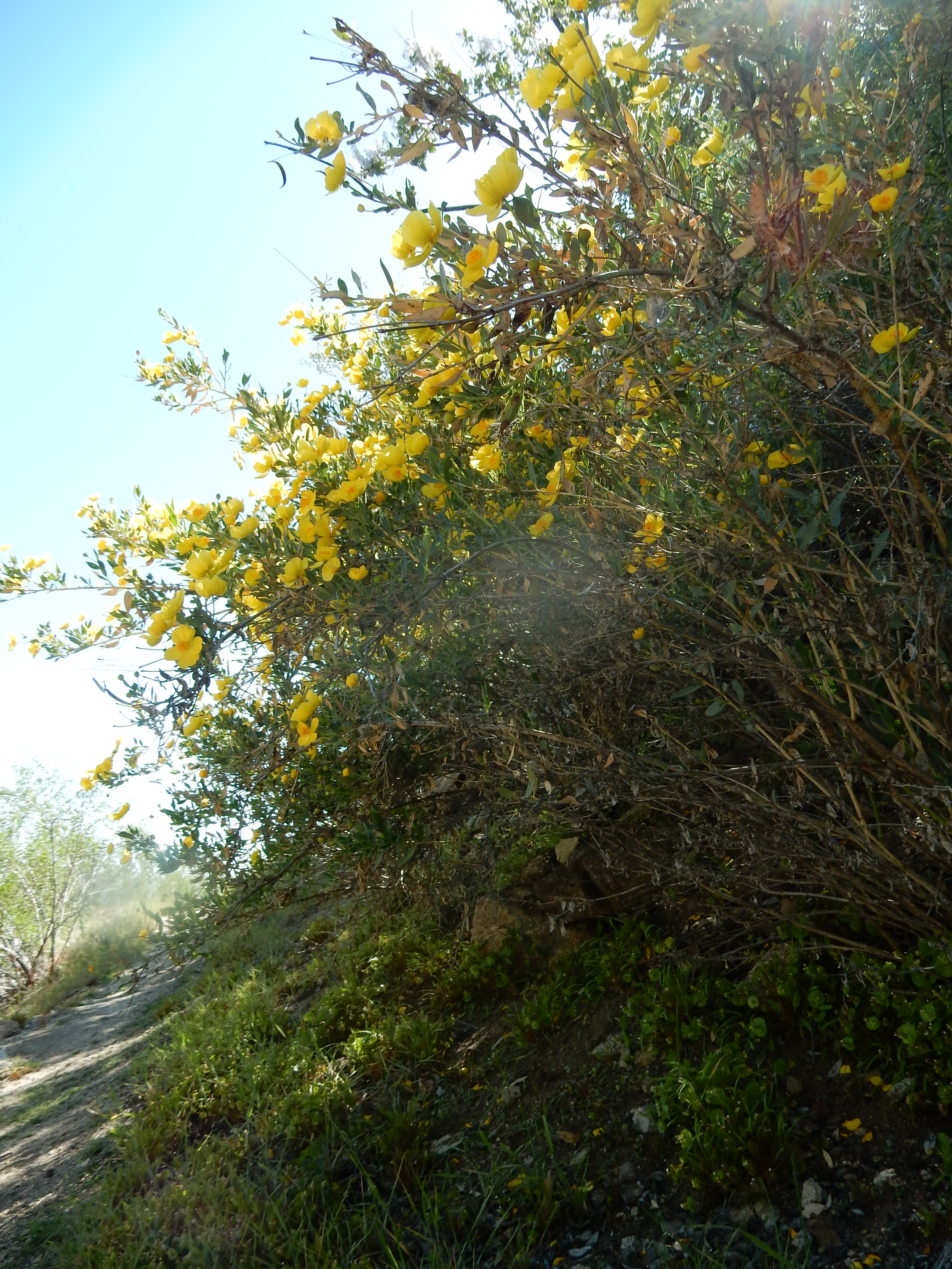
I stop by the lovely tree poppy (at left), which provides welcome shade and beauty for my lunch break.
As I get closer to Cajon Pass, which lies between the San Gabriel and San Bernardino Mountains and was created by movements of the San Andreas fault, the landscape starts to change, and I begin to get big views of the major transportation components of the Pass. They include multiple railroad tracks that host countless long freight trains with multiple engines, plus nearby Interstate 15, which crosses Cajon Summit as a massively divided highway.
Fortunately, the famous-among-hikers McDonald’s is not visible – otherwise, hungry thru-hikers would be tempted to turn their groundcloths into sleds and just slide down the slope to the hamburgers and shakes they have been dreaming about for several days.

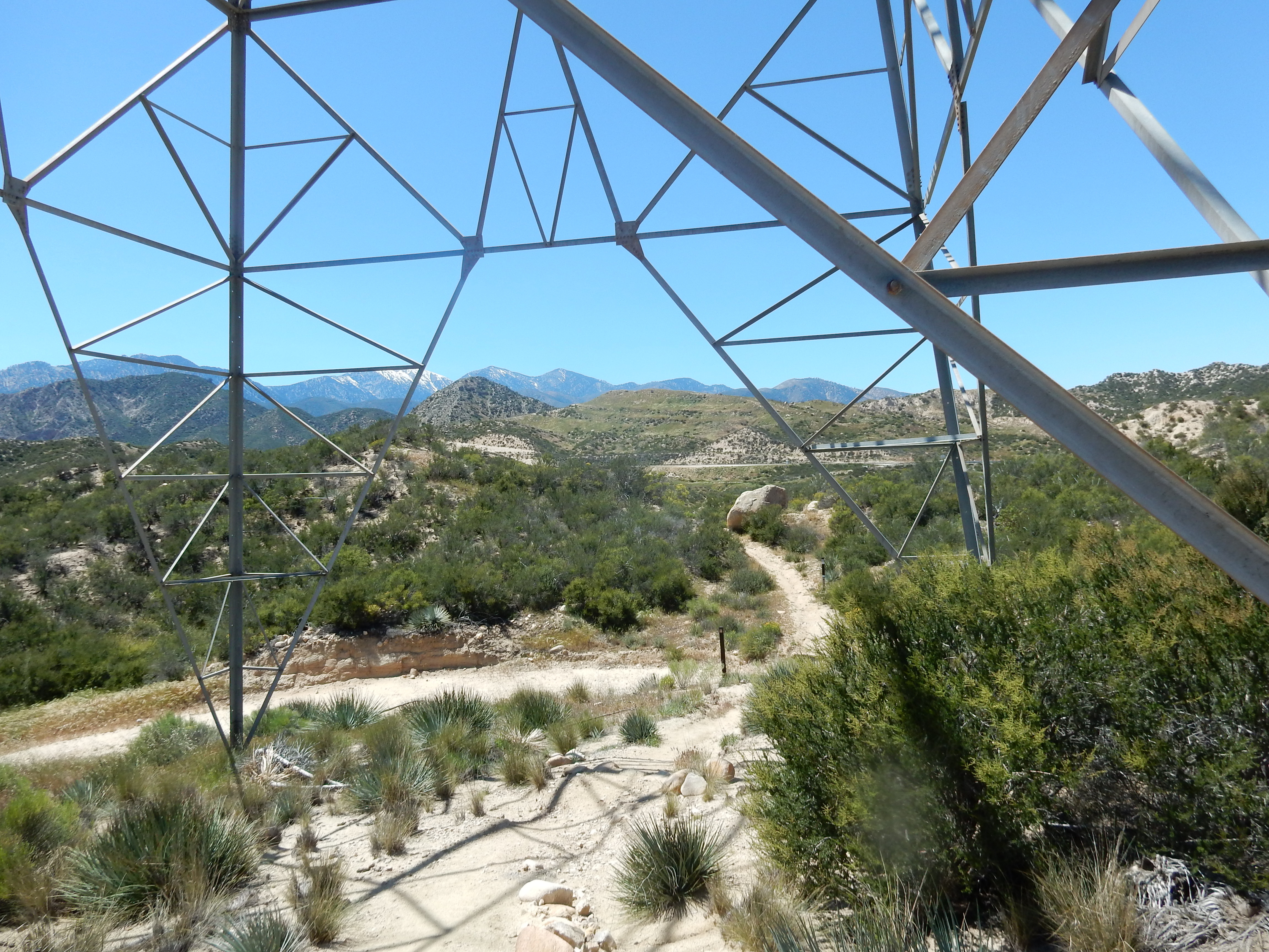 Before I get to the turn-off to the McDonald’s, the trail goes right under a massive tower. Yet, as industrial as this stretch of trail is, I find it much more beautiful than I had imagined it could be, going through steep, windblown sandstone bluffs and Crowder Canyon with a seasonal creek that still has pools of water for thirsty hikers! I’ve driven through the Cajon Pass area many times, and never imagined the natural beauty that is so close by.

This photo is taken right from the trail, as it traverses these sharply-etched bluffs with big drop-offs.
I reach the turn-off to the McDonald’s and soon encounter Zapka (“Lithuanian Guy”) who has a satisfied smile on his face as he returns to the trail with an iconic American hamburger filling his stomach. Dwight and Molly have just driven into the McDonald’s parking lot when I arrive at 2:15 pm, and I have a fountain drink (with ice!) and a medium order of fries before we head to the Best Western so I can launder my clothes and resupply my food. So I don’t actually have the on-trail shake referred to in this post’s title, but most hikers have at least one, along with massive quantities of burgers, nuggets, and other scary food. I’m guessing I’ve set the record for the smallest McDonald’s order by any thru-hiker.
Today’s miles: PCT Mile 324.69 to 341.87, for a total of 17.18 miles.
Day 24 (Apr.17): I spend most of the day at the Best Western doing all my resupply chores, and then have a late lunch with Dwight at the nearby Subway (not many food options here at Cajon Pass!) before hiking out mid-afternoon with a pack heavy with my food resupply and lots of water for what might be a hot and exposed climb, with the next water far away. Molly walks with me for a few minutes as the trail approaches a hilarious underpass that takes hikers under I-15.


Yes, that’s the Pacific Crest Trail at left, going under I-15. Yet, once I’m on the other side, I am again surprised by the natural beauty all around me – and I see from the Halfmile map that I’m walking along the San Andreas rift, which explains the interesting geological “story” that surrounds me.
I trudge along at such a slow speed that it would probably require specialized scientific equipment to even detect movement – I’m sleep-deprived from all my resupply chores, my pack is heavy, and even though it is significantly cooler than it often is in this area, it’s a sunny day that induces me to take a long near-nap under the shade of some shrubs.
 I enjoy the many views of the transportation infrastructure through this area, along with the varied landscape around me. When I reach Swarthout Canyon, after just 5.35 miles, I find a wooden cabinet with a water cache (and a fresh mango!, which I don’t eat only because I don’t want to have to carry out the heavy pit) and lovely campsites, so I set up my tent early in the shade of a tree poppy and call it a day at Mile 347.22.
Today’s “near-o” mileage: 5.35 miles. [Note: a “near-o” is a short hiking day with very few miles hiked; a zero is a day with no hiking at all.]
Day 25 (Apr.18): Today finds me sleeping in, enjoying my beautiful campsite (below) and not getting on trail until 7:40 am.
But one day after a resupply stop, ther e is no schedule, no need to rush. Once on trail, I hike for 8 hours under the shade of a “chrome dome” umbrella that attaches to my shoulder strap, and even under a bug net for a while to deter the annoying gnat-type creatures that buzz around my face. Yet, I know I’m enjoying an unusually cool day for this stretch of trail, as I hike from my starting elevation of 3,589 ft. to 8,123 ft. (Yikes – is that right? It’s in my little notebook, so I trust it is correct.) During the day, I meet Sparks, a section-hiker who is completing the PCT now by hiking from the Southern Terminus to Walker Pass and is a musician, a double bass player who plays classical, jazz and klezmer music; then Rainbow, a thru-hiker from Davis, CA. Though both Sparks and Rainbow hike faster than I do, it turns out that I will see them frequently on trail in the coming week or so.
As I approach the Wrightwood area, at one of the dirt road crossings, I encounter Ed, a trail angel who has been bringing cold drinks and snacks to this trail crossing since the 1990’s. The Gray Coyotes from Switzerland are there, enjoying a Gatorade, and soon I’m drinking one myself. Ed also has a big tub of wet wipes and I enjoy that luxury as well. What a treat!
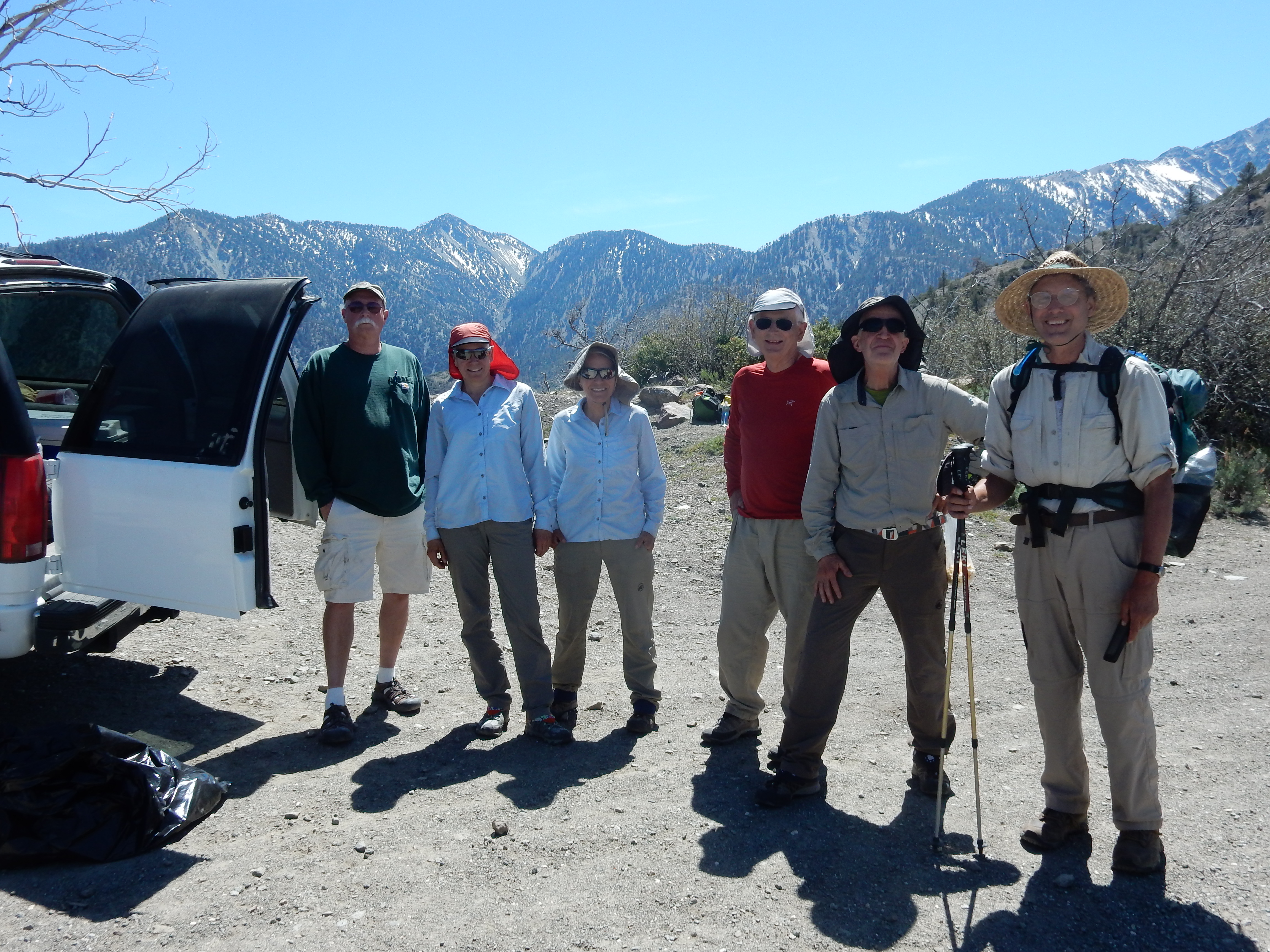
L to R: Trail Angel Ed from Wrightwood; the four Gray Coyotes; Sparks.
Later, at Mile 362.48, I pass the trail junction with the Mount Baldy Trail – I’m not tempted, since I’ve summited Mt. Baldy twice, and it’s a 3.74-mile side trip each way – not to mention the fact that three people died on Mt. Baldy in February, not prepared for the snow and ice they encountered.
 There’s a little snow on trail but nothing serious. There are great vistas today, including Mt. Baldy views, along with forests with big trees and other high-altitude treats.
I camp close to the side trail to Guffy Spring, sheltered by an enormous log, stopping just shy of Guffy Campground which is notorious for bear visitations.
Today’s mileage: 17.28 miles, ending at PCT Mile 364.5.

Betty — so surreal to read your blog and yet know that you are up and past Kennedy Meadow. Sorry we cannot get up the closed Cottonwood Meadow road near Mt. Whitney and hike up to Chicken Springs Lake to see you. Best regards — Charlie and Lynn
LikeLiked by 1 person
Looking forward to your next installment, no matter how far it lags behind your feet. I do hope you’ll revert to full botanist when you describe the Poodle Dog Bush, I still have so many questions, like does the dead, dried PDB pose same threat as fresh PDB.
Happy trail.
LikeLiked by 1 person
Can’t wait to read your next post, probably while we are in Indonesia with Louis, turning 50 this Sunday! We leave tomorrow AM, May 13.
LikeLiked by 1 person
Louis turning 50 — now that is a brain twister! WOW – and give him my belated birthday wishes and big hug. Loving your photos from Indonesia, and sorry to be so late in seeing your comment.
LikeLike
Sparks! I met him on the descent to the faucet in Section B. He’s almost done! Enjoying the blog.
LikeLike
Hello Betty, I like your blog. I read all of it. Beautiful photo’s. I hope you will meet Tim (my son) again. He is in Kennedy Meadows right now.
LikeLiked by 1 person
Hi, Christien – just now seeing your comment, and I’m guessing you are with Tim now — enjoy your visit!
I felt so lucky that we ran into Tim and Prince just as they were first approaching Forester Pass – I’ll have so much to say about that part of our hike once I am caught up on my blog. If Tim has a chance to call me, that would be great. My cell is 858-205-3834.
LikeLike
I am wondering how your feet were holding up at this point. OK?
LikeLike