Days 34-37  The Pacific Non-Crest Trail: Aqueducts, the Mojave Desert & a Huge Harvest of Wind and Magic

Days 34-37  The Pacific Non-Crest Trail: Aqueducts, the Mojave Desert & a Huge Harvest of Wind and Magic

Day 34 (Apr. 27): The Tejon Ranch Blues and other private property musings

DSCN1574.JPG

Hunt clubs (just an hour from L.A.!) ~~ Aqueducts for the thirsty millions in L.A. ~~Wind turbines that feed the L.A. power grid… Welcome to the Non-Crest portion of the Pacific Crest Trail, where land use politics have consigned the PCT far from the crest of the Tehachapi Mountains, its logical placement, to the margins of the Mojave Desert.

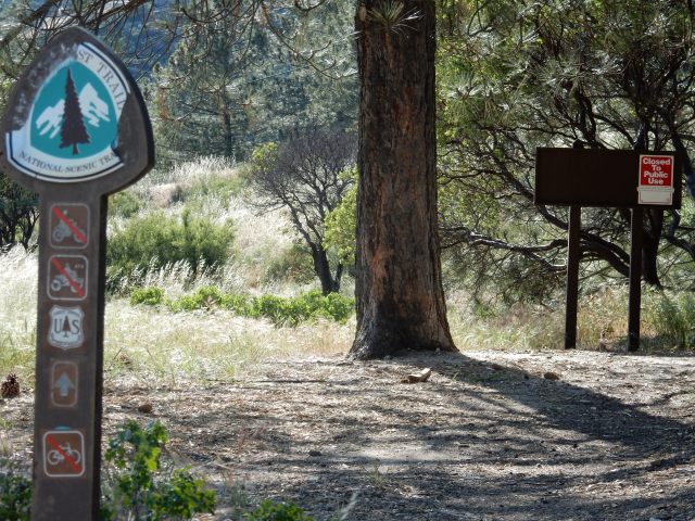
This section of trail was the last to be completed, with protracted negotiations in the early 1990s between the officials responsible for the PCT and private landowners, most notably the enormous (and politically powerful) Tejon Ranch. The resulting trail represents what could be achieved politically at the time, and not what is logical for a national scenic trail designed to follow the crest of the mountains. Some day, 37 or 38 miles of the PCT will be relocated to that more logical place near the crest of the Tehachapis, but since this process involves protracted negotiations between multiple entities, with the Tejon Ranch Company being (in my opinion, of course) a highly adept foot-dragger, I can’t count on that happening in my lifetime – so here I am, hoping for the best, bullet-wise and otherwise.

What could be more wilderness-like than walking by signs letting you know that hunting and shooting will be taking place for 8 hours of your hiking day? Or, I suppose, you could add a hunting adventure to your PCT thru-hike – for only $350 per person, you can get the “Mini Mixer” package including 2 pheasant, 3 chukar, 5 Tennessee red quail, a dog handler, and lunch. Political junkies will find this 1998 news report about the public hearing on the conditional use permit for the hunt club an interesting read.

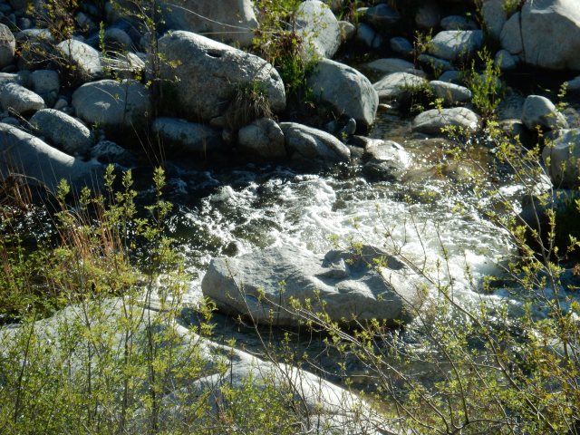
The day does not seem promising for those seeking nature’s beauty on the PCT, with the trail often closely confined by barbed wire, a flat desert floor ahead marked with large irrigation circles, and thoughts of birdshot floating through one’s brain.

DSCN1566-corr.jpg

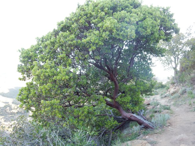
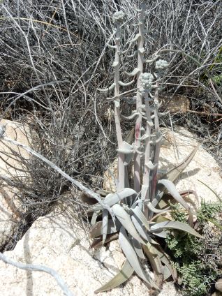
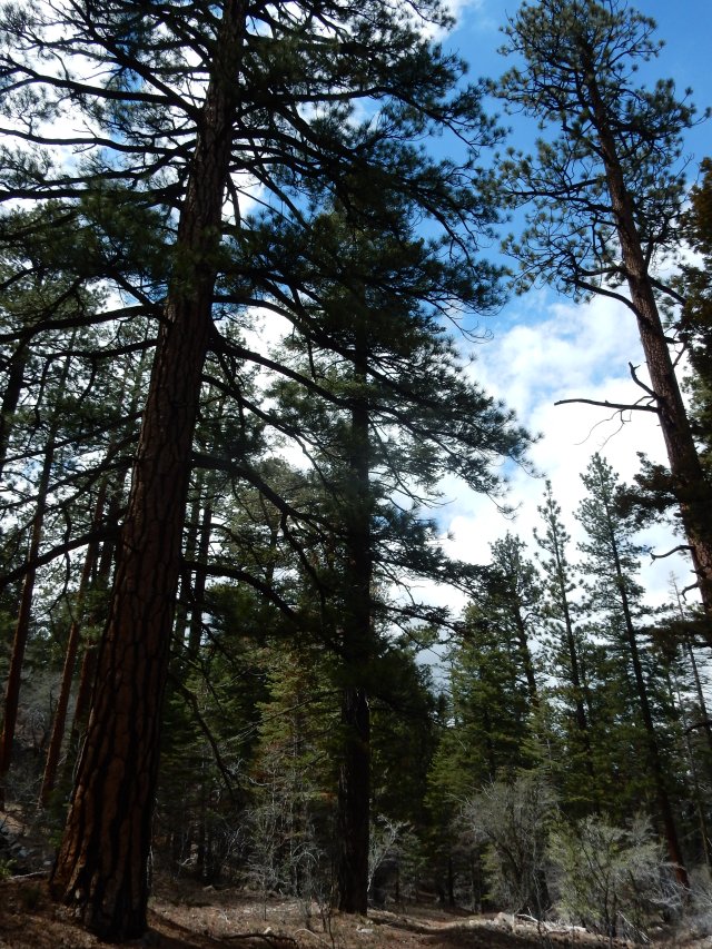
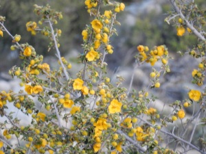
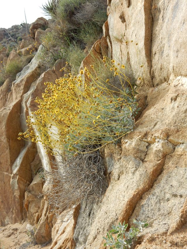
With careful framing, a certain sere beauty can be captured:

DSCN1588.JPG

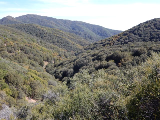
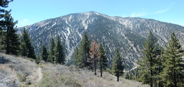
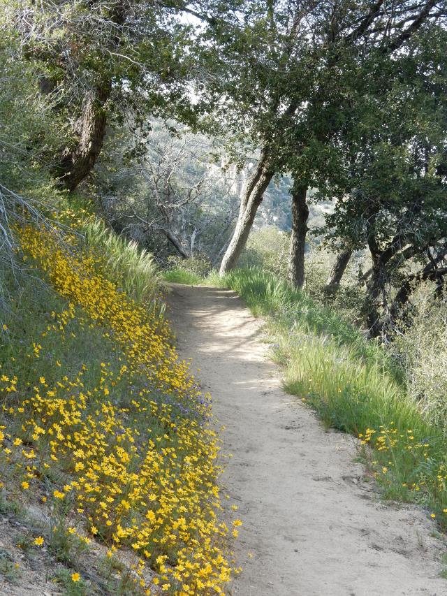
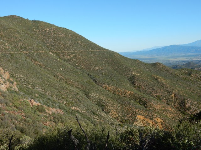
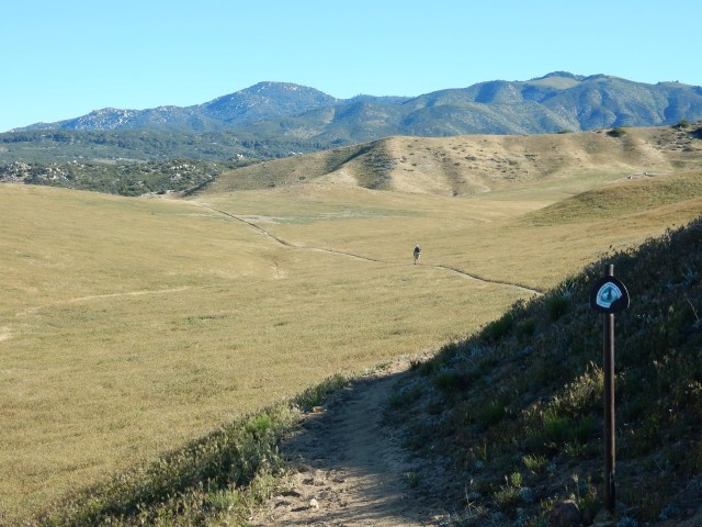
After seeing the Southern California hills at their greenest and most bloom-filled for most of my hike, I enjoy seeing hills cloaked in the classic California gold tones that prevail for much of the year:

DSCN1591.JPG

Descending to the flat land, a jeep track does double duty as the PCT for awhile:

DSCN1601.JPG

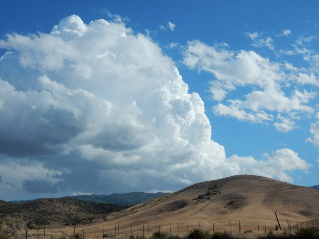
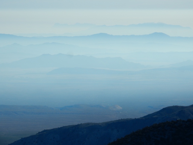
Meanwhile, looking back, I see that big clouds are building up quickly:
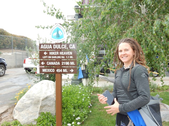
DSCN1602.JPG

DSCN1603.JPG

Hikertown

A big goal for my day is to get to the next water source, a strange place called Hikertown, refill my water (and leave a donation), and then continue hiking and find a place to camp in the strangeness that is the Aqueduct portion of the trail. Hikers can spend the night at Hikertown, which has various places to sleep, shower, do laundry, etc., but my tent strikes me as a cleaner place to sleep (and Sparks’ comment the next day about mouse droppings where he slept at Hikertown confirms my choice).  In the “hiker lounge,” where I hang out for a short while to clean my feet and refill my water, I encounter Zapka (“Lithuanian Guy”), Rainbow, and Sparks, along with other hikers, and catch up on trail news and gossip. As usual, trail “news” is of spotty accuracy, with a hiker announcing, erroneously, that the Lake Fire Closure has been lifted today.

With a few hours of daylight left, I hike the paved road that serves double duty as the PCT until it runs into the Aqueduct, which is an open canal in the first section I encounter:

DSCN1604.JPG

The PCT sign points the way southbound, toward Hikertown

The Trail is more concept than actual trail here, following the open Aqueduct for awhile, and from some vantage points, it certainly has a type of (unnatural) beauty:

DSCN1611.JPG

…along with some sections that have an industrial, unabashedly ugly aspect:

DSCN1613.JPG

DSCN1614.JPGThe PCT signs here are ad hoc, and to my eye, they are in perfect harmony with the spirit of the trail here (“You have an easement to walk through here – go that-a-way and move along.”).

I soon reach the part of the aqueduct that is no longer a open ditch – instead, there is a large metal pipe with big rivets, with a paved road alongside. It reminds me of a middle school art class exercise in perspective drawing.

DSCN1621

DSCN1618There are big valves at intervals along the pipe, so that it looks like a submarine is surfacing through the desert floor.

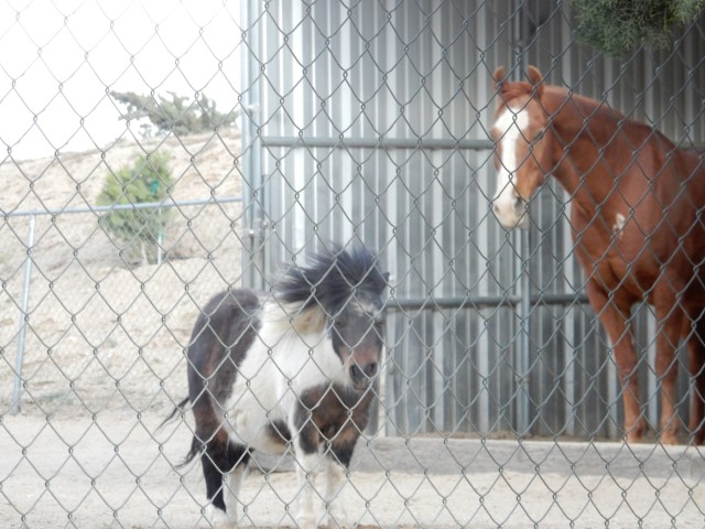
A few cars pass by on the road, and there are some houses, horse barns, a geodesic dome, and other kinds of compounds that are similar to what we have seen in other remote areas along the trail. I’m starting to wonder whether I’ll be able to find a safe place to set up my tent for the night – away from cars, not too close to houses or other “civilized life” where the presence of hikers in little tents might not be welcome.

It’s windy as all get-out, as illustrated by this Shetland pony’s mane, serving well at the moment as a windvane. I love the fact that the pony walks from its shelter to the fence, as close as possible to me. I greet it with a word of thanks for what I interpret (or anthropomorphize) as a warm welcome.

DSCN1617.JPG

As I hike along the edge of the paved road, the landscape transforms into a wonderland of Joshua Trees, and I hike on top of the aqueduct for awhile so that I can look for a suitable spot to pitch my tent, and I soon find one of my favorite campsites of my entire hike to date.

DSCN1625-adj.jpg

A large, multi-branched Joshua Tree shelters me from the wind and screens me from view of any passing cars. The sky provides a Technicolor show for my evening entertainment, and though I hear rain on my tent at some point during the night, I wake up to a perfectly dry tent, courtesy of the arid Mojave Desert.

Today’s mileage: 19.18 miles, ending at PCT Mile 522.21.


Day 35 (Apr. 28): Again with the Aqueduct and Monster Winds! and the Start of the Endless Wind Turbines

Even if you’re hiking the Non-Crest part of the Pacific Crest Trail, you really cannot complain when your morning looks like this:

DSCN1635.JPG

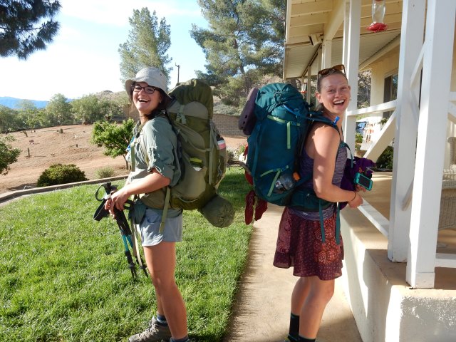
Since I hike alone so much, it’s truly a pleasure when I have the opportunity to hike with others, and today, Sparks and Rainbow, who spent the night at Hikertown but started hiking much earlier than I did, soon join me for a fun day of Aqueduct and Wind Turbine hiking together.

DSCN1637.JPG

Sparks (L) hikes the road, while Rainbow (R) hikes on the concrete top of the aqueduct.

DSCN1652.JPG
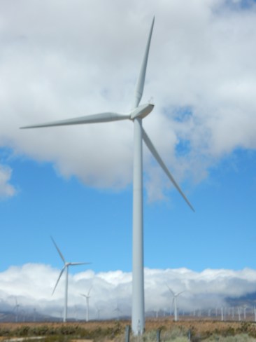
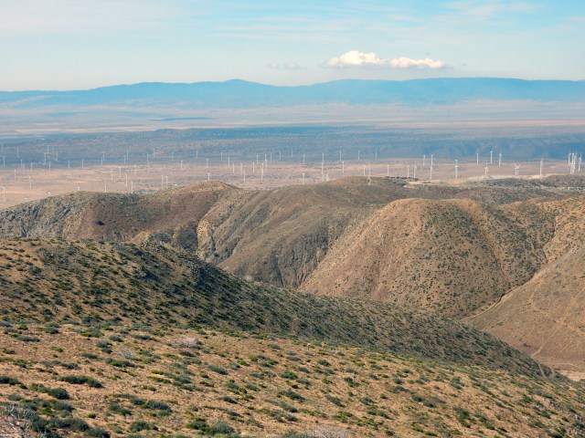
We are soon in full-blown Wind Turbine territory, hiking in big winds in the midst of a very large-scale wind farm. Hundreds of sleek, modern wind turbines surround us as far as the eye can see. I feel like I’m hiking through a giant kinetic art installation by Christo, akin to his (non-kinetic) Umbrella project. I know some people think these massive windfarms mar the landscape, but to my eye, they fit in perfectly, and I’m glad to see such a large-scale renewable energy project. (Drive by the oil rigs in Oildale near Bakersfield to see what the fossil fuel version of this “art installation” looks like.)

DSCN1653.JPG

The concrete-covered aqueduct does double duty as the PCT as we enter Wind Turbine Country.

DSCN1662.JPGRainbow has elected to hike all the way from Hikertown to Kennedy Meadows without resupplying, since he’s meeting a friend there on a date certain, so he’s carry a huge load of food. I know I won’t be seeing him after today, given his schedule.

Sparks has been section-hiking the PCT over a number of years, and once he gets to Walker Pass, he will have completed the entire trail. Thus, I have a relatively short time to share with him on the trail, as well. So I enjoy today’s company greatly, knowing how soon our paths will part.

It’s hard not to take a zillion photos of the wind turbines, with the varied backdrops of clouds, Joshua Trees, and mountains. Yet, we manage to hike at a fast clip because we’re on a flat, smooth road. At one point, we find a cooler where a dirt road intersects the PCT, filled with cold sodas. Magic! This section is often very hot, but it’s cool enough today that I’m often hiking in my jacket. More magic!

At last, the PCT departs from the Aqueduct and starts to look like “real trail” again.

DSCN1666.JPG

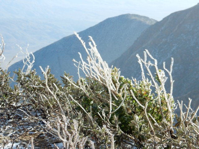
Once we start climbing up into the hills that will eventually take us to Tehachapi, we get a powerful reminder of why all these wind turbines are here – the wind blows so constantly, so forcefully, that it takes a huge effort to stay upright on the trail. Wind is apparently the force of nature that is my totem, the spirit being that is the symbol of my PCT hike. Not to fear: I have my cloak of invincibility, the LLBean jacket that has protected me in every wind-, rain- and snowstorm along the way. So I zip it up tightly, with the hood protecting my ears and face, and I lean forward and make my way through the huge winds. At times, it’s a hilariously slow slog, and by this point, Rainbow and Sparks are out of sight.

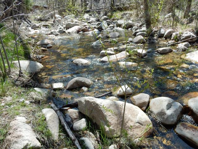
I reach Tylerhorse Canyon, which has a creek with a tiny flow, but enough to serve as our big water source for the day. Sparks calls me over to the area where he’s setting up his tent, and I camp near him, while Rainbow fills up on water and hikes out to stay on schedule for his Kennedy Meadows meet-up. Bye, Rainbow -it was a blast spending time with you on trail!

DSCN1674.JPG
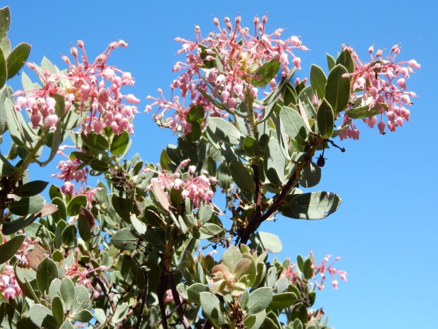
I know that I’ve pronounced last night’s campsite as my favorite so far on the trail, but tonight’s site outdoes even that amazing Joshua Tree site. I find a bare spot just big enough for my tent, surrounded on three sides by tall California flannelbush shrubs (Fremontodendron californicum) in full bloom. I set up my tent so that the door opens to the most riotous blooms, and though the winds howl around me, my little shrub-and-tent home is a perfect, peaceful haven for the night.

DSCN1670.JPG

Today’s mileage: 19.39 miles, ending at PCT Mile 541.60.


Day 36 (Apr. 29): Tehachapi on My Mind

I’m guessing that if you took a poll of  hikers at, say, Mile 600, they would report today’s miles as their least favorite on the trail so far.

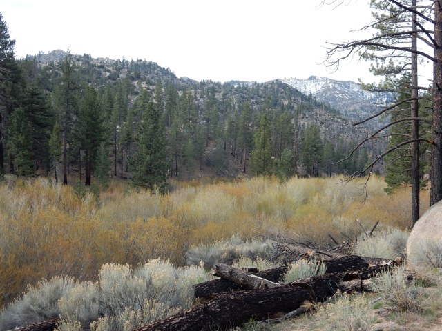
Here is what the creek in Tylerhorse Canyon looks like in the early morning – the water in the creek is so minimal it isn’t visible even from this short distance, and it’s hard to believe I found such a flower-filled haven for the night, looking at the photo below (but it’s there, on the right side of the image).

DSCN1675.JPG

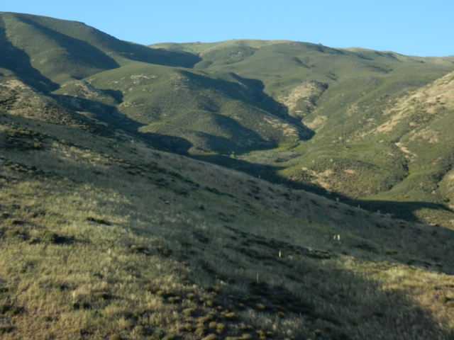
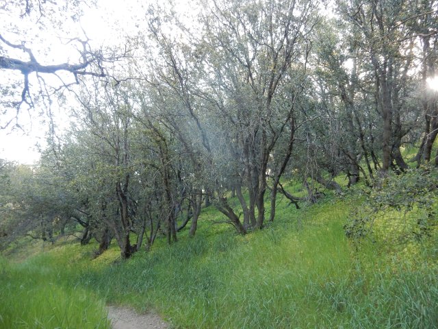
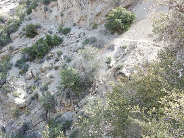
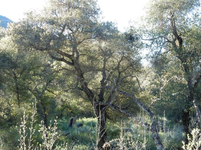
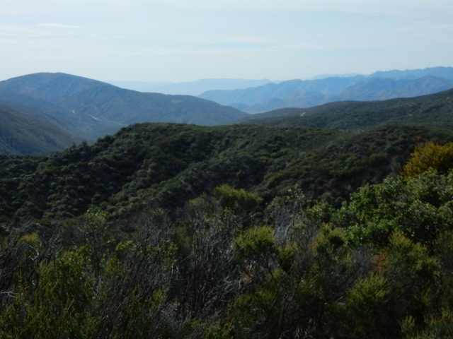
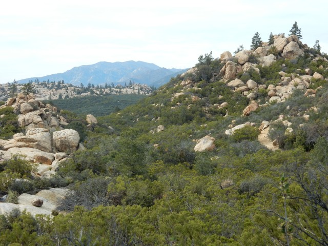
For much of the day, the trail winds in and out, in and out, ad infinitum, through the folds of these hills:

DSCN1677-adj

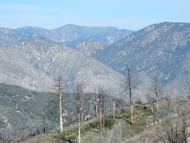
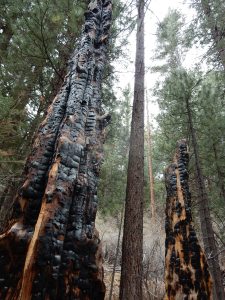
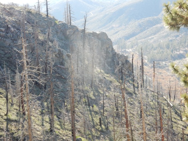
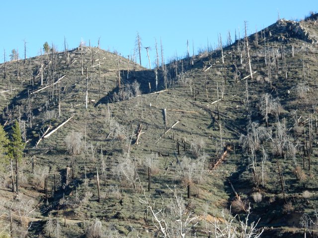
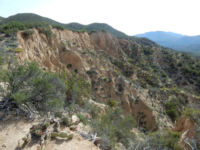
A recent storm has created some washouts that are a little difficult to traverse, but what really has a big impact on many hikers are the dirt bike trails that are prolific throughout this section. It’s a visual blight that piles on top of the already-harsh landscape, and the big areas of fire burn don’t help.

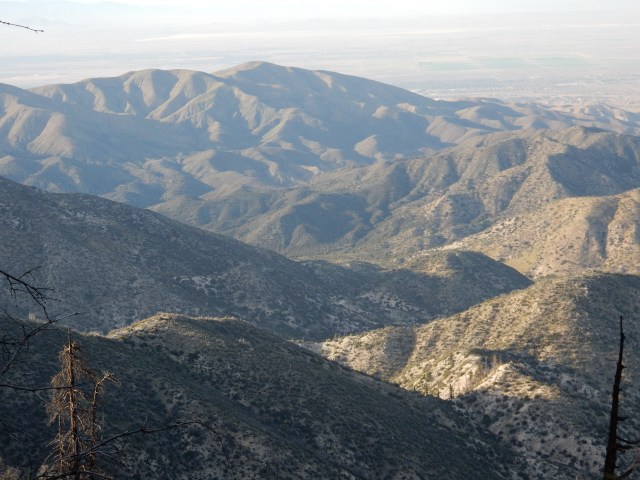
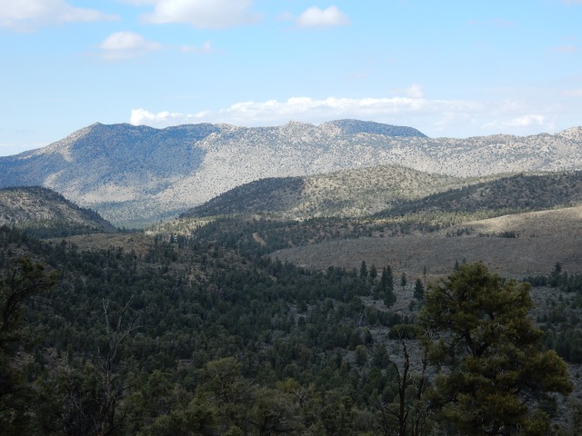
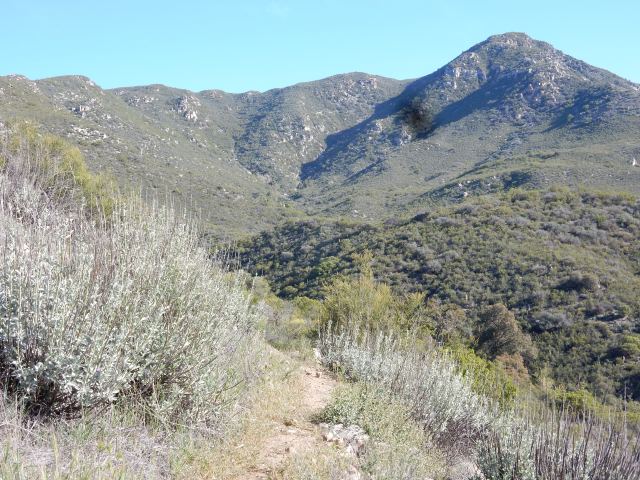
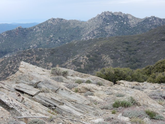
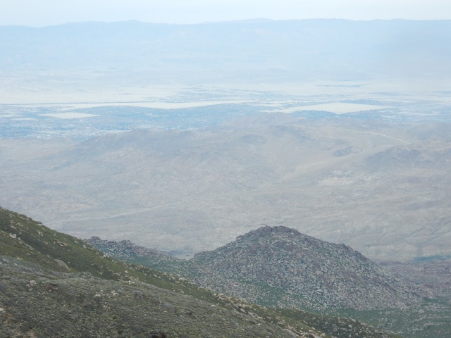
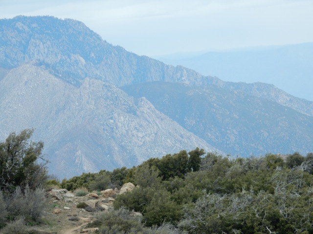
At times, I have big views looking back at the varied landscapes I’ve hiked through in recent days:

DSCN1686-adj.jpg

DSCN1684.JPG
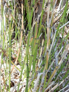
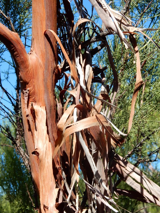
A few things are thriving here, most notably Mormon Tea (Ephedra sp.), which is greener and in fuller bloom here than I’ve ever seen it. Most living things, though, have a dispirited look – hikers included.

The fire burn areas, as usual, come with some blowdowns that turn the trail into a temporary obstacle course. All in all, you can’t blame hikers in this area from thinking ahead to Tehachapi, with its three Thai restaurants, two Best Western motels that feature hot and cold water on tap, and similar barely-imaginable luxuries. It’s good to be “in the moment,” but sometimes, it’s also good to skip ahead in your mind to someplace slightly more appealing.

DSCN1703.JPG

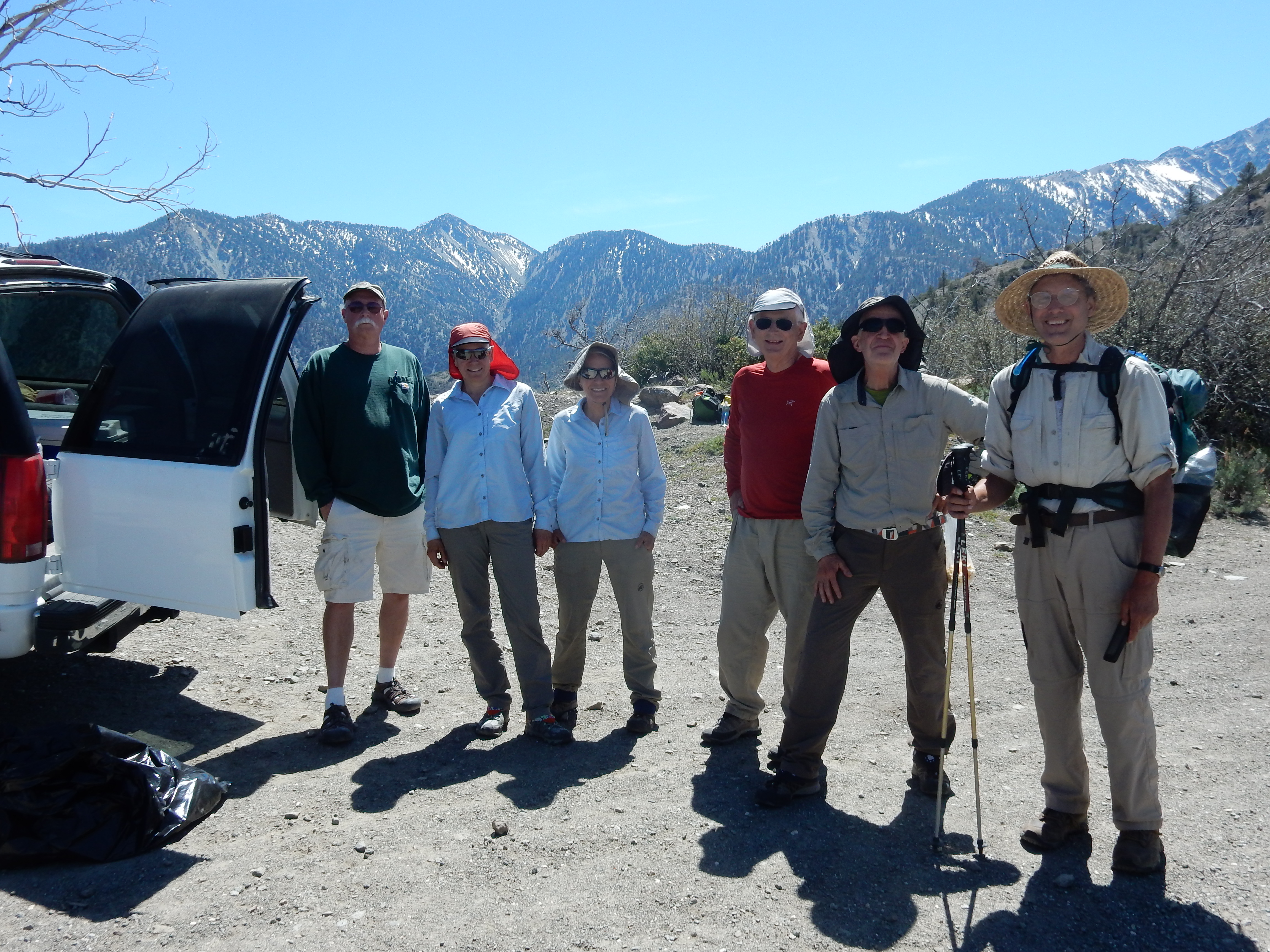
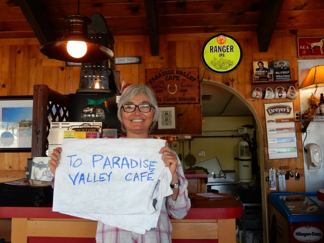
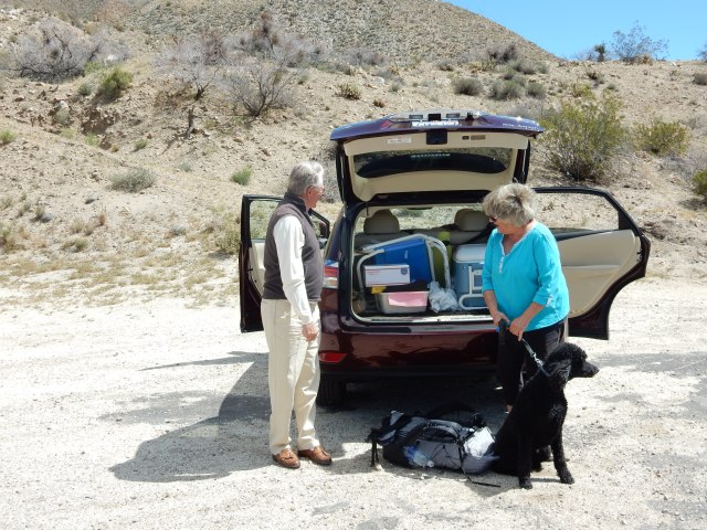
At least it’s not blazing hot, and in time I get to Tehachapi Willow Road, which is the first road hikers cross that goes to Tehachapi or Mojave. As the trail nears the road, I find a PCT register box that has a very long list of Trail Angel names and phone numbers – locals who are willing to help hikers get to town, or perhaps host them in their homes, or help them run resupply errands, since Tehachapi is very spread out and not very walkable. The list says “please randomize your calls,” so I do what I guess many hikers do, and call the person who is in the middle of the list. A trail angel named Jan immediately starts driving my way. She delivers me to the Best Western that accepts dogs (Dwight and Molly will be arriving shortly!), and firmly refuses my offer of gas money. A huge thanks to you, Jan, and all the trail angels on that big list!

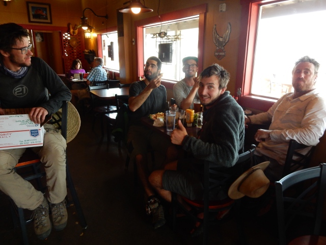
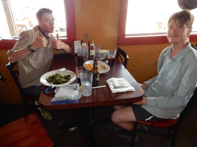
When Dwight and Molly arrive, I’ve already showered and cleaned up, ready for my “town clothes” from one of my resupply buckets. Cotton! Jeans! Flip-flops! Dwight, as usual, ends up ferrying hikers around town,  and then we head for a great, not-previously-dehydrated meal from King of Siam Thai Restaurant, where we share a table with two hikers from Switzerland (originally from Poland and Germany, respectively). So we have a great, convivial end to what may not have been the best miles the trail has to offer, but to paraphrase the fishing cliché, even a bad day of hiking beats a day at the office, and it wasn’t a bad day by any means.

Today’s mileage: 16.96 miles, ending at PCT Mile 541.60.


Day 37 (Apr. 30): Tehachapi Rocks!

I don’t usually write much about my resupply stops, but  my “zero” in Tehachapi provides some colorful experiences I want to remember – and first and foremost, this blog is intended to serve as my “memory.”

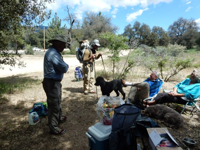
Beast and Forget-Me-Not call to say they have arrived in Tehachapi – perfect timing, since my motel room will have space for them once Dwight and Molly leave. I spend time on my laptop uploading photos and then updating my blog, since Dwight brings my computer to our resupply meetups. I mention in my blog post that I am posting about days on the trail that occurred several weeks ago, and that in “real time” I am in Tehachapi.  Soon after I update my blog, a woman named Barb who follows my blog posts a comment that she lives close to Tehachapi and wants to take me out for lunch or dinner. Wow! Since Dwight and Molly have to leave after lunch – a delicious Mediterranean meal with Beast and FMN at Petra’s – I arrange with Barb to have dinner with her tonight. Until then, it’s a huge bunch o’ chores – laundry, prepping my meals for the upcoming section, cleaning/repairing gear, getting a haircut (yay!), etc.

After my haircut, the hair stylist asks if I can give her a ride to the bus stop. Beast, FMN and I get a huge laugh out of this, because hikers are always cadging rides from locals, but this may be the first time a local businessperson has asked for (and gotten!) a ride from a thru-hiker. It does sober me up a bit, however, to contemplate that this woman has ridden a bus from Mojave, some 21 miles away, just to give a haircut to me and one other customer. I don’t know about the other customer, but my cut was just $25, so I run the numbers in my head and leave what I hope is a generous tip.

Barb is set to meet me, Beast, and FMN in the motel lobby for dinner. As promised, she is there in the lime green top she described, and she says to me: “I know you’re a vegan, and I thought we’d go to the steakhouse for dinner.” Now THAT is a stellar opening line. And it turns out to be a great choice, with terrific salads consumed all around, along with draft beers (but no steak).

Barb is a trail angel on her own terms – she’s not on the big printed list, and she essentially finds and chooses the hikers she wants to help. She knows me only through my blog, which she probably found through the PCT Class of 2016 Facebook group, and she reads it to her husband. She actually lives a fair distance away – in California City, north of Mojave – and she brings her beautiful and elegant daughter as her “chaperone.” The daughter and I joke that on either the hiker side or the trail angel side, someone could be a serial killer, and it’s too early to know yet whether that is the case.

Barb got interested in the PCT when her daughter’s former boyfriend was interested in hiking it, and since then, she has hosted a number of hikers, and has also traveled to the Idyllwild area to work on a PCT trail maintenance crew. All of this generosity, in terms of time, money and goodwill, is truly amazing, and I love the fact that Barb chooses her own path as a trail angel. When you hike the PCT, you might assume your best memories will be of spectacular mountains, alpine lakes, and other natural wonders, but in fact, some of your best memories will be about the hikers and trail angels you meet along the way.

Today’s mileage: 0.00 miles – a true Zero! 

Posted in Hikes | 2 Comments

Days 30-33: Sweet Water, Guzzler Water, and Another Fire Detour (with Ostriches)

Day 30 (Apr. 23): Agua Dulce, Descanso Dulce (Sweet Water, Sweet Rest)  Before sunrise, I pack up my tent as quietly as possible, since other hikers are in tents very close to mine behind the North Fork Ranger Station. Dwight and Molly are meeting me at the Acton KOA, just a little over 8 miles up the trail, and they can only stay about 2/3rds of the day, so I’m eager to spend as much time as possible with them.

DSCN1485.JPGI start hiking by the light of my Waka Waka solar charger and light – I clip it to my sternum strap and adjust it to focus the light on the trail ahead of me. Much better, in my opinion, than a headlamp.

Soon, the sun is out in full force, and I’m bounding mostly downhill. It turns out that this section of trail is heavily used by trail runners, and it’s great to see so many people out enjoying their local “piece” of the PCT.

DSCN1492.JPGDSCN1491
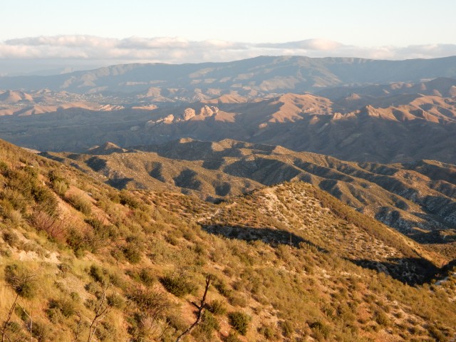
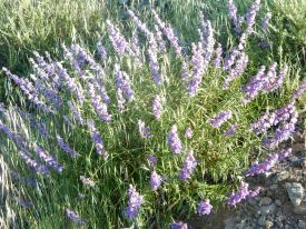
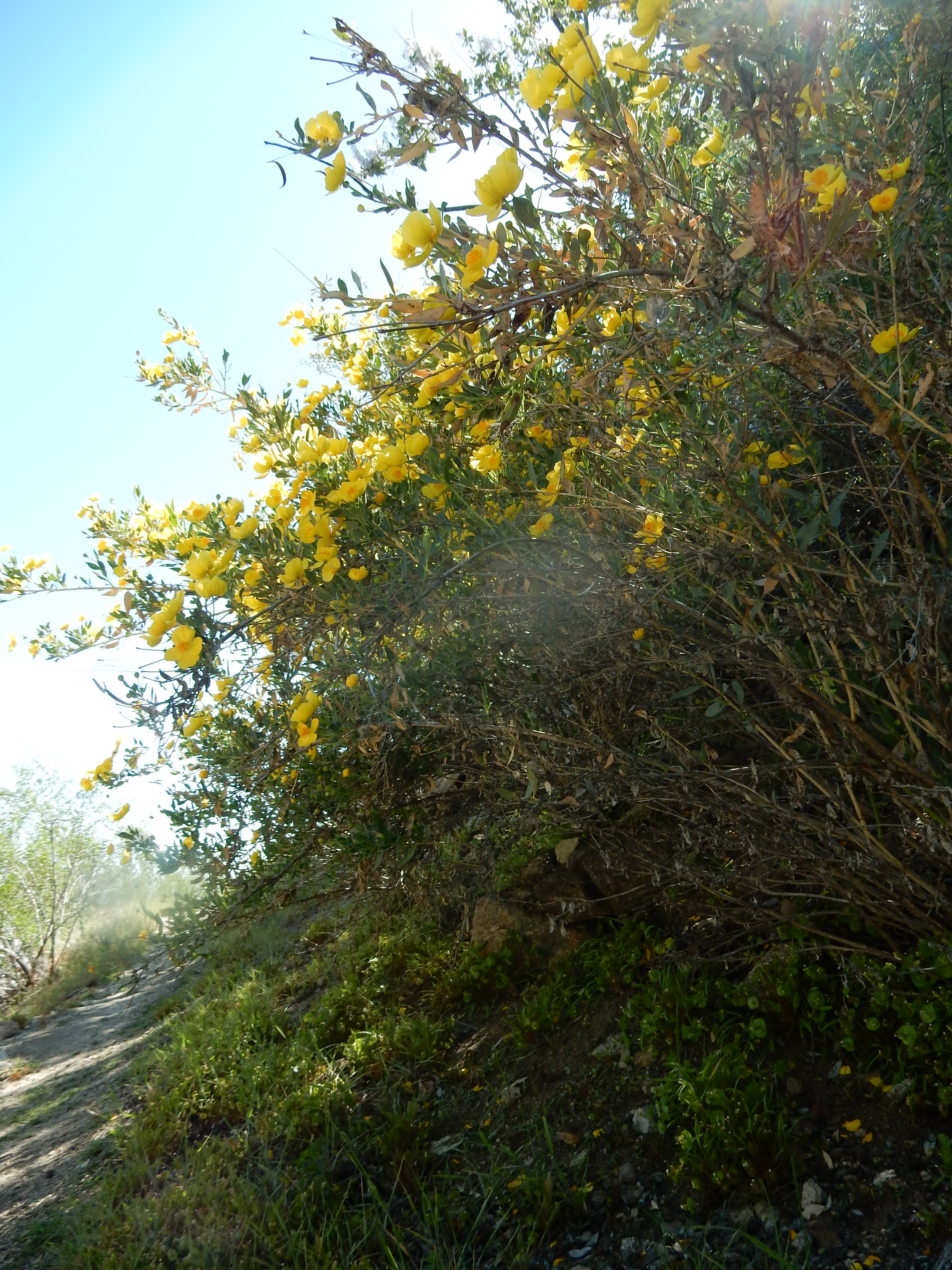
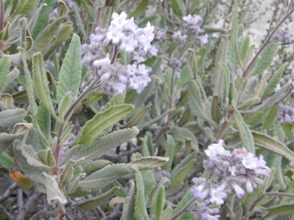
Once again, hills that look brown from a distance are actually full of beautiful flowering plants, including Yerba Santa (Eriodictyon sp., at right), California Flannel Bush (Fremontodendron californicum),  and some sages (Salvia sp.).

I soon see Forget-Me-Not ahead of me – she and Beast camped up the trail a bit from the North Fork Ranger Station. As the trail descends to the paved road near Acton, I catch up with them at a picnic table near a parking lot where someone has set up refreshments for the local trail running club, and I tell them that if they are going from Acton to Agua Dulce, they can slack-pack, because Dwight will be at Acton with a car, and can drive their packs to Hiker Heaven in Agua Dulce. Slack-packing is hiking with a minimal pack (perhaps just water and snacks). So we take the short side-trail to the Acton KOA where we wait for Dwight and Molly to arrive. Meanwhile, we find Wildfire, a Canadian hiker, who is limping around Acton KOA with an overuse injury, and agree to transport her to Hiker Heaven as well. So when Dwight and Molly arrive, we cram four backpacks and two hikers (Wildfire and me) into the car, alongside my numerous plastic tubs with resupply stuff, and head for the most amazing Trail Angel place imaginable: Hiker Heaven in Agua Dulce.

DSCN1494.JPG

Hiker Heaven is the product of the phenomenal organizational talents of Donna Saufley. About one mile off the main street of Agua Dulce, it has a guest house with a shower and tub, a fully-equipped kitchen, several bedrooms, and a living room with lots of space for hanging out (where Dwight, above, enjoys playing the “house guitar” while I work on my resupply); lots of spaces around the property for tents; clean “loaner” clothes hikers can wear while Donna and her helpers launder our hiking clothes, which are then delivered clean and neatly folded; canister fuel for purchase; well-organized hiker boxes that hikers use to leave items they don’t need, or find items they need; and much, much more. There are horses and dogs and lovely groupings of drought-tolerant plants in bloom. The donation jar is discreetly placed, but I hope all my fellow hikers find it (hint: in the garage near the fuel canisters for sale) and leave a nice donation to help defray all the expenses involved in the services that are so generously provided by these amazing trail angels!

I use the guest house to prep my resupply for the next stretch of trail (organizing my meals, replenishing my sunblock and other supplies, etc.), while Dwight plays the guitar. Tim (“MP3”), my 19-year-old hiker friend from the Netherlands, returns from a group trip to the REI, and he plays some guitar as well.

When it is time for Dwight and Molly to leave, they drive me back to Acton KOA so that I can hike the 10-or-so miles from there back to Agua Dulce, going through the often-filmed Vasquez Rocks in the process. (Early Star Trek, anyone?) We also give Sparks a ride back to Acton so he can wait for the Post Office to open on Monday and retrieve his resupply box there – he ended up at Agua Dulce with a resupply box in Acton by a series of hilarious-in-hindsight missteps. (And this is a good example of why I see Sparks so often on trail, even though he hikes much faster than I do…)

DSCN1497.JPG

Vasquez Rocks

Once I hike back to Agua Dulce, I stop at Sweetwater Farms, the local grocery store, and get a ride to Hiker Heaven, along with Team Emerson and some other hikers, from Hiker Heaven volunteer Ron, rumored to be the founder of Mountain Laurel Designs. We have the fun of watching 9-year-old Emerson take big swigs from a gallon jug of milk, and I enjoy a great evening of hiker camaraderie, with Beast, Forget-Me-Not, Tim/MP3, Team Emerson, and many others. The one thing you can count on from thru-hikers, however, is total respect for “hiker midnight,” which is 9 pm. By then, all is quiet, and I have a nice spot in the guest house living room, next to Beast, FMN, and a hiker who quietly packs up and hits the trail at around 3am, so he can do the road-walk out of Agua Dulce before it gets hot.

Today’s mileage: 18.42 miles (North Fork Ranger Station, PCT Mile 436.08, to Acton KOA, Mile 444.31, then, later in the day, Acton KOA to Agua Dulce, Mile 454.50)


Day 31 (Apr. 24): A Hiker Heaven Nearo, a Mary Poppins Lunch, and a Trail that is Mostly a Road  

I spend the morning lazing about Hiker Heaven, with the morning hours passing blissfully slowly so that my “nearo” (a day with very few miles hiked) almost feels like a true zero. Rainbow hikes out early, as do Beast and Forget-Me-Not, with Beast (below, left) sporting a shirt she found in the hiker box. Their packs are huge, but I’m not about to offer advice to people who can hike circles around me while wearing such beautiful smiles.

DSCN1498.JPG

I pack up my gear in slow-motion, and then walk into town with the fabulous Mary Poppins (Milissa) for a long lunch. Mary Poppins and I are both signed up for an on-trail snow class that will take us from Chicken Spring Lake (in the High Sierra) over Forester Pass, and we discuss timing it  so that we are in the same class, and can hike together from Kennedy Meadows to Chicken Spring Lake. Yay! After lunch, I hike on (in Agua Dulce, the main road through town IS the PCT), while Milissa returns to Hiker Heaven for a full zero.

DSCN1500.JPG

The “trail” turns out to be road for quite a while, but soon enough, I’m in the kind of gentle California rolling hills that I’ve often gazed at from the road, wishing I could be hiking across them – and the PCT provides the perfect opportunity to do just that. It certainly isn’t wilderness, but the land looks cared-for, and loved.

DSCN1510.JPG

DSCN1505.JPG
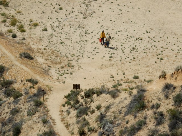
There are a few locals walking with babies and dogs, happy to chat about the PCT; there are familiar chaparral plants in bloom.

DSCN1507.JPG

Once I’m past the dirt roads that lace the lower sections, I have these beautiful hills all to myself, and I find a nice, tiny spot halfway up the hill and set up my tent for an early end-of-day. Today, I have no schedule, my next resupply is far away, and I can enjoy an early camp and a leisurely dinner that is quite tasty, even if it is something I “cook” and eat out of a freezer bag.

Today’s “nearo” mileage: 6.09 miles, ending at PCT Mile 460.59.


Day 32 (Apr. 25): A Beautiful Day, Right Up to the [next] Fire Closure  Today is another day in gentle rolling hills, with few people in sight. A local runner passes me and simply says, “Enjoy Canada.” Sweet!DSCN1511.JPG

As I cross a paved road and head up the next hill, I’m thinking about Wildfire, Prince and others who have had overuse injuries, and how lucky I am to have been essentially injury-free. At that instant, I start experiencing left knee pain with every uphill step. I look down at the road I’ve just crossed, knowing it’s my best chance to get somewhere (where?) if I have an injury. I can’t face that prospect, so I take out my Leucotape and fashion what I imagine a Cho-Pat strap is like, and keep going. I take some Advil and decide it will be fine – and it is.

There’s a lovely stretch of oak-lined trail:

DSCN1514.JPG

DSCN1516
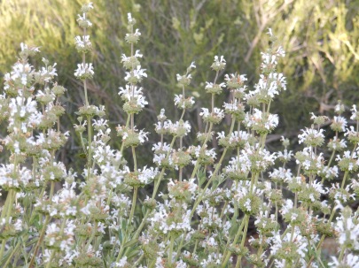
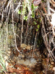
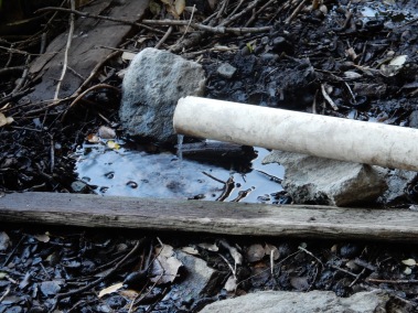
And then there is the morning’s water source: Bear Spring at PCT Mile 463.24, which turns out to be a small flow from a length of pipe (at right), with the next water 15 miles away.

DSCN1519.JPG

I see some of the largest examples I’ve ever seen of Wild Cucumber (Marah macrocarpa) fruit here, though I’ve been seeing this amazing plant, which I totally love for about 12 different reasons, since Day 1 on the trail. It is sometimes called Manroot because the underground tuber can weigh more to 220 pounds  and be several meters long. With winter rains, vines emerge from the tuber and scramble quickly across shrubs or the ground, using curly tendrils to grab support. Tiny flowers lead to the large, spiky fruit shown below. At some point, the fruit turns brown, then ruptures, scattering large seeds in the process. All of this happens fairly quickly, and by the time the dry summer arrives, all that remains is the underground tuber, until the next winter rains. Don’t try to sample this fruit – it’s probably toxic to humans, and there isn’t any fleshy part that looks edible, though wildlife benefit from the large seeds.

DSCN1520.JPG

DSCN1530.JPG

There are some Dudleya starting to bloom along the trail, as well (left).

At PCT Mile 478.23, the trail crosses the paved San Francisquito Road, where water is available from an outdoor spigot at the nearby fire / ranger station. But where the trail continues on the far side of San Francisquito Road, hikers encounter the set of signs below – the first marking the PCT, and the second marking the beginning of yet another fire closure, this one from the 2013 Powerhouse Fire, which apparently was caused by the electric arcing of improperly maintained power lines owned by the L.A. Department of Water and Power:

DSCN1538.JPG

DSCN1539.JPG
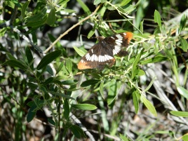
I realize that I’ve hit the Powerhouse Fire Closure at a fairly inconvenient time of day, because the Halfmile Unofficial Alternate around the Powerhouse Fire Closure involves a 12.9 mile detour that is mostly a road walk. I don’t have enough daylight left to hike 12 miles to something that resembles “trail,” where I could safely camp. (Somehow, camping in the narrow space between a paved road and a barbed-wire fence with “no trespassing” signs seems unwise…) I contemplate these facts as I road-walk San Francisquito Road toward the turn-off to Lake Hughes. Two cars that have passed me make a u-turn and stop just in front of me, and several hiker-types hop out to offer me a ride to Casa de Luna, the nearby home of trail angels Joe and Terri Anderson, who host hikers. I say I don’t want to go there, having just neroed at Hiker Heaven, but mention I wouldn’t mind going to Rock Inn, which is at the midpoint of the Unofficial Alternate roadwalk. Perfect, they say — we’re going there for dinner! So I accept a 6-mile ride to the historic Rock Inn, that includes a restaurant-bar that is a favorite with motorcyclists, with 3 motel rooms above the restaurant.

I pay $80 for a hilariously decrepit (but historic!) room, with a TV that hasn’t worked since the Kennedy administration, a sink with no running water, and a shower and bathroom down the hall. At dinner downstairs, one of the people who gave me a ride asks, “Did you give me and my then-girlfriend a ride from Scissors Crossing to Julian two years ago when we were hiking the PCT?” And indeed, it turns out that two years ago, and more than 400 PCT miles away, I gave Sasquatch and his then-girlfriend a 12-mile ride from Scissors Crossing to Julian, where they enjoyed the free sandwich and slice of pie that Mom’s Pies gives to thru-hikers.  So my good deed was repaid in full, with interest – and it was fun to get an update from Sasquatch about his current PCT hike. A big lesson of the PCT seems to be that the world is far larger than you might have imagined; and the world is much smaller than you might have believed.

Today’s mileage: 17.61 miles (from PCT Mile 460.59 to 478.20), plus an approx. 6-mile ride to the Rock Inn in lieu of a portion of the roadwalk that is part of Halfmile’s Unofficial Powerhouse Fire Detour.


Day 33 (Apr. 26):  A Roadwalk, then the “True” Trail

After loitering a ridiculously long time over my coffee cup at the Rock Inn’s restaurant, I start the remainder of the road walk that is part of the Unofficial Powerhouse Fire Detour. Lake Hughes used to be right on the PCT, and yesterday, the small store across from the Rock Inn asked me to sign their Trail Register that included signatures all the way back to the 1990s. Today, Lake Hughes strikes me as a forlorn place, as I pass sights like this one:

DSCN1541.JPG

DSCN1543.JPG
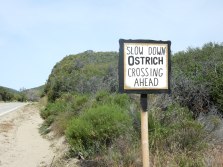
The road provides regular long-distance views of the fire damage that still scars this area heavily, but there are also some fun surprises, like the ostriches that walked to the edge of their pens to check me out as I passed by. Between the Rock Inn and the point where hikers leave the road to hike a side trail back to the PCT, very few cars pass by, none of which are interested in giving a ride to a hiker trying to hitch, so I have plenty of time to enjoy the amusements along the way.

DSCN1544.JPG

Soon enough, I’ve completed the Unofficial Powerhouse Fire Detour and am enjoying being back on the “real” PCT, including this lovely path under oaks:

DSCN1548.JPG

There are occasional big views all the way down the mountain to the next “flatland” area, with more mountains on the far side:

DSCN1550.JPG

I wind my way around and though big swaths of hills like this:

DSCN1551.JPG

At 4:08 pm, I send an InReach message to Dwight and my pal Lynn, announcing that I am at Mile 500. What a great, round number! Though I am hiking alone, I take a “milestone” photo that includes evidence that I am there – my shadow, plus one of my trekking poles:

DSCN1554.JPG

The day holds one more special delight, which is a new “guzzler” that captures rainwater and provides a fantastic water resource for hikers. I crawl under its corrugated “roof”:

DSCN1559.JPG

Under the “roof” (at left), I find this big plastic “lid” that I can open to access the water stored in some kind of undergound tank:

DSCN1557.JPG

The bubbles mean nothing – this is fabulous rainwater that I filter and drink with relish. Later, I hear from Rainbow that it actually snowed on him while he was getting water here, but I was here just a little earlier, or just a little later, in perfect weather. As we used to say in Texas, “If you don’t like the weather, wait a minute.”

Supposedly, it is not advisable to camp or night-hike in this area because of “law enforcement activity,” but I find a sheltered little site and sleep soundly, my guzzler water handy for dinner, tomorrow’s breakfast, and whatever the next day might hold until I get to the next water source.

Today’s mileage: 16.53 miles, including approx. 6.90 miles of the Unofficial Powerhouse Fire Detour and 9.63 miles of “true” PCT.


Posted in Hikes | 3 Comments

Days 26-29: Detouring around Snow and Frogs, plus a Return of the Monster Winds!

Day 26 (Apr. 19): The big question for today’s hike is how much snow/ice is on the PCT by Mount Baden-Powell – there is a lower alternate PCT route hikers can use when Baden-Powell has high snow – but on-trail info about snow conditions is usually sketchy and contradictory. So my big hope for the day is to get accurate info about the snow conditions.

Early in the day, I hike a bit with Rainbow, and we crossed a few stretches of trail covered with snow together, until I elected to stop to put on microspikes for a longer stretch with a fairly steep slope below the trail. How embarrassing would it be to slide down a mountain with microspikes in your pack instead of on your feet?

An important water source for today is something called Grassy Hollow Visitor Center, which is locked up tight, and I semi-freak our when I see signs on the Center that say the bathrooms are closed “due to a water outage” (and the adjacent water fountain is indeed shut off), but it turns out there is water from a spigot near a campsite, so I have water for the morning, even if it does turn more and more yellow as the hours go by… Once again, I trust in the 0.1 absolute micron Sawyer water filter to keep me safe from suspect water. Grassy Hollow does have one of my favorite kinds of signs, reporting the distance to Mexico and Canada.

DSCN1407.JPG

This section of the PCT also includes a longstanding “Official Endangered Species Detour” to protect the highly-endangered Mountain Yellow-Legged Frog, “once the most abundant amphibian in the Sierra Nevada and Transverse Ranges of Southern California.” I’m happy to walk a detour for this species, and I hope the U.S. Fish and Wildlife Service will finally develop the required recovery plan for this endemic species.

The morning includes a hike right next to the Mountain High ski resort, with its “Inferno Ridge” and “Conquest” ski runs.

DSCN1406.JPG

Views are terrific as I hiked toward Baden-Powell:

April19-nr-BadenPowell

I had an enormous stroke of luck when I reached Vincent Gap, the point where you make the choice to continue upward to Mount Baden-Powell or take the High Desert Trail Alternate (the Manzanita Trail) to bypass Baden-Powell during high snows. Vincent Gap is on Hwy 2, and in addition to a small parking lot, it has a few “amenities” – an outhouse, trash cans, and a bench. On the bench sat a hiker drinking a Coke, and meeting him was my stroke of luck.

April19-Woody-cr

Woody, at a little stream that was one of our water sources for the day.

I walked over to the hiker and my first question was, “Where did you get that Coke?” I don’t even drink Cokes, but it was such a luxury item I had to ask. Thus, I met “Woody” (James C.), who sends himself Cokes in his resupply boxes, and was drinking one from his Wrightwood resupply. As it turns out, Woody had just summited Mount Baden-Powell, but beyond that point, he found it impossible to navigate the PCT because the trail was buried in snow, so he had hiked all the way back down to Vincent Gap and was going to take the lower trail. He reported that “Team Emerson” – a mother and her 9-year-old son – had also hiked back down, unable to continue past the summit. That was just the fresh intel I needed to make my own decision, so after I lightened my pack by putting my accumulated trash in the trash cans, Woody and I started hiking the alternate trail together.

Woody pinpointed where I was from just by hearing traces of a regional accent as I spoke, and unbelievably, we soon discovered we had been born in the same hospital and went to the same elementary and high schools. I was about 5 years older so we weren’t in the same classes, but his step-sister was in my class and a close friend of my sister’s.  So we hiked together reminiscing about childhood places and landmarks –  Underwood BBQ, Furr’s Cafeteria, drive-in movies, bowling alleys, etc.

Woody and I enjoyed the Manzanita Trail and part of the Official Endangered Species Detour together, with interesting tilted layers of sedimentary rock:

DSCN1415.JPG

We camped together beside Holcomb Canyon Creek – after the limited water sources in recent days, it was a joy to camp beside a creek with abundant rushing water. The campsite had some strange items: a huge bedroll tied up in a decaying blue tarp, a rough-hewn bench made from branches, and other things that made us speculate about their source and possible illegal activities associated with them – but like many odd compounds you see in isolated areas near the trail, it is impossible to know the stories of most of these sightings.

Today’s mileage: 17.7 miles, including 9.5 miles from PT 364.5 to 374; 5.8 miles of the Manzanita Alternate (to South Fork Campground); and 2.4 miles of the Official Endangered Species Detour (Mile 5.3 to 7.7, Holcomb Canyon Creek).


Day 27 (Apr. 20): Woody and I continued on the Official Endangered Species Detour, with me hiking all morning under a chrome umbrella for sun protection and the ability to let the breeze reach my head and hair without hat interference.

DSCN1417.JPG

We had big views with lots of variety:

DSCN1416.JPG

And we opted out of a side trip to something called “Devil’s Chair.”

DSCN1419.JPG

We saw some beautiful Snow Plant (Sarcodes sanguinea), an entirely red, snow-following, non-synthesizing plant that lives based on a symbiotic relationship with underground fungi. So just because you see a plant without green photosynthesizing elements doesn’t mean it’s a parasite – it could be involved in a mutually beneficial cross-species relationship!

DSCN1425.JPG

DSCN1428
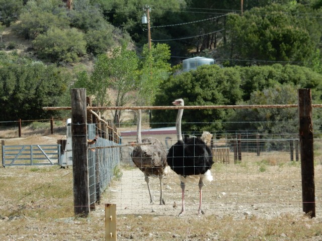
I see Beast and Forget-Me-Not (the two New England women who are 21 and 24 years old and who hiked the Appalachian Trail in 2014) at a water source where we all get water. I hike alone, ahead of Woody, for part of the afternoon. At last, I finish the Endangered Species Detour and re-join the PCT near a beautiful creek (at right).

At the creek, I finally meet the hiker known as Prince, who has been hiking close to Beast and FMN recently. Prince’s trail name comes from the fact that he carries a ukelele and performs a beautiful version of “Purple Rain,” along with a host of other songs. Until recently, he was in the Air Force Band, and his diverse repertoire and evening serenades will become a treasured part of my hike in the coming weeks.

The evening finds us all camping together at Cooper Canyon Trail Camp, a creek-side campground that has a pit toilet and picnic tables. It’s quite a festive group, with Beast, Forget-Me-Not, Prince, Woody, and me -a virtual party! We cook or assemble our dinners on a picnic table, then Prince and I have some hilarious moments reviewing a list of words that Beast and FMN don’t know, compiled while reading a book together on trail. Prince and I try to define as many of the words as possible. I double over laughing when I see the word “priapic” and defer to Prince to explain it to them. Prince tackles “tautology” with the example, “It is what it is,” which is a very useful concept for thru-hikers.

Today’s mileage: 13.9 miles, including 12.8 miles of the Endangered Species Detour (Holcomb Canyon to Burkhart Trail junction at PCT Mile 394.1), then 1.1 PCT miles to 395.2.


Day 28 (Apr. 21): The 400 Mile Marker + Return of the Monster Winds!

DSCN1431
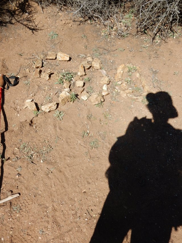
Today’s hike found us hitting the 400 mile mark early in the morning – a milestone suitably commemorated in rocks by the side of the trail. I hiked alone, but really enjoyed knowing that trail friends were relatively close, either ahead or behind me.

In this stretch, we’re still calculating our water sources carefully, making sure to carry enough to get us to the next reliable source. At a camp named Camp Glenwood, the tap from the water tank isn’t on yet, but there is a box of trail magic – fresh apples and oranges left by the staff of the Angeles Crest Christian Camp. Sparks, Rainbow and I enjoy some fresh fruit and I leave a thank you note on the box with my mini-Sharpie. Words really are inadequate to convey how amazing a fresh orange tastes on trail. Thanks, camp staff!

Some of our views today:

DSCN1434.JPG

Once again, we’re walking through some significant fire burn areas.DSCN1436.JPG

DSCN1435
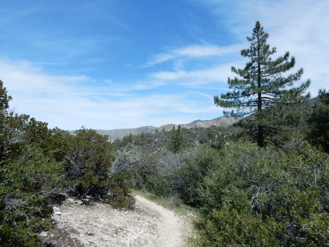
And since we’re in a fire burn area, we start to see the native fire-follower, the infamous poodle dog bush (Eriodictyon parryi, formerly Turricula parryi). It’s infamous because it is highly allergenic to many people, causing  a severe contact dermatitis. If you can get past that negative quality, in full flower, it can be one of Southern California’s most specctacular flowering plants, but  most people can’t get that far past the negative.

At some point, I pass by a dirt road where a PCTA trail maintenance volunteer (named John, if I recall correctly) asked if I needed water, and told me he would be working the following day to take out some of the blow-downs – large fire-damaged trees that have blown down across the trail. I’m so grateful for his work, because some of these blow-downs can be really difficult to cross, and I’ve encountered many on the trail so far.

I know that some of my fellow hikers are planning to get to Mile 415 today, which is the last good place to camp before a long descent down the mountain, so I hike on through some diverse and beautiful landscapes hoping to join them for the night:

DSCN1441.JPG

DSCN1443.JPG

Once I get to Mile 415, I find Rainbow, Sparks and Prince with their tents already set up, and a pretty big wind whipping around our exposed site. Prince thinks the wind will die down, and I set up my tent nearby. The views at dusk are stellar:

DSCN1450.JPG

DSCN1453The moon is full, and for awhile, Prince sings and plays his ukelele, until he announces that his fingers are too cold to continue. He says he thinks the wind will die down, but in fact, it just increases in intensity during the night.

Around midnight, Rainbow decides there will be no sleep in these winds, so he packs up his tent (no mean feat in the high winds) and night-hikes down the mountain.

At some point, Sparks’ tent collapses on him, and he doesn’t even try to set it back up. A guyline on Prince’s tent snaps, breaking a stake.

I lie in my tent, with monster winds bending and flexing the poles that form a frame for my tent. I wonder how much wind it would take to take my tent aloft, with me an involuntary parasailer. My amazing 2-lb.LL Bean tent handles the monster winds with no problem – WOW! – though sleep can’t override my wide-eyed fear as I listen to the howling winds and watch the tent poles bend and flex, bend and flex. Once again, I find myself sending up a huge thanks to my LLBean friends who have provided me with the most critically important gear for my wildest moments on the trail.

Today’s mileage: 19.8 miles, PCT Miles 395.2 to 415.


Day 29 (Apr. 22): By 5am, we are all packing up rapidly in the still-strong winds, and using the earliest light to start down the mountain. I’m at a near-running pace, on the theory that lower will mean more protection from the wind, and so I race through some interesting landscapes, many featuring the Angeles Crest or Angeles Forest Road below:

DSCN1473.JPG

DSCN1470There are some big fire areas and challenging blow-downs today, including some that require some intricate dance-steps to both get over/under a huge tree trunk and not end up right on a lovely specimen of poodle-dog bush.

DSCN1482

In the midst of the harshness, there continue to be beautiful flowers and fantastic living trees.

DSCN1454We also see abundant evidence – in the trail work that has ameliorated the impact of many blow-downs, done by incredible volunteers like John, and in the trail sign left by Trail Angel Mary (at left) – that many folks are dedicated to taking care of the PCT and the hikers who enjoy it. I think about all of these volunteers: people who drive and hike long distances to build and maintain the trail; people who are willing to host hikers in their homes, or drive them to the doctor, the local gear shop or grocery store, or get them to remote trailheads – and all I can say is that it is a humbling thing to contemplate all of these volunteers whose work, seen or unseen, known or unknown, makes hiking this amazing trail possible.

Just 3.63 miles into the morning’s hike, I reach the Mill Creek Fire Station, which has a small rest area nearby with a water spigot, picnic table with a trail register in a metal box, and a pit toilet (with toilet paper! Truly a 4-star trail amenity!). There, I find John, the PCTA trail maintenance volunteer, ready to meet his fellow volunteer and start work on some blow-downs. I share with him my observations about the worst blow-downs I’ve just passed, and am grateful that he and his one-person crew will be making the trail better for the hikers just behind me.

Prince hikes in and says he needs to go off-trail for a day or so because of a sore ankle, and needs to find out how he can get off-trail. “Call Trail Angel Mary,” I say, but he has no idea what that means. It turns out that Prince entirely missed seeing Mary’s lovely sign offering assistance that was right on trail, so I show him my photo of it, and he indeed ends up getting off-trail later that day with Mary’s assistance. (I encountered him again a day or so later at the Acton KOA, where he was taking some time to allow his ankle to recover).

The views continue to be interesting, as I hike toward the North Fork Ranger Station:

DSCN1472.JPG

DSCN1478.JPG

DSCN1466.JPG
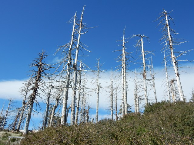
At one point, I cross a dirt road and start walking up the trail as it curves up and around a ridge. Instantly, I’m whacked by powerful winds that make it almost impossible to stand up. The winds are blowing me into the mountain, so even if I can barely stand, at least I’m not in danger of being blown OFF the mountain. Surely, if I can just get around the bend, I’ll be more sheltered. So I walk like a drunken sailor around the curve of the mountain, and make it by late afternoon to the North Fork Ranger Station.

Once there, I walk around to check out the water cache, though I don’t need water, and take advantage of the one other amenity: a pit toilet with toiilet paper! What an amazing, amenity-filled day it has been, with not one but TWO pit toilets! I’m about to continue up the trail when a ranger comes over to greet me, along with a section hiker named Shaggy, to let me know that because of the high winds, he is allowing hikers to shelter behind the ranger building tonight. So I set up my tent behind the building, and meet Team Emerson for the first time (the woman who is hiking with her 9-year-old son Emerson, often called Boone because he wears a cap with a coontail).

Emerson and I have a hilarious first conversation. He peers at me from his tent, which is fairly far from me, and says: “Say, is that a WART on your nose?”  Wow, I had no idea the ding in my nose was so prominent, from the basal cell carcinoma removal that took place the day before I started my hike. I reply, “No, that’s where I had a cancer removed from my nose the day before I started hiking the PCT.” Emerson screeched, “CANCER!!!” and I realized I was talking to a 9 year old, so I said, “Oh, it wasn’t a serious kind of cancer; nothing to worry about.” This conversation makes me glad I haven’t been around a mirror for the past month.

I warn my neighbors that I’ll be packing up and hiking out early, because tomorrow morning, I want to get to Acton KOA by 9am, where I’ll find Dwight and Molly – they will have just 2/3rds of a day to spend with me while I put together my resupply from the buckets of hiker food and gear that Dwight will bring. So tomorrow, I have a real schedule to keep, and I’m highly motivated to get going early.

Today’s mileage:  21.08 miles (PCT Mile 415 to 436.08).

Posted in Hikes | 15 Comments

Days 23-25: A Lake, a Snake, an On-Trail Shake, and Up-Up-Up!

Day 23 (Apr.16): I wake early to a strange, electronic version of the kind of clock bells that chime on the quarter-hour – emanating from the still-nearby Cedar Springs dam facility, I believe. Soon, I’m at Silverwood Lake, created in 1971 by the Cedar Springs dam as a reservoir that is part of the California Aqueduct system conveying water from the Sierra and Northern and Central California to Southern California.

DSCN1270.JPG

The trail fulfills the “Crest” part of its moniker by taking me on a winding route high up on the hills, through what, for chaparral, is a lush, green and bloom-filled landscape:

DSCN1281.JPG

DSCN1271“Dear Crestline Sanitation District: I dug an 8-inch deep hole near this sign without calling first: it was early on a Saturday, and I didn’t think anyone would be staffing the Dig Alert hotline. Sorry! But I don’t think I damaged your pipeline.”

Today’s destination is Cajon Pass, where Dwight and Molly will be meeting me at the McDonald’s that is just 0.4 mile off-trail, and we’ll be staying at the nearby Best Western so I can resupply. But first, I encounter Snake #4, a gopher snake stretched across the trail by a cattle gate I have to cross. It simply won’t move, and I’m not sure at the time what kind of snake it is, but I finally just step over it and continue on my way.

DSCN1283.JPG

DSCN1292

I stop by the lovely tree poppy (at left), which provides welcome shade and beauty for my lunch break.

As I get closer to Cajon Pass, which lies between the San Gabriel and San Bernardino Mountains and was created by movements of the San Andreas fault, the landscape starts to change, and I begin to get big views of the major transportation components of the Pass. They include multiple railroad tracks that host countless long freight trains with multiple engines, plus nearby Interstate 15, which crosses Cajon Summit as a massively divided highway.

Fortunately, the famous-among-hikers McDonald’s is not visible – otherwise, hungry thru-hikers would be tempted to turn their groundcloths into sleds and just slide down the slope to the hamburgers and shakes they have been dreaming about for several days.

DSCN1334

DSCN1344Before I get to the turn-off to the McDonald’s, the trail goes right under a massive tower. Yet, as industrial as this stretch of trail is, I find it much more beautiful than I had imagined it could be, going through steep, windblown sandstone bluffs and Crowder Canyon with a seasonal creek that still has pools of water for thirsty hikers! I’ve driven through the Cajon Pass area many times, and never imagined the natural beauty that is so close by.

DSCN1335

This photo is taken right from the trail, as it traverses these sharply-etched bluffs with big drop-offs.

I reach the turn-off to the McDonald’s and soon encounter Zapka (“Lithuanian Guy”) who has a satisfied smile on his face as he returns to the trail with an iconic American hamburger filling his stomach. Dwight and Molly have just driven into the McDonald’s parking lot when I arrive at 2:15 pm, and I have a fountain drink (with ice!) and a medium order of fries before we head to the Best Western so I can launder my clothes and resupply my food. So I don’t actually have the on-trail shake referred to in this post’s title, but most hikers have at least one, along with massive quantities of burgers, nuggets, and other scary food. I’m guessing I’ve set the record for the smallest McDonald’s order by any thru-hiker.

Today’s miles: PCT Mile 324.69 to 341.87, for a total of 17.18 miles.

Day 24 (Apr.17): I spend most of the day at the Best Western doing all my resupply chores, and then have a late lunch with Dwight at the nearby Subway (not many food options here at Cajon Pass!) before hiking out mid-afternoon with a pack heavy with my food resupply and lots of water for what might be a hot and exposed climb, with the next water far away. Molly walks with me for a few minutes as the trail approaches a hilarious underpass that takes hikers under I-15.

DW-PhonePic-1-20160417_130325

DSCN1353

Yes, that’s the Pacific Crest Trail at left, going under I-15. Yet, once I’m on the other side, I am again surprised by the natural beauty all around me – and I see from the Halfmile map that I’m walking along the San Andreas rift, which explains the interesting geological “story” that surrounds me.

I trudge along at such a slow speed that it would probably require specialized scientific equipment to even detect movement – I’m sleep-deprived from all my resupply chores, my pack is heavy, and even though it is significantly cooler than it often is in this area, it’s a sunny day that induces me to take a long near-nap under the shade of some shrubs.

DSCN1360I enjoy the many views of the transportation infrastructure through this area, along with the varied landscape around me. When I reach Swarthout Canyon, after just 5.35 miles, I find a wooden cabinet with a water cache (and a fresh mango!, which I don’t eat only because I don’t want to have to carry out the heavy pit) and lovely campsites, so I set up my tent early in the shade of a tree poppy and call it a day at Mile 347.22.

Today’s “near-o” mileage: 5.35 miles. [Note: a “near-o” is a short hiking day with very few miles hiked; a zero is a day with no hiking at all.]

Day 25 (Apr.18): Today finds me sleeping in, enjoying my beautiful campsite (below) and not getting on trail until 7:40 am.

But one day after a resupply stop, therDSCN1371e is no schedule, no need to rush. Once on trail, I hike for 8 hours under the shade of a “chrome dome” umbrella that attaches to my shoulder strap, and even under a bug net for a while to deter the annoying gnat-type creatures that buzz around my face. Yet, I know I’m enjoying an unusually cool day for this stretch of trail, as I hike from my starting elevation of 3,589 ft. to 8,123 ft. (Yikes – is that right? It’s in my little notebook, so I trust it is correct.) During the day, I meet Sparks, a section-hiker who is completing the PCT now by hiking from the Southern Terminus to Walker Pass and is a musician, a double bass player who plays classical, jazz and klezmer music; then Rainbow, a thru-hiker from Davis, CA. Though both Sparks and Rainbow hike faster than I do, it turns out that I will see them frequently on trail in the coming week or so.

As I approach the Wrightwood area, at one of the dirt road crossings, I encounter Ed, a trail angel who has been bringing cold drinks and snacks to this trail crossing since the 1990’s. The Gray Coyotes from Switzerland are there, enjoying a Gatorade, and soon I’m drinking one myself. Ed also has a big tub of wet wipes and I enjoy that luxury as well. What a treat!

DSCN1385

L to R: Trail Angel Ed from Wrightwood; the four Gray Coyotes; Sparks.

Later, at Mile 362.48, I pass the trail junction with the Mount Baldy Trail – I’m not tempted, since I’ve summited Mt. Baldy twice, and it’s a 3.74-mile side trip each way – not to mention the fact that three people died on Mt. Baldy in February, not prepared for the snow and ice they encountered.

DSCN1397There’s a little snow on trail but nothing serious. There are great vistas today, including Mt. Baldy views, along with forests with big trees and other high-altitude treats.

I camp close to the side trail to Guffy Spring, sheltered by an enormous log, stopping just shy of Guffy Campground which is notorious for bear visitations.

Today’s mileage: 17.28 miles, ending at PCT Mile 364.5.


Posted in Hikes | 8 Comments

Day 22: From Deep Creek to Deep Surrealism

Yes, my blog is lagging behind me – sorry! – but let’s take a look back at where I’ve been the last few weeks, starting with a day so varied and ultimately so surreal it deserves its own post.

Day 22 (Apr.15): From Deep Creek to Deep Surrealism

From my stealthy campsite high above Deep Creek, here’s what I see at 6:43 am. The Creek is far below, but it is loudly calling me to pack up and hike.
DSCN1135.JPG

It’s arid-looking up high where I am, but it’s a roaring party down below:

DSCN1144.JPG

Soon, I meet a hiker, Detour, who hiked NOBO (northbound) for a while and then flipped up (to Cajon Pass, I believe) to hike southbound. Everything about her signals a very experienced hiker, and we have an animated conversation about such vital topics as threading blisters. She lives near the PCT in Oregon not far from Ashland, and offers a ride or other assistance once I’m in that area. She also says she’s received so much help from trail angels over the years that she spent some time during the winter making “angel charms” to hand out on trail, so she gives me one for myself, and one to give away to someone else. Sweet!

DSCN1155
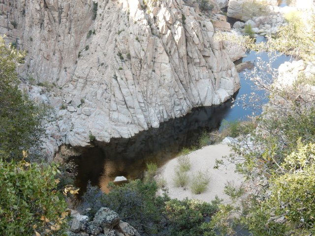
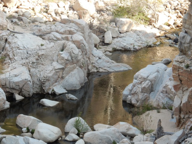
As I descend, I pass a sign proclaiming Deep Creek to be an officially designated Wild Trout Stream, managed exclusively for its stream-bred trout, with no supplemental stocking. I don’t see anyone fishing with barbless hooks for their limit of 2 trout – but luckily, I also don’t see the masses of naked BOHs (burned-out hippies) I expected to see in the creek’s famed hot springs, based on Deep Creek’s reputation and its proximity to L.A. Close to the hot springs, however, I note that every shrub near the water has a collection of toilet paper at its base, and I elect to wait until later to resupply my drinking water.

After having Deep Creek’s music in my ears continuously since midday yesterday, I go round a curve and suddenly hit silence – a reminder that all of this water is a Southern California anomaly, and soon enough, I’ll once again be thrilled at the sight of a tiny flow that I can capture to refill my water bottles – or perhaps even a stock trough. For a long while I’m hiking in and around the folds of these hills:

DSCN1175.JPG

The trail is often a narrow ribbon perched high on the steep slopes, so I pay close attention to my footing:

DSCN1177.JPG

Soon, I am at a bridge that crosses Deep Creek Canyon (Mile 310.4), and you can see the trail cut steeply into the canyon after the bridge:

DSCN1179.JPG

The day turns surreal. First, I start getting the feeling that though I am a NOBO (northbound) hiker, I am essentially hiking south at times, mostly west, and definitely not one step north.(It turns out this is a regular feature of the PCT – if you want to go to Canada as the crow flies, get off the trail and buy an airplane ticket!)  Then, a snow-covered mountain comes into view, which I decide must be Mt. Baldy, even though it seems exceedingly strange to be hiking toward something that I mentally think of as south of me. (Little do I know that the PCT will offer up a side-trip to the Baldy summit on my way to Mt. Baden-Powell.)

DSCN1188.JPG


I then hit a stretch of trail with scores of sacred datura (Datura wrightii) in peak bloom, and I’m in a living Georgia O’Keeffe artspace for awhile – but the trail art is free of charge, while O’Keeffe’s 1932 painting, “Jimson Weed/White Flower No. 1,” sold for $44.4 million at a 2014 Sotheby’s auction to Walmart heiress Alice Walton. Of course, I took about 300 photos of this bloom-fest, but will share just one:

DSCN1198.JPG

Well, okay – one more, but it’s an insect photo (“Me and My Shadow”), not a flower pic:

DSCN1213.JPG
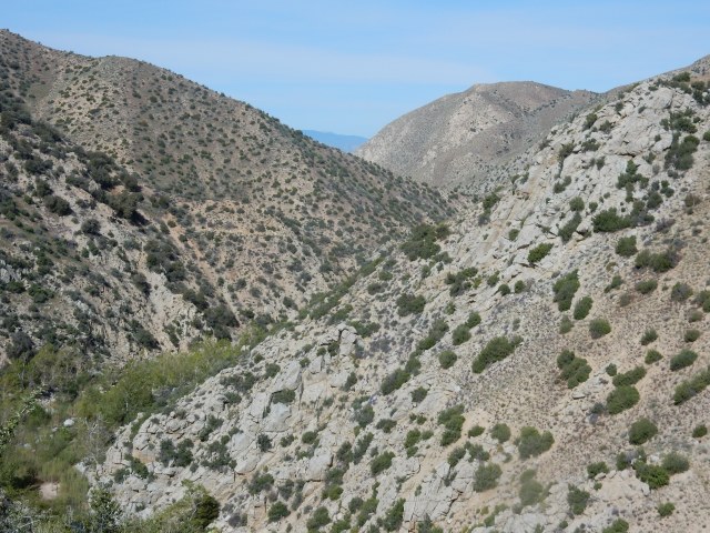
I then apparently walk into a different room of the art museum and I’m in Keith Haring/Basquiat territory:

DSCN1219.JPG

On what is clearly not a day of pure wilderness hiking, the PCT next serves up something that could be a huge earthwork akin to “Spiral Jetty” by Robert Smithson, if it weren’t so irredeemably ugly: The Mojave River Forks Reservoir:

DSCN1238.JPG

I’m following my phone app to stay at least vaguely on the trail, since a big bulldozer seems to have obliterated anything that might have indicated where (along the left of the photo above) the trail might actually be. Looking down, I see a vintage metal PCT sign, and two women striking out across the desolate landscape – they aren’t hikers, but I can’t discern who they might be.

DSCN1240.JPG

Some miles later, I encounter something so ugly I can’t bring myself to photograph it – Cedar Springs Dam – but two 2015 PCT hikers posted this photo. It’s a 249-foot high rockfill dam, and the PCT briefly follows a dirt road at the base of this dam, which is unnervingly close to an active fault (the Cleghorn Mountain Fault). The facilities around this dam are not only posted “No Trespassing”, but also have prolific “No Loitering” signs. It’s relatively close to dark, and I wonder whether sleeping in a tiny tent a few feet away from such a sign would constitute loitering. I think about the “Shuffling Sam” Supreme Court case we studied in law school about loitering and due process. I decide I don’t have time in my schedule to be a civil rights plaintiff, so I hustle past the dam facilities until I am back on something that resembles real trail, and find a little spot for my tent. From my perch at the side of the trail, a small community just below me offers up the sounds of motor vehicles and barking dogs, answered by coyotes. Goodnight, surreal PCT!

Today’s mileage: Mile 304.70 to 324.69, for a total of 19.99 miles.


Posted in Hikes | 9 Comments

Days 19-21 : Meditations on Fire and Water

Greetings, friends and random blog followers, from real-time Day 37 of my PCT hike, catching up on as much as the confluence of Internet and laptop access and spare time on my resupply day here in Tehachapi (PCT Mile 558.5!) allows.

Day 19 (Apr.12): With the Lake Fire Closure  still in effect, my Super Trail Angel Dwight drives me to Onyx Summit, Mile 252.1 (elevation 8565) where the official fire closure ends. Here, the trail offers forests filled with spectacular large trees:

DSCN0957

and big vistas:

DSCN0971

but the land is heavily scarred by fire:

DSCN0968

DSCN0961
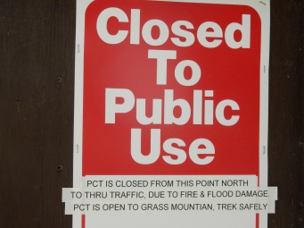
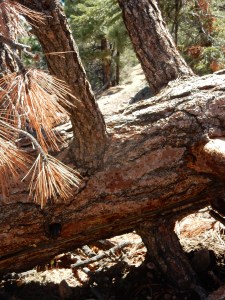
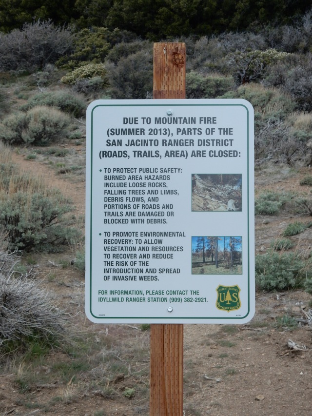
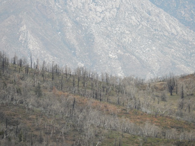
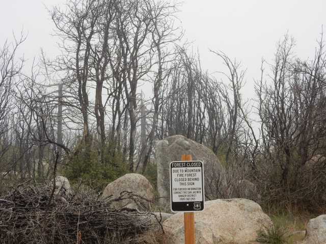
I know that the Lake Fire (2015) was human-caused, but can’t find an update on the final determination as to the cause, or the details. After walking 20.0 miles of the 20.4-mile Unofficial Mountain Fire Closure last week, I’m beginning to think someone needs to publish a special PCT Fire Guide, with details of all of the fire damage we hikers will be seeing throughout the Southern California portion of the trail.

The fire damage is extreme in some areas, with very tall, thick trees having broken like twigs at perhaps the 30-foot point, with huge chunks of trunk and limbs scattered over a wide area, sometimes right across the trail.

DSCN0965
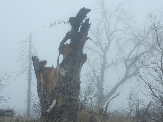
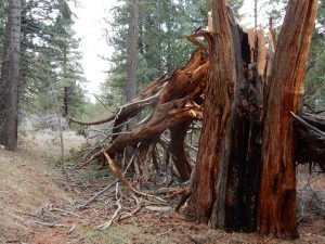
I try to imagine what wind or other force would snap such a huge trunk 30-feet up, and I’m glad to be hiking through here on a day with no wind.

Knowing that many hikers are getting back on trail at Big Bear, rather than Onyx Summit, I assume I’ll be hiking alone today, and indeed, I see no one on the trail all day. I do see this semi-amusing, semi-appalling (Leave No Trace, anyone?) example of Trail Magic along the way:

DSCN0954.JPG 
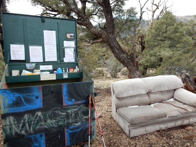
The metal bin holds a random assortment of Easter candy, hand sanitizer, foot powder, and other items hikers might want, plus information about Big Bear. (Note the snow on the sofa.) The bin also has a trail register that allows me to see how few hikers have signed in for this Onyx Summit-to-Big-Bear stretch of open trail. These trail registers are also a key way to check to see where people you’ve met on the trail are – one day ahead? two? – and estimate if/when you might see them again.

Though I didn’t see any other hikers today, I did see a jack rabbit so large it reminded me of the novelty “jackalope” postcards that we saw as kids at gas stations along Route 66, and then I saw 7 of these creatures – feral donkeys? – hiking the PCT just ahead of me:

DSCN0980.JPG
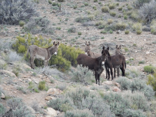
They would walk on the trail for a bit, then stop and look back at me. I would stop when they stopped and talk to them. This went on for awhile, until they reluctantly went off-trail.  Bye, and thanks for the company!

DSCN0986.JPG


DSCN0959
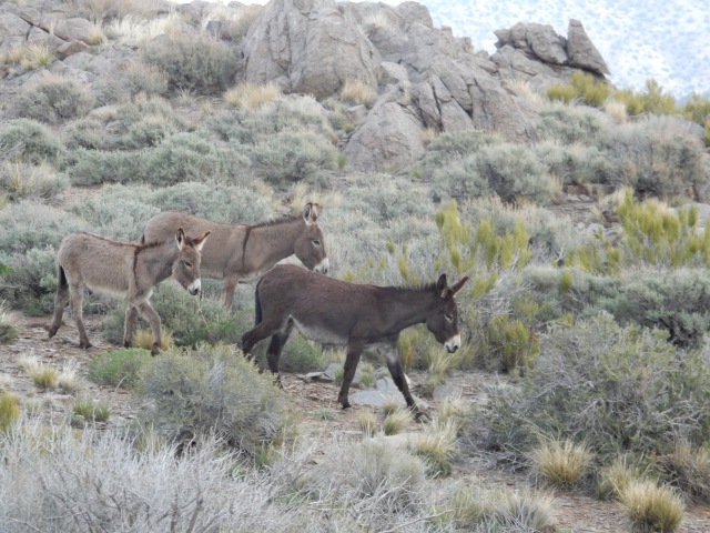
The Southern California section of the PCT is quite dry, so we hikers closely study a crowd-sourced Water Report to see what water sources are available.  At left is what qualifies as a magnificent water source in these dry parts: some snow melt drips down right by the trail, forming a pool of water at least 6 inches wide. Yay!  I do my part and phone in an update to the Water Report once I get to a place where I have phone reception.

Though I have great views both toward the mountains backing Big Bear, and out toward the desert, there’s a big ridge separating me from views of Big Bear Lake, and I know that tomorrow will include lots of winding in, out, and around all the folds of that ridge before I get those lake views. Meanwhile, with the drive to Onyx Summit having taken most of the morning, I end my day at Mile 265.75, for a total of 13.61 miles.

Day 20 (Apr.13):  The morning brings some stellar long-distance views both south and north:

DSCN1005.JPG


DSCN1002.JPG

DSCN1006
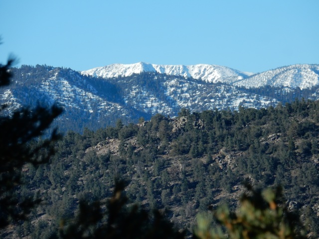
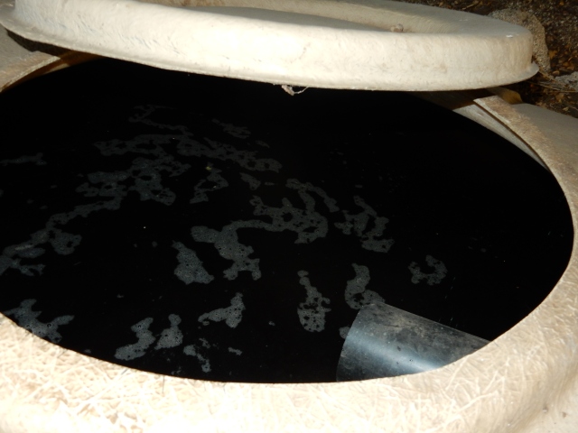
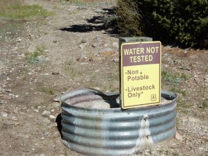
The morning also brings me to this amusing water source (at left), at Doble Trail Camp, with a small horse corral, a stock trough filled with water that a hiker could filter if nothing better is around, and a faucet behind the “non-potable” sign that delivers a slow trickle of water. Again, this is considered an excellent water source for So. Cal. PCT hikers! We trust the 0.10 absolute micron hollow fiber membranes of the  Sawyer filter to protect us from water-borne harm.

DSCN1007
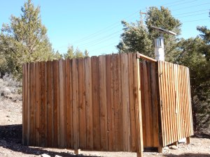
The Doble Camp also featured a solar composting toilet that was in excellent condition (with toilet paper!) and also provided a nice enclosure I used to hang up my tent for a few minutes to dry off the morning dew.

I knew I had to hike around a long ridge to get to the stretch of trail that offers views down to Big Bear Lake, but I found myself on long switchbacks that would take me far back in the direction I come from, just a little higher up the ridge than when I had originally walked that stretch. I tried not to be annoyed (the trail has to be graded to accommodate equestrians as well as hikers) – but I was a little annoyed that I had to cross this long, steep rubble field twice, at two slightly different elevations:

DSCN1008.JPG

Yes, this is the trail. . .

I kept thinking it would not be good to be on this rubble field during an earthquake – death by stoning!

DSCN1012
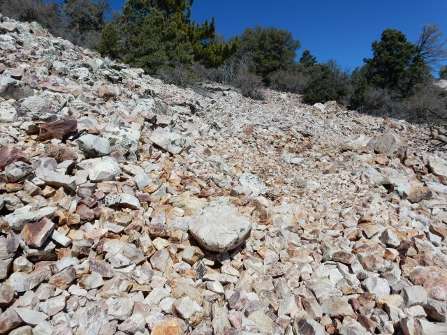
There were lots of blowdowns on today’s trail – some are small enough to step over, some are on a gentle grade that allows you to walk around them, but some you just have to clamber over, like the one at left. A challenge for short-legged folk like myself!

At the Cougar Crest Trail junction above Big Bear Lake, I met four hikers – two Swiss couples, ranging  from 62-66 in age – who are thru-hiking under the group trail name of the “Gray Coyotes.” I asked them about their experience through the San Jacintos, and they said, “There was a lot of snow, but we are Swiss so we are used to it.”

Big Bear Lake came into view, with beautiful snowy mountains as the backdrop:

DSCN1032.JPG

Once past the lake area, I entered one of the most depressing fire burn areas I’ve seen so far. For miles, almost everything was burned, with very little new growth.

DSCN1045.JPG

The scene below looked like a giants’ game of pick-up sticks:

DSCN1048.JPG

As the day ended, I reached Little Bear Springs Camp, a horse camp similar to Doble, right by Holcomb Creek with lots of accessible water, and even better, with a terrific family camping there: a 13-year-old girl whose trail name is Spinner who turned out to be a very skilled fire-builder (in the camp’s fire ring), and her parents. Mom (Dora) has lupus, and I was filled with admiration for the persistence and resilience she is showing to hike this trail. Dad Jason cooked them a terrific looking dinner, while I prepared my freezer-bag-style dinner of millet and brown rice ramen noodles, freeze-dried veggies and tofu, and miso powder. What great company this family was for a little dinner conversation and a warm fire on a very cold night! They told me they had had a miserable time going through the San Jacintos, with their dry bags eventually failing, leaving them with wet sleeping bags. That puts you in “hike or die” territory. I found out later they had gone through that area with Flashback Dave, who posted a video on the Facebook PCT Class of 2016 page that helped me decide that the best course was to come back for the section through the San Jacintos later, after the snow melts.

Mileage for today: 19.95 miles, ending at PCT Mile 285.60.

Day 21 (Apr.14): When I opened my tent door in the early morning, I thought some dirt fell on me, until I realized it was flakes of frost. Okay then – I’ll be packing up a wet tent again today, and hiking in my amazing wind/rain jacket for warmth. I can’t believe I ever worried that this jacket was too heavy for the Southern California section of the PCT – I’ve worn it more days than I can count. Thank you, L.L. Bean!

This morning’s trail followed Holcomb Creek, which meant that between the pines and the trail was a beautiful strip of stream-loving plants – willows, for example – and lots of access to crisp flowing water.

DSCN1055.JPG

Around 8:30, I passed a hiker from Lithuania  whose trail name I later learned is Zapka (sp?)  – he would become someone I would see periodically in the coming two weeks, though he is a faster hiker than I am. Our first conversation was hilarious: Me: “That was a sad fire area we hiked through yesterday, wasn’t it?” Z: “Fire area? No, I did not see such a thing.” Me: (pointing to all the burned trees in our immediate vicinity): Like this! Z: “Oh well, these things happen.” Later on, I learned that Z. thought maybe I was an official from the Forest Service, interrogating him as to whether he had walked through a fire closure area.

Holcomb Creek is my companion for at least 10 miles of trail, sometimes far below me, as in the photo below, where the trail is high up on the ridge, often narrow where a misstep could send you on a long white-sand slide down-canyon:

DSCN1073.JPG

The trail crosses the stream – a little balance test, just a modest practice for what’s ahead in the Sierra:

DSCN1077.JPG

DSCN1080
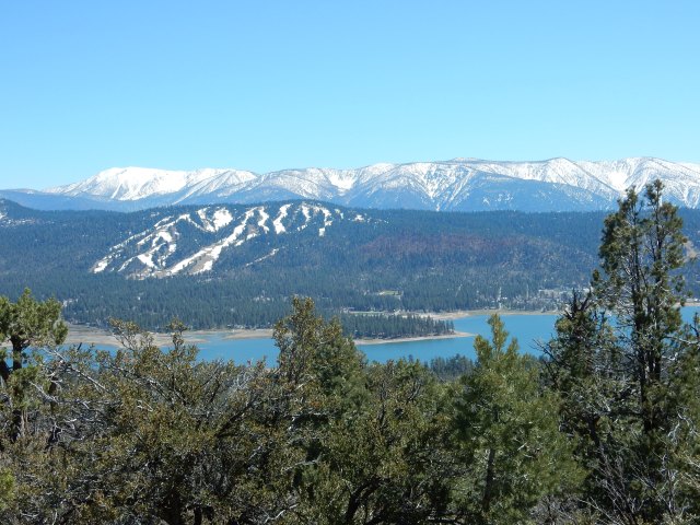
And by the stream is some Equisetum (Horsetail, pictured at left), modest-looking here, but a “living fossil” in that it is “the only living genus of the entire class Equisetopsida, which for over one hundred million years was much more diverse and dominated the understory of late Paleozoic forests. It propogates by spores rather than seeds, and its stems contain silicates that make them useful for scouring metal, leading to its other common name, scouring-rush.

DSCN1083
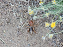
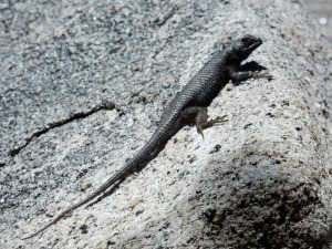
Lots of lizards and similar creatures are all along the trail in So. Cal., but few will pose for a photo; here’s one I captured.

At Deep Creek Bridge (Mile 298.7), a road is nearby, so some day visitors were around who obliged me by taking my photo (and no, I’m not carrying more than one shirt – I just temporarily swapped shirts at my last resupply for a warmer one for this section).

DSCN1089.JPG

This bridge marks a very long (11+ mile) beautiful section of trail with Deep Creek far below, the trail often on high perches next to steep slopes. You could spend a lifetime taking photos of the beautiful creek views, plus the fabulous flowers blooming everywhere under beautiful canyon oaks. Here are just a few photos from this section:

DSCN1093.JPG

DSCN1117.JPG

DSCN1122.JPG

DSCN1124.JPG

What beautiful mahogany colors in the manzanita, above, that has managed to survive so many years rooted in what is almost bare rock!

DSCN1133

I’m pretty sure this is the first place I saw one of my favorite native shrubs, Fremontodendron californicum, on trail. (Its common names include California flannelbush or California fremontia.) I may never have seen it before other than in botanical gardens, so I was thrilled to see it in full bloom here.

By the end of the day, I was still hiking above Deep Creek – and Deep Creek is a day-use only area, with no camping – but I decided I really wasn’t at Deep Creek itself, since I was so high above it, and I found myself a tiny flat spot off-trail, just big enough for my tiny tent. More beautiful than any 4-star hotel!

Today’s miles: 285.6 to 304.70, for a total of 19.1 miles.

I’ll try to post more today, because my blog is lagging so far behind real time – but for now, my priority is putting together my resupply for the next stretch of trail.

Posted in Hikes | 19 Comments

Days 11-18: To Paradise and Near-Hell and Back, plus 3(!) Zeroes

I’m signing in from real-time Day 24 to report on Days 11-18, and while it will take a few days to get to Paradise, this report also includes both a literal and a figurative Near-Hell, for those with the patience to read to the end.

Day 11 (Apr. 4) Just as I finish packing up my beautiful creekside camp and shouldering my backpack, here comes B. bounding up the trail. I hike with him a bit to catch up on his news: he’s changed to “tennis shoes” (trail runners), lightened his pack up some, read the food notes on my blog, is planning to try out some of my recipes, and he has a conference call in 49 minutes. I’m planning on enjoying this oak-filled heaven and stopping to get water the last time the trail crosses Agua Caliente Creek, so I drop behind after a while (and “see” him next in the trail register at the Paradise Valley Cafe, a few days later). B. turned out to be the only hiker I saw on trail all day, though I saw two later that day at Mike Herrera’s place, definitely NOT on trail.

DSCN0773

As the trail climbs, the views open up, with lots of big sagebrush (Artemesia tridentata): DSCN0774.JPG

For the first time on the PCT, I’m seeing red shank (Adenostoma sparsifolium, below), which I thought was a manzanita relative, but in fact it is the only other species, along with chamise (A. fasciculatum) in the genus Adenostoma, and the total range of red shank is only about 300 miles. Respect!
DSCN0776.JPG

Okay – I promised Dwight to trim down the botanizing in my blog, out of consideration of my long-suffering readers, so below, I am not showing you the beautiful blooms of manzanita (Arctostaphylos sp.); rather, I’m showing you how incredibly blue the sky was:

DSCN0786.JPG

Lots of big boulders dominated today’s stretch of trail:

DSCN0796.JPG

I started to think, “Gee, if I were cold-blooded, today would be a great day to warm up in the sun,” and soon enough, at PCT mile 126.4, I encountered this beauty:

DSCN0801.JPG

Snake #3, and this one a Southern Pacific Rattlesnake (“SPR”).

DSCN0802
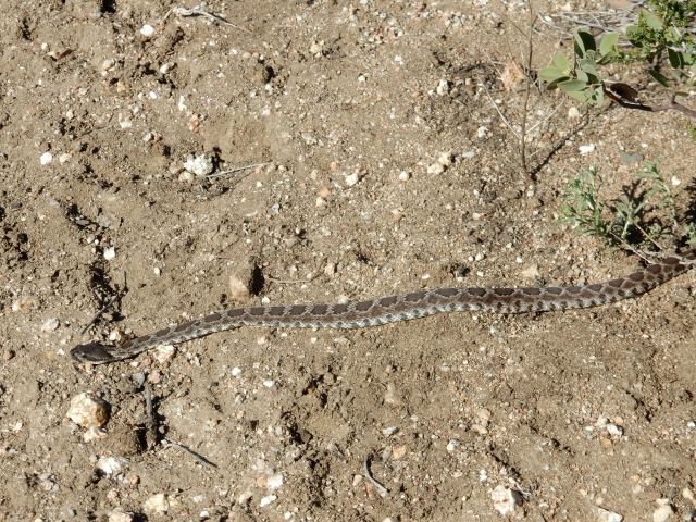
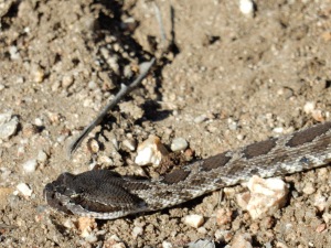
We had the following conversation: Me: Hey there! Say, would you mind moving off the trail? SPR: Naw, I’m very content here. Why don’t you just walk around me? Me: Well, there isn’t enough space for me to walk far around you, because of all these spiny shrubs. SPR: You don’t need a lot of space – I’m just going to lie here. Peace out!

So I took SPR at its word and walked carefully around, and took the opportunity on the far side to grab this photo showing its four rattles and a button:

DSCN0803.JPG

DSCN0804
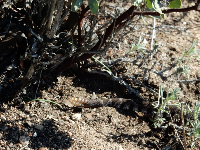
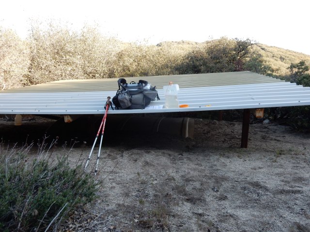
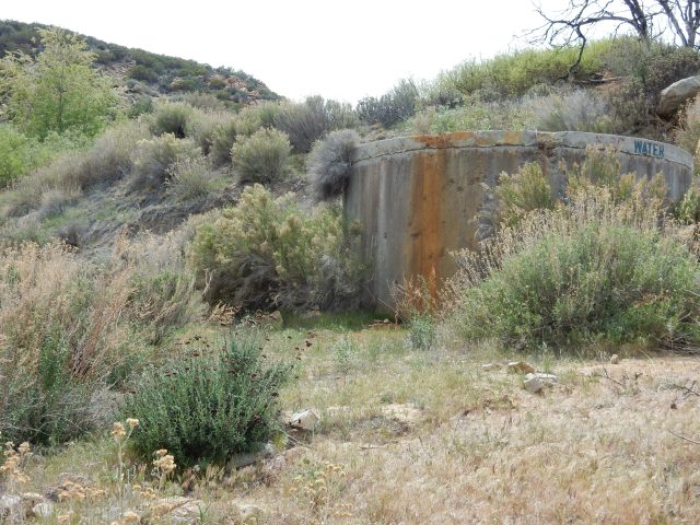
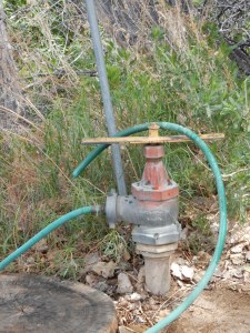
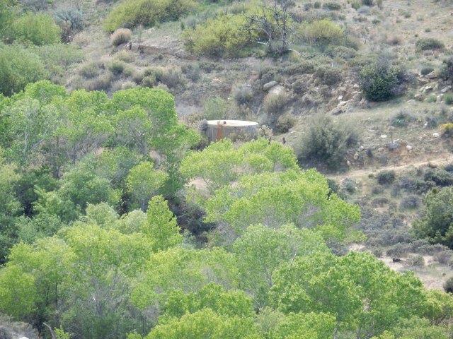
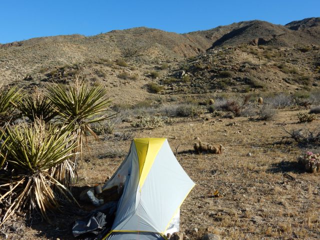
A half-mile later, I was at Mike Herrera’s water tank, an important source of water in what is often a very hot, exposed section of trail. Today was sunny but not really hot, with some nice breezes – another advantage of having started early, so no need to carry huge quantities of water today. I took 3 liters, left a donation, and had an amusing chat with two young men who were lying rolled up in their sleeping bags like burritos on cots in the bunkhouse available for hikers. I had the impression they hadn’t moved in about two days.They told me my hiker friend Tim had been by earlier that afternoon, so I must be about half a day behind him. Herrera’s caretaker Josh offered me the RV reserved for “women and couples,” but I wanted to get in a few more miles, so I hiked on to a campsite below Combs Peak, pitching my tent after a 14.49-mile day, and sleeping at 5433 ft. elevation, with great views out toward the desert.DSCN0807.JPG

Day 12 (Apr. 5)

Here’s the morning view from my campsite (and no, I’m not camping on vegetation – I’m just snuggled up next to the chamise). This LL Bean tent is tiny, lightweight and super fast to pitch. I’m really loving it; I’ll write a detailed review of it on my gear page after I’ve spent more time with it.

DSCN0809.JPG

Here’s an unusually horizontal stretch of today’s trail. The PCT loves to put you high up on whatever ridge or canyon wall might be around, and doesn’t like a straight line if it’s possible to have long switchbacks instead, taking you around every possible curve.

DSCN0812.JPG

As I was finishing lunch under the shade of some shrubs by the trail, two fast young hikers from Calgary, Canada came by: Jake and Chris, both 19 years old. Humans! Fellow Hikers! I asked if they were going to Paradise Valley Café today, but they said they would stop short of there for the night. Paradise deferred for the sake of being able to eat breakfast as well as lunch there!

A 1/4 mile detour from the PCT takes you to Tule Spring, another important water source in this semi-arid land:


DSCN0828.JPG

DSCN0829

You actually get the water from this contraption  (at left) rather than directly from the tank, turning the big yellow bar to get water flowing through the hose.

Of course, you have to filter the water, but it’s an amazing water source out here. At such an oasis, I expected to see other hikers getting water, but not a soul was there. I laughed later to learn that Jake and Chris had opted to avoid the 1/4 mile detour and instead take water up the trail from a crumbly cement thing called “the guzzler” that holds some sketchy, scummy water underground.

At Tule Spring, the nearby creek is lined with cottonwoods, a bright green strip running through an otherwise dry landscape. Below, you can see the scale of these trees compared to the water tank. The trail at right brings you here from the PCT.

DSCN0835.JPG

Once again, a huge variety of plants are in beautiful bloom today – If you beg, I’ll show you the dozens of photos I took, but I’ll put just one here, a brittlebush (Encelia farinosa) that found a fine home in a rock crevice.

DSCN0861.JPG

During the day, I passed a number of “compounds” isolated out in the hills – who would live in these remote places? Survivalists? Marijuana growers? All I knew was that I didn’t want to sleep to the sound of massive generators. Hiking upward, I heard singing – was it fellow hikers? Laborers enjoying a beer after a hard day’s work at one of the mysterious compounds? By the end of the day, I found myself at some campsites scattered between huge boulders, with six other hikers: Matt (now “Sunrise Chatterbox”), the two Swiss guys Dwight and I met at Warner Springs (who admitted to being the singers I had heard), a hiker now trail-named Olaf, and the young Canadians, Jake and Chris. Lake Morena and Barrel Springs are the only other place I’ve camped around other hikers so far, so I was delighted to be around human voices – though by the time I arrived around 7:30, it was almost lights-out for everyone, well in advance of “hiker midnight” (9 pm).

Today’s mileage: 14.83, ending at PCT Mile 144.02.

Day 13 (Apr. 6) – Paradise!

All of my fellow campmates hiked out early so they could arrive at the storied Paradise Valley Café in time to order from the breakfast menu, then wait for the kitchen to turn so they could order lunch. My own version of Paradise involved the incredible, highly varied terrain along the way:

DSCN0894.JPG

DSCN0896

Once the PCT hits Hwy 74, there is a one-mile road walk (or hitch) to the Café. Road walking is hard on the feet and spirit, and I was concerned no one would pick me up, thinking I was going all the way to Idyllwild and not just to the nearby café, so I made this hitching sign on part of my Tyvek groundcloth. It worked, but only for the last 1/3 mile.

DSCN0904.JPG

Once there, all my hiker friends had finished breakfast, and were about to order lunch. Tim (at left) is opening a box of freeze-dried veggies and tomato powder I had left him at his request, to improve his nightly spaghetti. The two Swiss hikers are closest to Tim; that’s Matt in the white shirt, and Olaf with the big smile at the back.

DSCN0905.JPG

And here are Jake and Chris from Calgary, looking somewhat askance at my salad topped with a veggie burger, and somewhat wistfully at my beer – the drinking age is apparently 18 in Canada, but 21 here, so they are beer-less during their time on the PCT, at least at restaurants.

DSCN0906.JPG

I spent some time on the café patio organizing and packing my food resupply from the box Dwight and I had dropped off here earlier, on my Warner Springs nearo (a zero is a day with no hiking; a nearo is a day with very few hiked miles). On the patio, I met Lucky, a young man hiking in very short, brightly colored shorts; chatted with Vince, a section hiker; and met Gillian, who is thru-riding with her horse. She’s apparently done it once before, and while many equestrians complete sections of the trail, relatively few have managed to do the entire trail in one season.

All my hiking pals elected to hitch to Idyllwild for a zero – they would stay in Idyllwild two nights, and then instead of coming all the way back to PCT Mile 151.7, one mile east of the cafe, they would hike up the Devil’s Slide Trail to rejoin the PCT at Mile 179.4

[Skip this part if you aren’t interested in the logistics of the Mountain Fire closure.] The rationale for the route my hiking pals are taking, one that most 2016 hikers appear to be taking, is that the PCT is closed between Mile 162.6 and 178 because of the 2013 Mountain Fire, so it seems practical to hitch from Paradise Valley Cafe to Idyllwild, then rejoin the PCT at Mile 179.4, where the Devil’s Slide Trail meets Saddle Junction in the San Jacinto Mountains. Halfmile has mapped out an alternate route that allows hikers to get the miles from 151.7 to the closure at Mile 162.6 – that’s more than 10 PCT miles that are open to hike. But for hikers going to Idyllwild for a zero, it would be a long hitch back to get back to Mile 151.7, and then once you hit the closure, there are a lot of non-PCT miles that take you back down to Hwy 74, and then along mountain bike trails and dirt roads to reach the Southridge Trail, which Halfmile’s alternate uses to take hikers up into the San Jacinto Mountains rather than Devil’s Slide Trail. Southridge Trail is less convenient to get to from Idyllwild, but avoids missing the 1.4 PCT miles that the Devil’s Slide Trail misses.

Hikers decide individually what is important to them and what defines their own thru-hike – and for me, it is hiking every mile of the PCT that is legally open to hike. So as my hiking pals headed toward Idyllwild, I wrapped up my resupply chores, then walked back one mile from the cafe to PCT Mile 151.7 and headed up the trail to get those open 10.9 miles. I knew I would almost certainly see no other hikers while on Halfmile’s Mountain Fire Alternate Route, but the trail itself provided great company, with stellar views out toward the desert (near Palm Desert, I think), and beautiful, ever-changing terrain.

DSCN0909

DSCN0913
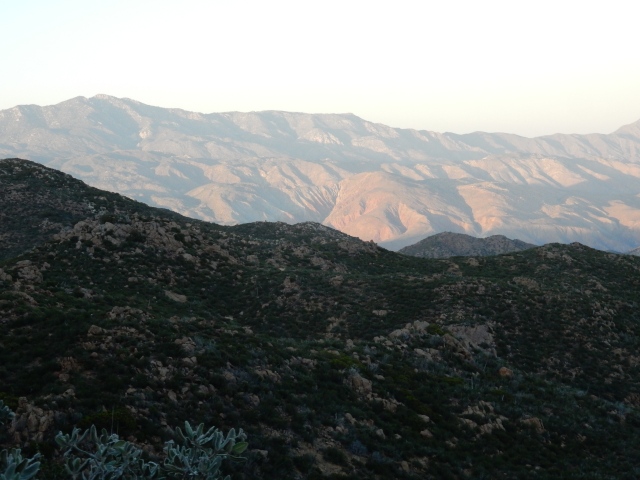
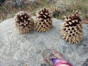
My late afternoon start provided me with cool hiking weather. The pine cones were huge, and my campsite for the night was encircled by manzanita, pines, and ceanothus.

I pitched my tent taut expecting rain, but there were just a few sprinkles, and after some hours at the wonderful and hiker-friendly Paradise Valley Cafe, I now felt like I was in the trail version of Paradise, with beauty all around me.

My mileage for the day: 13.35.

Day 14 (Apr. 7) – From Paradise to (the first) Near-Hell and Back

I know I keep saying that “the terrain today was incredibly diverse and beautiful,” but the miles to the fire closure were exactly that. Here are just a few glimpses:

DSCN0915.JPG

DSCN0925.JPG

DSCN0921.JPG

DSCN0927.JPG

And then – I reached the signs marking the official fire closure.

DSCN0935.JPG

Looking past the closure sign, I could zoom in with my camera and see a small part of the aftermath of the fire – the Near-Hell of today’s hike:

DSCN0929

With a pang of regret that I couldn’t continue, but very happy to have experienced the beauty of the miles up to the point of closure, I finally turned and went downhill – lots of non-PCT miles along trails and roads back toward Highway 74.

Once I hit Morris Ranch Road, a paved road with almost no traffic, I thought again about what my PCT thru-hike means to me, and decided while it definitely includes hiking every open PCT mile, it does not necessarily include roadwalks that are not part of an official PCT alternate route. So when I heard what may have been the only car that came down the road that day, I quickly stuck out my thumb and hitched the 6.6 miles to Lake Hemet Market, where I could grab a few supplies and then walk to the Hurkey Creek Campground. There, I took a coin-operated shower, washed some clothes, and hunkered down in the rain in my tent, with the second half of the Halfmile Fire Mountain Alternate Route my plan for tomorrow.

Day 15 (Apr. 8) – Near-Hell and Back

This day featured some additional Near-Hell of the physical sort (fire aftermath), as well as a figurative version, later in the day.

Following the second part of Halfmile’s Alternate, I set out on a mountain bike trail, intending to connect to the Southridge Trail to ascend into the San Jacintos. There were searing images along the way, photographed from dirt roads that are open, but have fire closures on either side of the road:

DSCN0939.JPG

DSCN0941.JPG

The alternate map was a little harder to read than the usual Halfmile maps because of a smaller scale, and some ambiguous (to me) wording caused me to miss the correct place to pick up the Southridge Trail going up into the San Jacintos. Instead, I walked several miles out of the way to Saunders Meadow, which turns out to be a community on the outskirts of Idyllwild, and then I road-walked a crazy-steep road, sometimes paved, sometimes not, to the Southridge trailhead. In fact, it was useful to be familiar with this community, later on.

At the Paradise Valley Cafe on Wednesday, I had talked with a table full of CalFire guys, and their take on the weather (rain Thursday, snow today at higher elevations, snow tomorrow down to 6500 ft.) led me to conclude that today was my best day to get up to the PCT and through the high-elevation miles up in the San Jacintos. That was especially true now that the forecast included snow/rain through Monday, rather than through Saturday back when I talked with the CalFire guys.

DSCN0943

“Last 1/2 mile from lookout to Saddle Junction is steep ice. Use ice ax & spikes. Or take the unpaved road down into Idyllwild.”

So when I saw this note on the Southridge Trail signboard, I thought: “Well, the note is 4 days old; the weather has been fairly warm since then; it is raining now, not snowing. So I can’t really tell what the conditions are now, and I should go up and check it out – I can always come back down, but today is my best shot to get through.”

Where, you might ask, were my spikes? Why, on my gear shelf, with my Whippet nearby, back at home.

Hiking up the trail, I saw almost no snow. Promising, I thought! Even above 8,000 ft. elevation, it was raining, and snow was visible along the trail just in isolated patches.

I didn’t take many photos along the way, since it was raining all day. (Rain, I thought – that’s good! – not for my camera, but for melting snow!) Plus, there was very little visibility because of the weather. Since I’ve hiked to San Jacinto’s summit before (at 10,834 ft. elevation, So. Cal’s second-highest peak), I didn’t care that much about the missed views today. I did capture this giant blowdown across the trail:

DSCN0948.JPG

Halfmile’s Alternate Route is 20.4 miles in total. I had now completed 20.0 miles of it: 13.8 by hiking, and 6.6 by road hitch (not counting my “bonus” miles to Saunders Meadow). Then I reached the Tahquitz Lookout Tower (8,846 ft. elevation), at Mile 20.0 of the Alternate Route. Just 0.4 mile left – then, BOOM. Reality is non-negotiable, and just past the Lookout Tower, the reality was that the trail was covered with deep snow, with a fairly steep downslope. Hmmm.

I could see a set of footprints going across, so I decided I would carefully test out the first few of those steps and see if I might be able cross by stepping into those prints. Hmmm. So this worked for several steps, though I was sinking in pretty deep – then the next step was on a part of the trail that no longer had snow, but was deeply saturated, and the edge was crumbly. So the rocks and stones here couldn’t be trusted to hold weight. One of my trekking poles got stuck in deep snow, and in the process of trying to free it, it slid down the steep slope. All right then — I am NOT following my pole.I used my gloved hands to dig good handholds, and kicked each step carefully, testing each one before putting weight on it. Very slowly, crouching to lower my center of gravity and maintaining 3 points of contact at all times, I crept back to the safe place.

So there it is, the figurative near-hell.

I had excellent cell reception by the lookout tower, and I made some quick calculations: the weather was going to get worse for 3 days before it got better, so there was no sense in camping up here in a sheltered place until tomorrow. Idyllwild is an expensive, touristy town bursting at the seams with hikers waiting out the weather; home is pretty close. So I called Dwight from 8,846 ft. and he readily agreed to drive to Idyllwild to pull me off trail for a few days. My phone’s battery was almost gone, so I told him it would probably take me about the same amount of time to get down the mountain as it would take him to drive to Idyllwild, and I’d find a way to call him so we could find each other.

Knowing I had not only the mountain to descend, but also that crazy steep road from the trailhead back to Saunders Meadow, I practically ran down the trail whenever the path was smooth. At some point, I also figured out I really didn’t need most of the water I was carrying, so I poured out about 4 pounds of water to lighten my pack, and put on my down jacket under my rain jacket since it was getting colder.

Once I got into the Saunders Meadow area I had become familiar with earlier because of my “bonus” miles, I walked past some of the fancy “No Trespassing” signs that are pervasive in Saunders Meadow; walked past many dark homes, presumably empty vacation homes, and walked past an occupied home with a dog that barked ferociously. I realized I wasn’t sure how to get to the center of Idyllwild, and then I walked by a house that looked super-friendly and laid-back, with a warm fire visible through the window. With my phone now dead, I knocked on the door to see if the residents would call Dwight and give him directions to where I was. This turned out to be the home of Megan and Tucker, two amazing people who put a chair in front of the fire for me until Dwight arrived. We enjoyed some great conversation, and Megan took this photo and emailed it to me the next day. If they weren’t trail angels before, they are certified for life now! Thanks, Megan and Tucker, for this amazing hospitality – it was sublime.

x-MeganMcIntyrePhoto-IMG_0120.JPG

Days 16, 17 and 18 (Apr. 9, 10 & 11): ZERO, ZERO, ZERO!

So I went off-trail for three (!) zeroes, to give me time to figure out what made the most sense based on the weather forecast, plus another fire closure (the Lake Fire closure) located a few miles north of San Jacinto.

Three zeroes! I was home, but I pretended I wasn’t so that I would get all the chores done that need to happen during zeroes: resupply, laundry, planning, etc. One task was to call the Rangers’ office to let them know that in case anyone reported a concern based on seeing my trekking pole down the steep slope, there was in fact no hiker there as well. I offered to accept a fine for what had to be the week’s largest “Leave No Trace” violation, but the ranger laughed and said he would give me a pass.

I assembled all the intel I could about the conditions in the Jacintos and the experience of other hikers, including those who had gone up Devil’s Slide Trail. Flashback Dave posted a very informative video shot in his tent on-trail, reporting “Saddle Jct to Mile 190 lots of snow, hardpack with ice on top,” sometimes difficult to navigate because footprints from people who are lost/not on the trail. He reported steep areas on the backside, plus lots of blowdowns – maybe 40 trees down with a few that are a challenge to get around.

I sent a summary of all this intel to Scout and Frodo (San Diego trail-angels-in-chief and PCT thru-hikers) by email, and then had a long discussion with Scout about my options. Bottom line: the conditions may not be significantly better for awhile, and since I am local, I can easily come back and get these miles later in the season, either at the end or at some other point – and by then, the Lake Fire closure might be lifted or reduced in size, or there might be an official alternate route. So I might well end up with more legal PCT miles to hike, later on.

For the Lake Fire closure, many 2016 hikers are taking a van from Ziggy and Bear’s (just north of I-10, at approx. Mile 210.9) to Big Bear – missing the open miles from Z&B north to Mission Creek at Mile 236.5, and also missing the open miles from Onyx Summit (at Mile 252) to Big Bear (where most people appear to be getting on trail at Cougar Crest Trail, at approx. Mile 277.9). By skipping to Onyx Summit now, I’ll catch the approx. 26 miles between Onyx Summit and Big Bear that many hikers are missing by going by road to Big Bear. I’ll also be able to hike from Mile 178 to Mission Creek at Mile 236.5, instead of missing the 25.6 miles between Ziggy and Bear’s and the Lake Fire closure at Mission Creek, since I can hike out-and-back to Mission Creek from Whitewater Preserve, where Dwight can get to by car to pick me up; and I might be able to get some newly opened miles once authorities can evaluate the Lake Fire closure and perhaps lift some or all of that closure, or develop an official alternative.

So that’s the plan I developed after talking it all over with Scout and Dwight – temporarily skip to Onyx Summit now in order to get the fullest number of legal PCT miles during my hike. I realize other hikers come from long distances and don’t have the options I do, but this seems like the right choice for me.

(And now, in real time, I’ve spent four and a half wonderful days hiking from Onyx Summit (Mile 252), to Mile 341.8, the crazy place at Cajon Pass where the PCT is just 0.4 mile from a McDonald’s and a Best Western motel, with massive I-15 traffic and huge long trains that go through continuously, day and night. But in real time, I am also out of computer time – so reporting on the next part of my hike will have to wait until perhaps next week.)


Posted in Hikes | 14 Comments

Days 9-10: Pastures of Plenty and Warner Springs Goodness

Day 9 (Apr. 2): Waking up early at Barrel Spring, I was eager to pack up and go, since a meetup with Dwight and wonderdog Molly at Warner Springs was in my immediate future, just 8.5 miles up the trail. After so many days where I had seen almost no one on trail, I had thoroughly enjoyed yesterday’s hike with B. and Tim often in conversation range, and then eating dinner with other people – an on-trail first! – Tim and the terrific section-hikers, Dan and Chris. (Tim looked at my freezer-bag dinner (millet and brown rice noodles, big chunks of freeze-dried tofu, freeze-dried asparagus, spinach, kale, red bell pepper, Japanese eggplant, and mushrooms – and said, “You’re going to eat ALL of that?” And indeed, I did.)

I encouraged Tim to think about ditching his huge tent for a 2 lb. Tarptent I was offering to lend him, and to consider what other items in his humongous pack (blue jeans! many clothes! huge metal fuel can!) that he would be willing to part with, and with that, I headed out for a short half-day of hiking.

From Barrel Springs north, the landscape is a mix of oak-filled creeks and big open pastures separated by low hills. It isn’t wilderness – but it has the look of well-loved, well-cared-for land, and at least in spring with recent rains, it’s a beautiful, gentle landscape:

DSCN0755

Jean (?) from France passed me, stopped for a quick consultation about some odd bumps on his leg – poison oak? bites? – and after giving him a little packet of hydrocortisone cream, I captured this image of him hiking across one of the beautiful pastures.

DSCN0759

DSCN0764

In some of the pastureland, big swaths of our state flower, California poppy (Eschscholzia californica) brightened the day. Often, hikers encounter cows on or near the trail in this section. I saw none, though there were some odoriferous cow patties to add to the morning’s sensory experience.

Near Warner Springs is one of the PCT’s iconic images: Eagle Rock. From a distance, and from some angles, it is only vaguely eagle-like:

DSCN0765

But if you go around to just the right spot, it is amazing. Check out Google Images for “Eagle Rock Warner Springs” and you’ll see what I mean.

At times, I was hiking right behind Chris and Dan, enjoying their discussion about whether it is better to rent or buy a house; and as we got closer to Warner Springs, we encountered many day hikers heading to Eagle Rock. Much to my surprise, Deb and Halfmile came around the corner – out for a hike to Barrel Spring, apparently, as they get ready to head out to the Continental Divide Trail. What a thrill to unexpectedly run into friends on the trail! I got big hugs, hiker-stink notwithstanding. Halfmile graciously congratulated me on completing 100 miles – though if he weren’t focused on the nice round milestone that hikers celebrate, he no doubt he could have congratulated me with great precision, perhaps “107.63 miles” without even consulting his eponymous map or app.

By late morning, I hit the first crossing of Hwy 79, just a few steps away from the Fire Station and then, across the street, the amazing Warner Springs Community Resource Center, where community volunteers stepped up in a HUGE way to support PCT hikers, once the Resort closed. Dwight was waiting there for me with Molly, with a cooler full of the leftover Whole Foods treats that Lynn and Charlie took home from our Scissors Crossing meetup. So I made a yummy lunch out of that, and then Dwight and I drove hikers over to the Post Office and the golf course grill, where we found Tim, Clint and other hikers polishing off a nice lunch on the patio.

Tim went back with me to the Resource Center and we did a pretty major pack shakedown. We went out into the field the Resource Center makes available for hiker camping, and I set up my Tarptent DW Moment tent, which Dwight had brought from home, so that he could check it out. After a long phone conversation with his folks, he decided to borrow it, and allow me to send his huge tent home. We went through all his stuff and he also agreed to relinquish a huge heavy groundcloth, his blue jeans and other cotton clothes, and more. I gave him a plastic Rumrunner flask for his fuel, so he also gave up the crazy-big metal fuel can. All told, we removed about 18 lbs. of stuff from his pack – 4+ pounds more than my entire base weight!. He joked, “I feel like I’m on that hoarder TV show, and I’m trying to cling to all of my stuff!”

Dwight and I then left for a motel (in Banning – don’t ask!) for the night. He brought all my resupply buckets, and the overnight motel stay was designed to allow me to prep my food for the next stretch of trail, swap out maps, wash all my trail-filthy clothes, and otherwise clean up and get ready to hike the next section.

Day 10 (Apr. 3): I worked hard on all my chores until check-out time, then we headed to Paradise Valley Cafe to drop off my resupply box (plus one for Tim with some freeze-dried veggies and tomato powder to add to his nightly spaghetti). Dwight got to experience what many claim is the best burger on the PCT – the José Burger, with avocado, bacon, jalapeños, and much more, while I enjoyed a huge salad topped with a veggie burger.

Back at Warner Springs Community Resource Center, I logged in time on the computer to post Days 2-5 on this blog, did a few other computer chores, and then bid farewell to Dwight and Molly, heading out at about 5:15pm to catch some miles. Ever since Dwight and I dayhiked in this area a few years ago, I’ve wanted to sleep under the big oaks along Agua Caliente Creek just north of Warner Springs.

With feet feeling almost completely healed after my twice-daily ministrations involving thorough cleaning and liberal use of Leucotape and Gurney Goo, I wanted to hike a foot-friendly pace so as not to lose any of the gains I had made with my feet. So I hiked an easy pace, listening to my feet the entire way.

DSCN0768.JPG

After a lovely pasture stroll, the trail crosses Hwy 79 again, ascends gradually, and then there’s a magical section where the trail crosses Agua Caliente Creek multiple times. Here was my view as night approached:

DSCN0771.JPG 
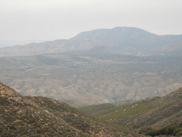
Since I had hiked this part of the trail before, I felt comfortable doing a bit of night hiking, by the light of my Waka Waka light and solar charger, until I reached a perfect campsite right before the first creek crossing. I set up just the tent body, which is micro-mesh bug netting, and for all of 5 minutes before I fell asleep, I listened to the sounds of the creek and looked at the stars through the oak limbs spread out above me. Well worth the price I paid in being a little cold that night, without the added warmth of the tent’s rain fly.

Once again, I find myself out of computer time before I can get caught up to “real time” – I need to head back out to the trail for Day 19 of my hike – so you’ll have to wait until Saturday or Sunday to read about next part of my hike, which I already know will be called “From Paradise to Near-Hell and Back.” Stay tuned!


Posted in Hikes | 7 Comments

Days 6-8: The Desert, an Amazing Dessert, and a Two-Snake Trek through the San Felipe Hills to Barrel Springs

Day 6 (March 30) found me packing up a wet tent from the light rain that fell during the night and continuing my downhill trek toward Scissors Crossing, where I would connect the next morning with friends Lynn and Charlie for an on-trail resupply meetup. In the photo below, the trail is visible as a very thin horizontal line mid-point on the hill at right, and Scissors Crossing (where several roads meet and form a scissors shape) is on the flat before the brownish San Felipe Hills in the far background.

DSCN0699.JPG

After an entertaining session checking out the Rodriguez Spur Fire Tank, one of the precious few water sources in this dry stretch of the PCT, and filtering water obtained there, I continued on. The trail took the most indirect route possible to Scissors Crossing – at times, you could see it (or the Banner Grade Road that forms part of the “scissors”) directly below, and yet the trail would go a long distance essentially parallel to the road, around a hill and then a long way back the other direction, again parallel to the road. This happened more times than I care to remember. Sheesh! There’s a nice flat field between me and the Crossing – can’t we just walk straight across that field and get there, already?

DSCN0703

Meanwhile, I’m in what I consider to be true desert now, with agaves, various cacti including chollas and prickly pears; Mormon tea (Ephedra sp.), and “belly flowers” – tiny flowers that are perhaps a quarter-inch high, so you almost need to lie on your belly to see them. At my lunch break, I spread out my Tyvek ground cloth on what looked like a bed of gravel – and then when I sat down, I saw hundreds of the tinest imaginable white flowers scattered throughout the gravel. Beautiful!

DSCN0709

After three days of mostly downhill walking, one of my knees is starting to feel a little tweaked. Thanks to my impending resupply visit, and decent cellphone reception, I was able to phone Dwight and ask him to pick up a knee brace to send out the next day with Lynn and Charlie.

I haven’t seen anyone since leaving Pioneer Mail yesterday morning, so I’m thrilled to pass a SOBO (southbound) section hiker late morning, then Piper overtakes me and reports on a big group of hikers camped by Rodriguez fire tank last night, including Tim from the Netherlands, who was the only hiker I saw on Day 2, with a humongous tent and the largest fuel can I’ve ever seen a hiker carry. (He said, “Well, this is what they sold me and it seemed wasteful to pour any out,” and I pointed to the Gatorade bottle in front of him as perhaps a better fuel bottle…) Piper laughed and said she just hoped he would stop carrying blue jeans.

As I was preparing to set up an early camp on the rise just above the dirt parking lot at Scissors Crossing, I met a great thru-hiker named Milissa, and then I set up my micro-tent in the shelter (and bit of shade) of a multi-stemmed yucca, shown below the next morning.

DSCN0715

Day 7 (March 31) found me doing various “housekeeping” chores until Lynn and Charlie arrived with fresh food (and vegan donuts!) from Whole Foods for lunch, my resupply box, and my wonderdog Molly, along with their dog Barley.

DSCN0717.JPG

L-R: Charlie, Lynn, and Molly (giving me the cold shoulder for having ditched her for the trail…)

Since there is no shade at Scissors Crossing, we drove up to Barrel Spring (13.5 road miles north, but almost 24 miles by trail). Barrel Spring features a concrete trough with water slowly flowing into it through a pipe; again, an important, rare water source on-trail (it looks clean, but needs filtering – there are dead animals at times in the spring box that feeds the pipe!). I knew we would see PCT hikers coming through while we were eating lunch, so we would get lots of “trail news.”

Lynn delivered an amazing edible bouquet of fresh fruit, artfully arranged on skewers – a gift from my friends at the Del Mar Foundation, our community foundation that is responsible for so much that is good about Del Mar’s culture, community, and environment. Wow! I could possibly be the only thru-hiker ever to get such an extravagant food gift delivered right on the trail! And the accompanying note gave me a big laugh. What a terrific treat!

DSCN0719

Lynn brought ziploc bags so that I could carry some of the fruit out with me (for that night’s dessert and the next morning’s breakfast), and we also had the joy of handing out some to other hikers passing through, including a veteran who was celebrating his last official day in the military.

DSCN0722

We also had the fun of talking with Coach and Suds, two North Carolina thru-hikers I had met on the morning of Day 3 near Cibbets Flat. Suds (age 18?) positively beamed as he stuffed fruit into a baggie, while we explained to Coach (age 48) what honeydew melon is.

When Lynn is your friend, your passions become HER passions, even if only vicariously, and she’s been an enthusiastic supporter of my hike. She was puzzled at first why I needed to go back to Scissors Crossing to resume hiking. Why not start here, and catch up a bit on my schedule (a tentative one at best), since I have been dialing back the miles to let my blisters heal? I explained the thru-hike concept of a continuous hike of every mile of the trail that is legally available to hike (i.e., not closed for some reason like wildfire damage). And Charlie is a hiking pal as well as a good friend- we hiked Mt. Whitney together last year. So it was great to have the chance to visit with them, and have the luxury of getting resupplied right on the trail.And Barley was friendly to me, even if Molly was a bit miffed.

After enjoying a phenomenal lunch, visiting with passing hikers, and sorting through my resupply, we drove back to Scissors Crossing so I could get in a few hours of hiking that afternoon. Molly took one look at the spine-filled hill I was about to climb up, and jumped immediately into Lynn and Charlie’s car. Smart dog!

After climbing up the little hill toward the trail, I turned to wave goodbye, and hilariously backed into a cactus in the process. It brought to mind the children’s joke: Q: What did the baby porcupine say when it backed into a cactus? A: “Mommy, is that you?” (And if you back into a cactus and get spines, or even worse, glochids stuck in your skin, just cover them with duct tape and then rip the tape off. Much more successful than tweezers.)

One reason I started my hike early (about a month before the traditional starting time) was the hope that I could walk through the San Felipe Hills in moderate temps, because it can be crazy-hot out here. I definitely got my wish today (and tomorrow), walking through on a sunny but breezy day, with temps in the 70s.

As I climbed into the hills, the cholla were incandescent in the afternoon light (below, looking back down toward Scissors Crossing). This one had a nice collection of segments at its base that had broken off, ready to be picked up by a passing animal – human or otherwise – and carried off to a potential new home. And they say plants don’t travel! And to the left of the cholla is a another desert favorite of mine, Encelia farinosa, the desert relative of Encelia californica that is seen all long the Del Mar-area coast and in the coastal sage scrub. The desert version almost always has a perfectly round shape that looks like a gardener has carefully pruned it.

DSCN0729
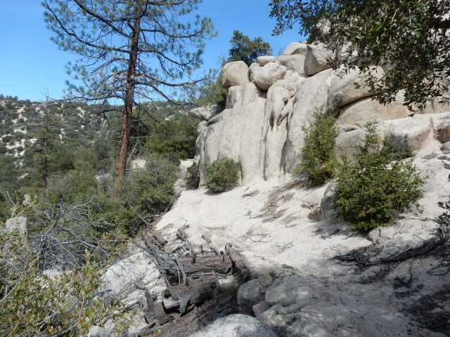
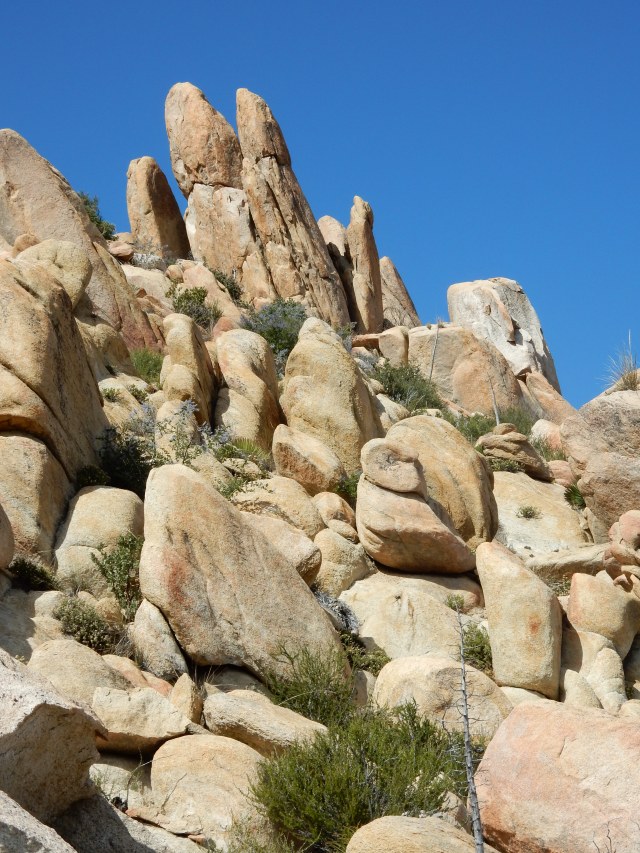
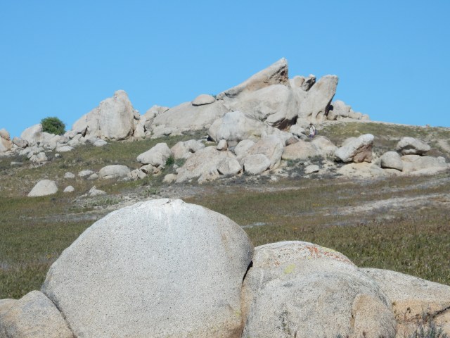
Around every corner was the kind of rock garden you would pay hundreds of dollars to have professionally created in your home garden.

DSCN0723

With a growth rate of perhaps just an inch a year, these barrel cacti are venerable San Felipe residents.

DSCN0724

DSCN0726
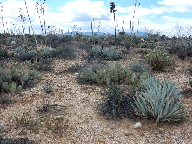
Botanists have measured and found significant differences in temperature at the base of cactus spines, as compared to that at the outer edge of the plant, so all that fierce armament serves an important purpose beyond protection from would-be predators.

Because of the recent rains, one of my favorite desert plants, the towering Ocotillo (Fouquieria splendens) had leafed out, and was starting to bloom (though my photo below doesn’t show one in bloom state, alas).

DSCN0727I met Arash, a 65-year-old thru-hiker, this afternoon – a super-strong hiker who worked in government in Sacramento for some 25 years before retiring to Canada. He told me with great precision what milepoint he was hiking to, “then I’ll have made my 20 for the day.” He slowed his pace for awhile so we could converse, then marched on to complete his 20.

As afternoon turned to evening, some pretty big winds started gusting through, and we knew that campsites were not that numerous in the San Felipe Hills. I came across Clint, the hiker I met on Day 1 who is from a town close to my Texas hometown, and is also close to my age. He had set up his tent in a pretty windy spot, too tired to go on the expected 2 miles to other campsite options.

I chose to go on, not wanting to be pounded by the wind all night, and found a small site in the shelter of a lovely small juniper. The cigarette butt I found there was not as lovely, nor the orange peel scattered about, but it turned out to be a good home for the night – I could hear the winds blustering all around me, but my tent kept me totally comfortable, with no flapping at all. Meanwhile, as I was about to set up camp, Arash came by, dissatisfied with the campsite he had selected earlier on, and I later heard he hiked 30+ miles that day to get to a better site. From then on, I would see Arash only in hiker registers he signed a day or more before my arrival, but seeing his notes in the registers would always make me smile.

Day 8 (April 1):  I packed up early and hit the trail,  carrying out the cigarette butt to earn a few LNT (leave no trace) karma points I knew I would be needing along the way. After about an hour, I came across Tim, the 19-yr-old from the Netherlands. I put my pack next to his to compare but he hadn’t finished strapping everything that went on top of his pack to make it a huge tower. He picked up my pack and said, “Wow, it’s nothing!” I was selfishly glad to hear that he had to pass up my campsite last night because it was too small to accommodate his tent.

DSCN0734

Clint then came along, and his first words were hilariously colorful expletives, a commentary on the windy night he had spent at his very exposed site.

DSCN0737

I hiked alone much of the day, and from time to time, I would think – hey, if I were a cold-blooded reptile, I’d be out soaking up some sun after the last few days of rain and cold weather! Sure enough, I soon encountered my first snake – I think (and hope) it was a rosy boa.

DSCN0739

DSCN0740

After that, every stick on the trail with the slightest curve looked like a snake, causing me to be a little jumpy – until one of those “sticks” actually was a snake. This one was some type of racer that went across the trail quickly right in front of me, into the nearby shrubs. No time to grab a camera for that one.

I stopped at Mile 91.3 to write a note of thanks to Jan and all the Third Gate water cache team, but it was my hope to carry enough water not to need to take the water they bring here at such enormous cost of time, money and distance, and I managed to do that.

The views all day were fantastic, in all directions:

DSCN0746.JPG

DSCN0747
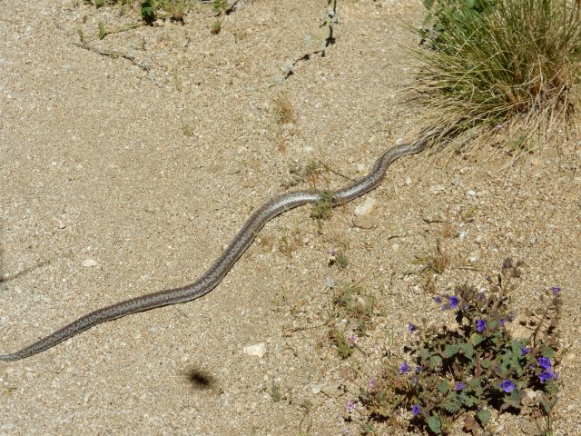
So: I had a two-snake day with pleasant temps and breezes in the San Felipe Hills – glorious! And after days with little human company, I had some hiking companions at various points during the day – Tim, Clint and later on, I met B., a coder from Valley Center who was hiking with me as we crossed the 100-mile mark, so I had a photographer on hand. (B., I’ll post your photo sometime soon on a photo page so that you can grab it.)

DSCN0751.JPG 
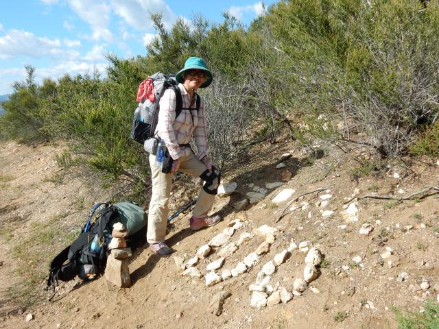
It’s a modest milestone, to be sure, and I was chagrined to be reaching it on Day 8 – but as I kept telling B., this is not a foot race. I knew my schedule had the flexibility to allow me to knock my mileage way back so that my feet could recover from some pretty intense ball-of-foot blisters, and toughen up. I knew that slowing down was the right thing to do for the sake of the many miles ahead of me.

As we hiked toward Barrel Spring, the landscape changed from desert-like to chaparral, with beautiful California tree poppies again, and then we headed into the lovely canyon live oaks of Barrel Spring. Tim and I both camped there, along with some great section hikers (Chris and Dan?), all to the sounds of frogs that would sing, then stop for awhile, and then sing more, all night long.

Week 1, in a single word: GLORIOUS!


For those who are curious, here are my daily mileages for Week 1 plus Day 8, counting only PCT miles. As the Nickel Creek song says, “Others have excuses; I have my reasons why” – so here are my #s and reasons:

Day 1: 20.1 miles (to the exact spot on the PCT across from my tent at Lake Morena): no excuses needed! But I apologize to my feet –  even though I Leucotaped midday, it wasn’t enough to prevent the blisters that slowed me down the rest of the week.

Day 2: 8.47 miles. ending at PCT Mile 28.57 – A half-day of hiking at best, since I spent most of the day hanging with Dwight and Molly and blogging, hiking out on tender feet at about 2:30 pm.

Day 3: 12.83 miles, ending at PCT Mile 41.5 (the Burnt Rancheria spur)- again, tender feet, and I stopped at Laguna for a “feet consultation” with Dave Super. Given the weather report, I chose not to hike out, and instead, enjoyed a Pine House Tavern dinner and a night at the lodge.

Day 4: 11.2 miles, ending at PCT Mile 52.7 (Pioneer Mail Picnic Area) – no apologies here – almost every step was in crazy Wind Tunnel conditions!

Day 5: 14.73 miles, ending at PCT Mile 67.43 – no apologies here either, given my tender feet.

Day 6: 10.13 miles, ending at the hill above the dirt parking lot near Scissors Crossing – I needed to stop here to meet tomorrow’s resupply, so my hiking day ended early.

Day 7: 5.51 miles, ending at PCT Mile 83.07 – I spent most of the day on my resupply visit, hiking out mid-afternoon.

Day 8: 18.03 miles ending at PCT Mile 101.7 – Finally! – a near-normal mileage day, since 20 is more or less what I need to average. Feet still tender but greatly improving.


Posted in Hikes | 7 Comments

Days 2-5: Sun! Monster Winds! Snow! Icicles!

Walking carefully on blisters through a SoCal wonderland

It seems like a month since my Day 1 post, but I’m actually on Day 10, back with my laptop to report on Days 2 through 5 on the PCT.

Days 2 & 3: Sun and Mercifully Mild Temps

DSCN0627

Leaving Lake Morena quite late on Day 2, mincing on ball-of-foot blisters, I enjoyed the live oak pastures and gentle (though very sandy) trail, as it goes toward and then under I-8:

DSCN0628

I had a short Day 2, with about 8.5 miles, camping far above (but within earshot of I-8. As the trail climbs the hill above I-8, there’s a lovely natural allée of mature manzanitas. Here is an especially lovely one I passed the following morning:

DSCN0637

Just a short distance below the trail is Kitchen Creek, currently a terrific water source (I could hear water as it fell over the rocks, all the way up at the trail), though I had enough water not to need to climb down for more.DSCN0639

Here’s a classic sight on the PCT: a military crash nearby distributed ordnance over a wide area, apparently. The PCT sign in the background makes for an odd pairing of messages.


DSCN0641.JPG

Beautiful big vistas in every direction:

DSCN0645

DSCN0636 DSCN0646

Meanwhile, the Flower Show continued unabated, as the trail climbed up into the transition out of chaparral and into the pines (Jeffrey, Ponderosa) of the Laguna Mountains.

DSCN0647

I arrived at Mount Laguna in time for a feet/blisters consultation with Dave Super at the terrific gear shop there, followed by a fabulous meal at the Pine House Restaurant (seriously: arugula sauteed with onions in white wine!), and a sobering weather report for the following day: very high winds (35-45 mph with gusts up to 90 mph, followed by snow overnight). I shared a lodge room with a young hiker, Becky from Essex and then hiked out the following morning to see how I would fare in the winds.

DSCN0648

Day 4: The winds picked up almost immediately, and when I saw this Ponderosa pine cone on the trail, it did occur to me that I could be felled by something like this getting blown down onto my head. I also hiked through some burn areas that contained a lot of potential widowmakers.

But it was quite exhilarating: winds so strong I could  barely stay upright with the help of my trekking poles, and regular gusts that were quite forceful. The only hiker I saw all day once I left Burnt Rancheria campground was Piper; the winds were gusting into her pack cover so strongly I thought she might be borne aloft.

DSCN0660

Long horizontal clouds blew quickly past, often obscuring all views and sometimes dropping a few fat raindrops; but at times it would clear up for these magnificent views into the Anza-Borrego Desert.

DSCN0661

The winds seemed to be getting even stronger, and my terrific Julian friends Ken and Carol were on call to pluck me off the trail from the nearby Sunshine Highway, so after about 6 hours, I called for that pickup at the Pioneer Mail Picnic Area. Right before they arrived, a young man from the National Weather Service raced in, asked if I was a hiker, and recommended that I get off the trail until the following morning – the prediction was for gusts to 110 mph on the summits, and snow.

The photo above is at Pioneer Mail, and shows me in the phenomenal LL Bean jacket that allowed me to be completely comfortable in the crazy winds; you can read more about it on my gear page. And no, I haven’t ballooned into the Michelin Man — that’s the wind puffing me out (and it was cold enough that I hiked all day with my down jacket on under the rain/wind jacket, never breaking a sweat).

I had an exhilarating day hiking in these crazy winds – just standing upright was a measure of success, and I managed to add 11 miles to my PCT trek.

Day 5: After a cozy night at Ken and Carol’s, close to a wood-burning stove, I went back out to Pioneer Mail, now covered in a blanket of snow. Here’s what the trail looked like the morning of Day 5:

DSCN0663.JPG

DSCN0669

I loved the icicles on the side of the trail, and though how fabulous it could be if these natural popsicles could appear in the San Felipe Hills instead, where hikers could use them to cool off from the 90-degree temps…

DSCN0689

Snow was along the trail well below 4200′ elevation, but as I hiked on, blue skies were overhead, with beautiful clouds that would drop some rain on me that night, but only after I was snug in my tent.

DSCN0693

Soon, I was back in chaparral, with lots of California Tree Poppy (Dendromecon rigida)  and sages (above) to carry on the Flower Show.

DSCN0696

Chaparral yucca (or Our Lord’s Candle), Herperoyucca whipplei

Beautiful days, all: the sunny ones, the windy one, and the snowy one. And now, back in sunshine. I’m out of time at the computer to get to where I am on the trail now, but I should see my laptop again in about a week. So I’ll leave you with Day 5, as I hike out for a short few miles on Day 10.

Posted in Hikes | 5 Comments