
Yes, my blog is lagging behind me – sorry! – but let’s take a look back at where I’ve been the last few weeks, starting with a day so varied and ultimately so surreal it deserves its own post.
Day 22 (Apr.15): From Deep Creek to Deep Surrealism
From my stealthy campsite high above Deep Creek, here’s what I see at 6:43 am. The Creek is far below, but it is loudly calling me to pack up and hike.

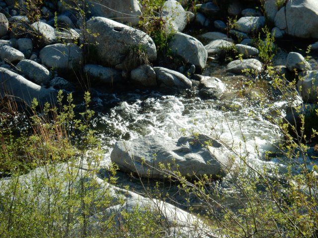
It’s arid-looking up high where I am, but it’s a roaring party down below:
Soon, I meet a hiker, Detour, who hiked NOBO (northbound) for a while and then flipped up (to Cajon Pass, I believe) to hike southbound. Everything about her signals a very experienced hiker, and we have an animated conversation about such vital topics as threading blisters. She lives near the PCT in Oregon not far from Ashland, and offers a ride or other assistance once I’m in that area. She also says she’s received so much help from trail angels over the years that she spent some time during the winter making “angel charms” to hand out on trail, so she gives me one for myself, and one to give away to someone else. Sweet!
 As I descend, I pass a sign proclaiming Deep Creek to be an officially designated Wild Trout Stream, managed exclusively for its stream-bred trout, with no supplemental stocking. I don’t see anyone fishing with barbless hooks for their limit of 2 trout – but luckily, I also don’t see the masses of naked BOHs (burned-out hippies) I expected to see in the creek’s famed hot springs, based on Deep Creek’s reputation and its proximity to L.A. Close to the hot springs, however, I note that every shrub near the water has a collection of toilet paper at its base, and I elect to wait until later to resupply my drinking water.
After having Deep Creek’s music in my ears continuously since midday yesterday, I go round a curve and suddenly hit silence – a reminder that all of this water is a Southern California anomaly, and soon enough, I’ll once again be thrilled at the sight of a tiny flow that I can capture to refill my water bottles – or perhaps even a stock trough. For a long while I’m hiking in and around the folds of these hills:
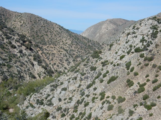
The trail is often a narrow ribbon perched high on the steep slopes, so I pay close attention to my footing:
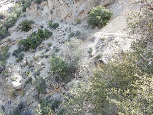
Soon, I am at a bridge that crosses Deep Creek Canyon (Mile 310.4), and you can see the trail cut steeply into the canyon after the bridge:

The day turns surreal. First, I start getting the feeling that though I am a NOBO (northbound) hiker, I am essentially hiking south at times, mostly west, and definitely not one step north.(It turns out this is a regular feature of the PCT – if you want to go to Canada as the crow flies, get off the trail and buy an airplane ticket!) Then, a snow-covered mountain comes into view, which I decide must be Mt. Baldy, even though it seems exceedingly strange to be hiking toward something that I mentally think of as south of me. (Little do I know that the PCT will offer up a side-trip to the Baldy summit on my way to Mt. Baden-Powell.)

I then hit a stretch of trail with scores of sacred datura (Datura wrightii) in peak bloom, and I’m in a living Georgia O’Keeffe artspace for awhile – but the trail art is free of charge, while O’Keeffe’s 1932 painting, “Jimson Weed/White Flower No. 1,” sold for $44.4 million at a 2014 Sotheby’s auction to Walmart heiress Alice Walton. Of course, I took about 300 photos of this bloom-fest, but will share just one:

Well, okay – one more, but it’s an insect photo (“Me and My Shadow”), not a flower pic:
 I then apparently walk into a different room of the art museum and I’m in Keith Haring/Basquiat territory:

On what is clearly not a day of pure wilderness hiking, the PCT next serves up something that could be a huge earthwork akin to “Spiral Jetty” by Robert Smithson, if it weren’t so irredeemably ugly: The Mojave River Forks Reservoir:

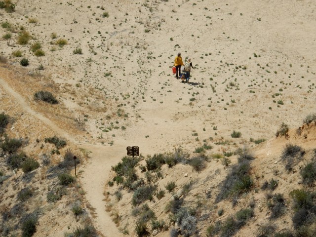
I’m following my phone app to stay at least vaguely on the trail, since a big bulldozer seems to have obliterated anything that might have indicated where (along the left of the photo above) the trail might actually be. Looking down, I see a vintage metal PCT sign, and two women striking out across the desolate landscape – they aren’t hikers, but I can’t discern who they might be.
Some miles later, I encounter something so ugly I can’t bring myself to photograph it – Cedar Springs Dam – but two 2015 PCT hikers posted this photo. It’s a 249-foot high rockfill dam, and the PCT briefly follows a dirt road at the base of this dam, which is unnervingly close to an active fault (the Cleghorn Mountain Fault). The facilities around this dam are not only posted “No Trespassing”, but also have prolific “No Loitering” signs. It’s relatively close to dark, and I wonder whether sleeping in a tiny tent a few feet away from such a sign would constitute loitering. I think about the “Shuffling Sam” Supreme Court case we studied in law school about loitering and due process. I decide I don’t have time in my schedule to be a civil rights plaintiff, so I hustle past the dam facilities until I am back on something that resembles real trail, and find a little spot for my tent. From my perch at the side of the trail, a small community just below me offers up the sounds of motor vehicles and barking dogs, answered by coyotes. Goodnight, surreal PCT!
Today’s mileage: Mile 304.70 to 324.69, for a total of 19.99 miles.

So the hot springs at a Deep Creek didn’t tempt you to come in and soak? It just seemed yucky because too many people have been there with no consciousness? Someone needs to dig a potty away from the springs. And then the river drys up/ goes back underground for a while? Before it comes up and you can fill your bottle from it again. I’m just wondering if I’m understanding what Deep Creek was like. I told you I’ve been there several times back in the mid 70’s. It was paradise then. Detour sounds like someone I would love to meet. I’m enjoying your adventures. Thanks for taking the time to share with us.
LikeLiked by 1 person
Ramona: I was “on a schedule” to meet Dwight and Molly, and all the nearby TP didn’t make the hot springs look that tempting. But many of my fellow hikers enjoyed a soak. The river doesn’t dry up or go underground – the trail just curves into the folds of the hills farther away from the creek on occasion, so I would lose the sound of the water. I did cross a lovely smaller side creek, if I recall correctly, to refill my water. All in all, I thought Deep Creek was very beautiful, and pretty well managed given the high visitation numbers from day visitors. By the way, whenever the thought crosses my mind (frequently!) that I am so lucky to be on trail, it’s a cue for your song “Lucky in Love” to start playing in my head. Love it!
LikeLike
I loved the Georgia okeefe photos….I was thinking about you last night and here you are! Thank you for the update.Arline
LikeLiked by 1 person
LOVE the artistic flower shots complete with “Me and My Shadow!” So impressive, and as you say, so surreal with the starkness, etc. It’s very hard to imagine weirdos so far away from civilization “loitering.” A sign, really? Promise us you will stay safe, girlfriend! And keep blogging – just love living vicariously through you!
LikeLiked by 1 person
Many “no loitering” signs, and since they are right by a road, it isn’t really far from civilization – though it would be a harsh place to live! I promise to stay safe, and just be aware that I won’t be around computers again for about 10 days, so silence should not be a cause for concern. Love to you, girlfriend!
LikeLike
Random internet reader, here, loving your blog! Thanks for the art lesson, and more importantly the botany lessons… It’s great to find someone who knows what everything is called. Someday I hope I’ll be out there as well. Happy trails!
LikeLiked by 1 person
Wow Betty! Loving your blog and travels! Stay safe and keep all the pictures coming! OKeefe pictures beautiful!
LikeLike
Still following your travels with amazement and respect for your determination. Such a great adventure!
LikeLike
Beautiful photos! 🙂
LikeLike